U.S. 70
< 64 | Home | 70-A | 70 Bus | 70 Byp | 70-1 >
Photo: US 70's end in Atlantic back when it was still posted (Adam Prince)
| U.S. 70 493 miles | |||
| The Road: | Enters from Tennessee west of Hot Springs (Madison County) and ends at SR 1380 in Atlantic (Carteret County). Nationally the road runs from Atlantic to US 60 at Globe, AZ. | Towns and Attractions: | Madison Co.: Hot Springs, Marshall, Pisgah Nat'l Forest
Buncombe Co.: Weaverville, Asheville, Oteen, Swannanoa, Black Mountain, Ridgecrest McDowell Co.: Old Fort, Marion Burke Co.: Morganton, Valdese, Rutherford College, Icard Catawba Co.: Hickory, Conover, Claremont Iredell Co.: Statesville Rowan Co.: Salisbury, Spencer Davidson Co.: Lexington, Thomasville Randolph Co.: None Guilford Co.: High Point, Greensboro Alamance Co.: Burlington, Haw River, Mebane Orange Co.: Hillsborough Durham Co.: Durham, Bethesda Wake Co.: Raleigh, Garner Johnston Co.: Clayton, Smithfield, Selma, Princeton Wayne Co.: Goldsboro Lenoir Co.: La Grange, Kinston Jones Co.: None Craven Co.: New Bern, Havelock, Croatan Nat'l Forest, Cherry Point MCAS Carteret Co.: Newport, Morehead City, Beaufort, Atlantic |
History: |
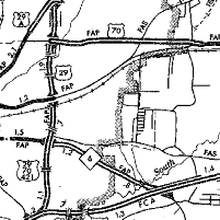
US 70 is an original US Highway that came to North Carolina in December 1926, joining NC 20 from Tennessee to Asheville and NC 10 east from there via Marion, Morganton, Hickory, Newton, Statesville, Salisbury, Thomasville, High Point, Greensboro, Burlington, Hillsborough, Durham, Raleigh, Goldsboro, Kinston, and New Bern to its original end in Beaufort. Here is a closer look geographically:
Madison, Buncombe, and McDowell Counties
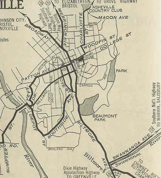
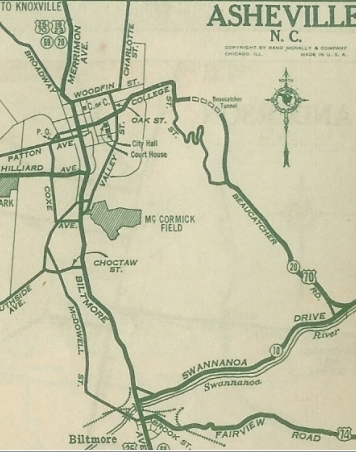
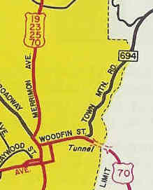
About 1932, US 70 was rerouted in Asheville to leave Merrimon Ave at College Ave and follow Tunnel Rd east through Beaucatcher Tunnel and southeast on current US 74-A S Tunnel Rd. The old route used Biltmore Ave (remained US 25 for a time) south to Swannanoa Ave east which remained US 74/NC 10 (now NC 81).
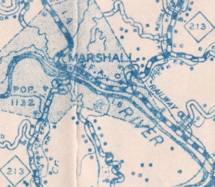
About 1936, US 70 was removed from S. Tunnel Rd (remained US 74, now US 74-A) and Swannanoa River Rd (became NC 81) in E. Asheville. In 1939 (bridge date), US 25-70 was removed from Hollins Rd east of Marshall and placed on current US 25-70 Business.
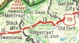
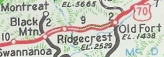
In 1941 (bridge date), US 70 was removed from SR 1411 Ed Allison Rd east of Old Fort. In 1947 (bridge date), US 70 was removed from SR 2436 Riverwood Rd and SR 2435 Old US Hwy 70 from Swannanoa to Black Mountain. In 1948 or 1949, US 70 was removed from Machine Shop Rd in Marion. In 1951 (bridge date), US 70 was removed from some of SR 1304 River Rd at Hot Springs and the old bridge over the French Broad River. In 1954, US 70 was placed on its current alignment between Black Mountain and Old Fort, using what is now I-40's corridor. The old route is SR 2542 E State St to about High St/abandoned route covered by I-40/SR 2702 Old US 70 E Ext from about Shumate Rd to where the I-40 EB Exit 66 off-ramp begins/abandoned route covered by I-40/SR 2542 Old Hwy 70 E from about Abel Dr to just past Moore Cir/I-40 EB lanes for 0.2 mi/Ridgecrest Dr/SR 2542 Old Hwy 70 E and Yates Ave/SR 1407 Mill Creek Rd/Point Lookout Trail/SR 1400-1407 Old US 70
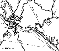
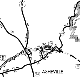
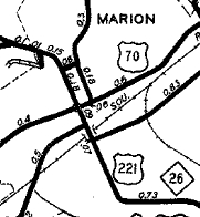
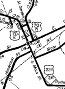
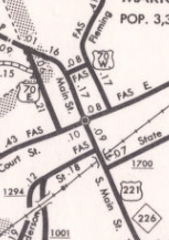
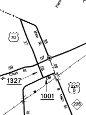
Also around 1954, US 70 was rerouted to use Woodfin St over to Merrimon. Some of this had been part of NC 694. Between 1954-57, US 70 was given split alignments in central Marion: EB continued to use the Main St to Court St. WB used Garden St to New St back to Main. In 1960, US 25-70 was put on a newly constructed bypass around Marshall, leaving behind US 25 Business. In 1961, US 70 was removed from Woodfin St and placed on what is now I-240 from roughly Town Mtn Rd overpass to Merrimon Ave. It appears that Woodfin became part of NC 694 for a while. In December 1970 (NCDOT), US 70 EB through Marion was moved to Logan St to Court St. Main St continued to be US 221/NC 226. In February 1972 (NCDOT), US 70 was removed from Merrimon St (remained US 25) and placed on its current freeway north leaving Asheville. US 70 still followed US 19 Business towards Weaverville to reach Heavner Rd. In March 1981 (NCDOT), US 70 received its current downtown Asheville routing, leaving I-240 and replacing NC 694 on Charlotte/College Sts.
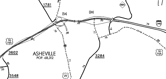
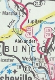
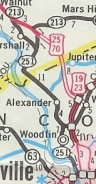
US 70 moved to College/Charlotte Sts 2009 Buncombe County In January 1982 (NCDOT), US 25-70 was rerouted above Asheville to follow the US 19-23 freeway around Weaverville, then headed west as new construction to connect to the existing Marshall Bypass. Heavner Rd (some maps show Old Marshall Hwy) became SR 1839 and along the French Broad River became NC 251, including what had been the easternmost bit of the Marshall Bypass.
In April 1987 (NCDOT), US 25-70 received its bypass of Walnut, leaving behind SR 1349 Walnut Rd and unposted NC 213. US 25-70 was also removed from SR 1440 Nantucket Rd; SR 1441 Hartford Tweed Rd In 1990 (bridge date), US 25-70 was substantially rebuilt between Hot Springs and Hurricane. A lengthy segment of abandoned winding aligments resulted plus Lookout Mtn Rd from Mill Ridge Rd to where it parts ways with Little Hurricane Creek plus abandoned routing over to and using Firefly Ln. In January 1991 (NCDOT), US 70 dropped the split alignment in Marion and uses two-way routing on Court St and Logan St.
In 1995 (bridge date), US 25-70 was removed from the following west of Hot Springs: Slingshot Way; SR 1453 Fairview Loop; abandoned/SR 1208 Stokely Hollow Rd; SR 1207 Cogdills Dr/SR 1452 Lookout Loop; Burke, Catawba, Iredell, Rowan Counties
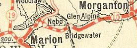
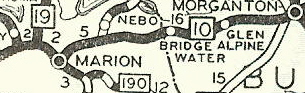
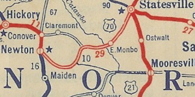
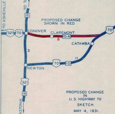
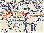
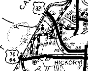
Between 1931-36, US 70 was placed on 1st Ave through Hickory. The original route used 1st Ave SW/2nd St SW/Government Ave SW which used to connect directly back with 1st Ave SE. In 1940 (bridge date), US 70 was placed on its modern routing in the Bridgewater/Muddy Creek area leaving behind an "Old US 70" (still paved in vintage concrete) that loops over current 70 to (no longer) cross Muddy Creek. Also in 1940 (bridge date), US 64 was removed from the SR 1620 Old US 70 loop/Potter St/Knobbs Landing near Icard. About 1948, US 70 was placed on its current bypass of Hickory and Conover in a route swap with US 70-A (now SR 1007 1st Ave to Hickory and SR 1007 Highland Ave/1st St to Conover).
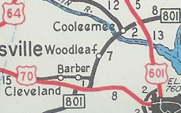
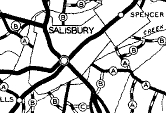
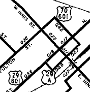
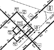
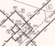
Between 1950-53, US 70 was rerouted in central Salisbury to leave Innis St on Fulton St northeast to Liberty St to US 29. In 1954 (bridge date), US 70 was removed from SR 1975 west of Cleveland. About 1956, US 70 was placed on its modern alignments in western Rowan County bypassing Cleveland and Barber. The old route is SR 1744 Old US 70/abandoned routing/SR 1840 Old Amity Hill Rd; SR 1847/1957 Old US 70/Main St through Cleveland and Barber
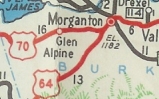
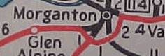
Also about 1956, US 70 was placed on its bypass of Morganton. The route through town is shown as unnumbered on the 1957 Burke County map but was US 70 Business on the 1962 Burke County Map. This is now just Union St.
Between 1954-57, US 70 was routed away from central Salisbury by replacing US 70-A: crossing Innis St (instead of turning south) onto Mahaley Ave which becomes Confederate Ave. US 70 then turned south on Club House Dr over to 11th St down to US 29.
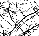
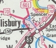
About 1961, US 70 was rerouted in Salisbury to follow Innis St south through Salisbury to I-85, then used I-85 north to Davidson County. The Mahaley Ave et al route has been secondary ever since. About 1965, US 70 was removed from I-85 in the Salisbury/Spencer region. Instead it was given split alignments in Salisbury: EB used Innis St to US 29; WB used US 29 to Liberty St to Fulton St to Innis St. Innis St south to I-85 remained US 52 (now unnumbered). Between 1973-80, US 70's EB split routing in Salisbury changed to follow Innis past US 29, then Lee St northeast to Liberty St northwest to US 29. In May 1981 (NCDOT), US 70 was placed on its current Salisbury area routing using Jake Alexander Blvd to US 29. This was already in existence as SR 1530 and SR 1702. The old routing to downtown was Statesville Blvd to Innis Ave
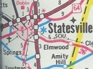
In January 1990 (NCDOT), US 70 was rerouted to its current Garner Bengal Blvd (replacing SRs 1488, 2523, and 2564) routing in southern Statesville. The Front St/Newton Rd portion of the old route remains part of US 64.
In August 2010 (NCDOT), US 70 was removed from SR 2638 Old Salisbury Hwy east of Statesville. In 2014 (bridge date), US 70 was removed from the Wil-Cox Bridge over the Yadkin River. This 1922 bridge is now a trail/park. Adam Prince profiles this historic bridge. Davidson, Randolph, Guilford, Alamance, Orange Counties:
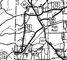
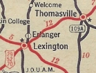
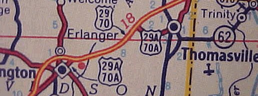
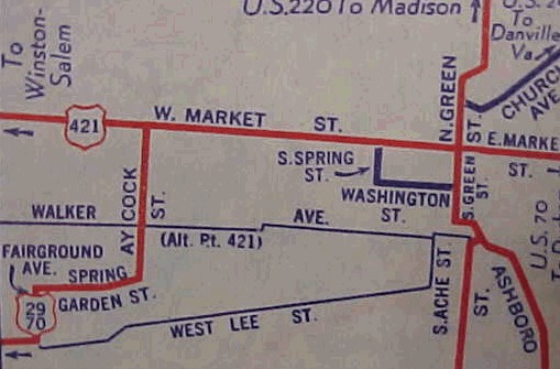
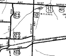
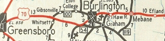
In 1936 (bridge date), US 29-70 was removed from S. Salisbury St in Lexington. About 1941, US 29-70 was given its modern routing between the Yadkin River and outside Lexington. The old route used SR 1147 Trading Ford Way/Old Salisbury Rd to I-285; SR 3158 Anna Lewis Dr; Main St into Lexington; Between 1945-49, US 70 was placed on brief one-way splits in central Greensboro. NB used Market to Forbes to Summit; SB used Summit to Church to Market. Also in this timeframe, US 70 was removed from Fairground Av and Spring Garden St and instead use Lee directly to Aycock. Fairground Ave became an extended US 29A-70A. Also between 1945-49, US 70 was placed on a new High Point route using Westchester to Lexington to Greensboro Rd. This was a route swap with US 29A-70A (now just English Rd, Main St and Montlieu out to Greensboro Rd).
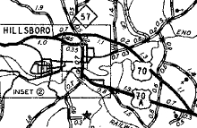
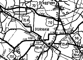
About 1948, US 70 was placed on its current bypass of Hillsborough in a swap with US 70-A.
About 1949, US 70 was given its modern routing between Lexington and Thomasville. This left behind Atlantic St/Greensboro St in eastern Lexington; SR 1844 Greensboro St Ext; SR 2123 Old US Hwy 29; SR 2044 Old Lexington Rd approaching Thomasville. In 1952, US 70 was given bypasses of Lexington and Thomasville, leaving behind US 70-A routes. Today this is SR 1298 Grimes Blvd; SR 3157 Brian Center Dr; Main St/Atlantic St/Greensboro St through Lexington and Lexington Ave/Main St/National Hwy through Thomasville.
Between 1950-53, US 70 was split in southern Greensboro: NB continued to use Lee to Aycock. SB used Aycock, Spring Garden and Fairground down to Lee.
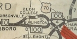
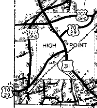
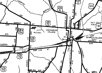
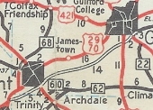
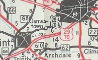
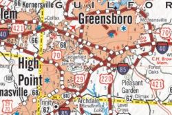
About 1956, US 70 was given a modern routing from Thomasville bypassing High Point, Jamestown and Sedgefield, then continued along today's I-40/85 corridor to bypass Greensboro, Burlington, and Mebane. US 70 tied back in to the original highway west of Hillsborough using today's Exit 161 at Efland. The old routing through all these places became one long US 70-A (now US 70; English Rd, Main St, and Qubein/Montlieu which is no longer continuous through High Point Univ). High Point to Sedgefield became US 29A-70A (now just Greensboro Rd; Main St through Jamestown; Gate City Blvd (except used High Point Rd around I-73 area); Lee St/Aycock/Market/Burlington through Greensboro; current US 70 back to Efland. In June 1963 (NCDOT), US 70 was removed from I-85 between Sedgefield and Efland and placed back on its former routing, replacing most of the US 70-A. The connector between I-85 and US 70 in Efland became a short US 70-A
US 70 Greensboro to Efland via Burlington 1953 Official
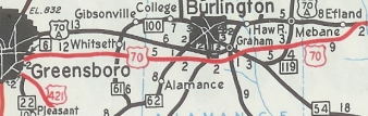
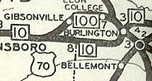
US 70 using new super-2 routing Greensboro to Efland 1958 Official
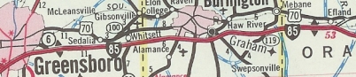
US 70 removed from I-85 Greensboro to Efland 1963 Official In March 1967 (NCDOT), US 70 was given its current routing following US 29 north to Wendover Ave instead of E Market St and Burlington Rd
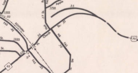
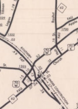
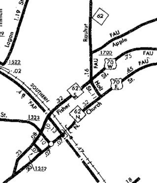
In December 1972 (NCDOT), US 70 was placed on one-way alignments through Burlington. EB used the original route of Church St. WB used Fisher/Hoke (now part of Fisher)/Davis. In February 1981 (NCDOT), the one-way split in Burlington was expanded west to 5th St. WB was new construction west of Davis St.
In July 1993 (NCDOT), US 70 was placed on its bypass of Haw River, leaving behind SR 1802/NC 49 Main St. In Sept 2021 (NCDOT), US 70 was rerouted from High Point to Greensboro by following NC 68 around western High Point, then replacing SR 1541/2254 Wendover Ave northeast to Greensboro and following US 220 back to where US 70 leaves US 29 in Greensboro. The previous High Point-Greensboro routing remains US 29. Posting changes did not occur until 2024.
Durham, Wake, Johnston Counties:
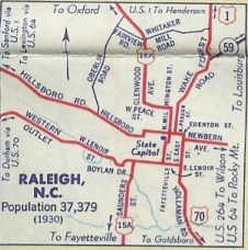
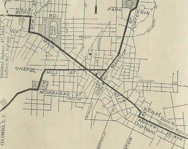
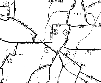
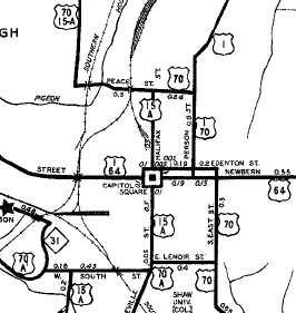
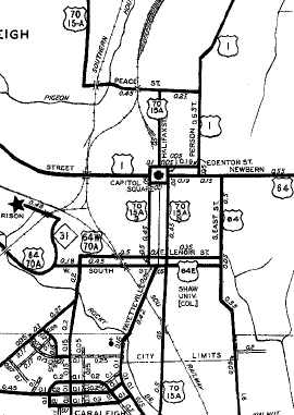
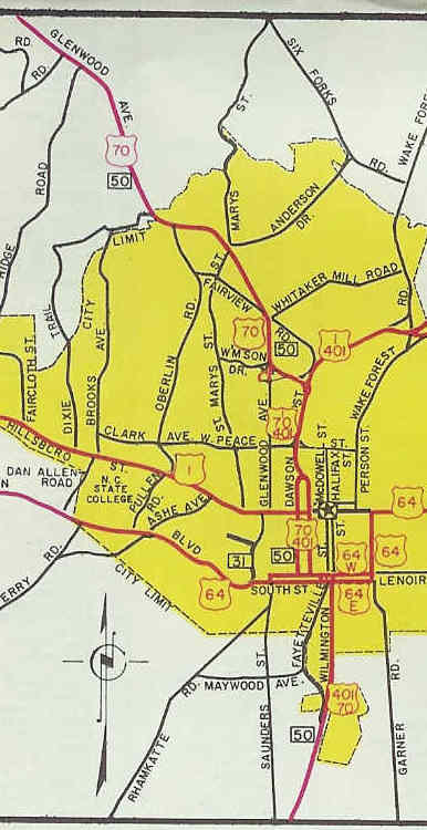
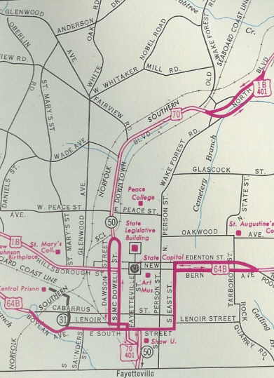
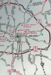
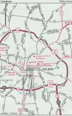
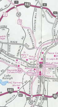
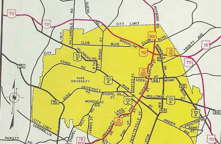
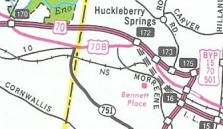
Between 1939-44, US 70 was removed from Bennett Memorial Drive in northwestern Durham. About 1948, US 70 was rerouted in Durham from using Hillsborough Rd/9th St/Main St/Alston Ave/Angier Ave to instead use Hillsborough Rd/9th St/Main St/Duke St/Chapel Hill St/Pettigrew St/Roxboro Rd/Holloway St. US 70 then followed its current routing southeast to Raleigh. US 70 followed Glenwood Ave/Peace St/Person St, then New Bern St (EB)/Edenton St (WB), then East St south as it always had getting to Garner Rd. From Roxboro Rd/Main St jct Durham to East St/Lenoir St Raleigh was a route swap with US 70-A (leaving Durham the former US 70 is now SR 1926 Angier Ave to Bethesda; SR 1959 Miami Blvd to Clegg; NC 54 to Cary loop; Chapel Hill Rd through Cary; NC 54; Western Blvd into southern Raleigh, then Boylan Ave/South St/Fayetteville St/Lenoir St to East St which was now the US 70 routing).
In 1952, US 70 was given a routing around the north of Durham: duplexed with then-NC 98 Miami Blvd northwest to Geer St/Avondale north to what is now I-85. US 70 then followed I-85 west to where NC 147 ends, then Hillsborough Rd westward. The route through Durham became US 70-A (now US 70 Business, except: US 70 used Miami south of NC 98
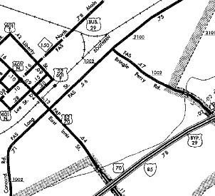
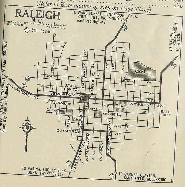
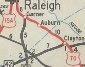
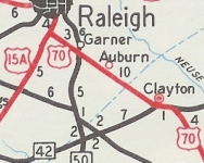
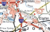
About 1953, US 70 was rerouted in Raleigh to leave Peace St on Halifax St south to the Capitol, then used one-way splits: Salisbury St to South St (EB)/Wilmington St (WB). Below South St US 70 followed McDowell St out of Raleigh and bypassed Garner, Auburn and Clayton. The old route is SR 1004 Garner Rd/Old US Hwy 70/Main St (Clayton).
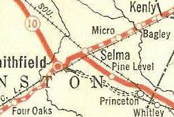
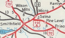
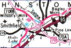
In November 1953 (AASHO), US 70 was rerouted to run directly from Smithfield to Princeton over an existing secondary road. The route via Selma became US 70-A (now US 301 to Selma and US 70-A to Princeton). About 1954, US 70 was rerouted through Raleigh to leave Glenwood at Williamson east to Dawson, then south to one-way splits: Dawson/Lenoir/Salisbury/South (EB); Wilmington/Lenoir/McDowell (WB). US 70 then used Wilmington St south. In 1956 or 1957, US 70 was placed on its current bypass of Durham on the east side, as new construction. Miami Blvd below Holloway became an extended US 70-A; above Holloway and the Geer St piece remained NC 98; Avondale became part of NC 55. In March 1967 (NCDOT), US 70's Raleigh routing was altered to have the EB split use Salibury directly to Wilmington St.
In 1970, US 70 was given its current bypass of Princeton leaving behind Donnie Jones Blvd.
In September 1972 (NCDOT), US 70 was placed on the Raleigh Beltline east around the north side to today's US 1-401, then used Downtown Blvd southwest back to Dawson. In April 1984 (NCDOT), US 70 was extended further around the Beltline around the east and south of Raleigh to Saunders St, then US 70 used Saunders St south to Wilmington St. This left no primary routes inside the Raleigh Beltline. In November 1989 (NCDOT), US 70 was placed onto I-40 heading southeast off the Beltline. The old routing further west to Saunders and southeast back to I-40 became US 70 Business. In July 1991 (NCDOT), US 70 was removed from the Beltline and returned to Raleigh surface streets. It went back to its previous routing from the northwest except at the south end of the one-way splits it used Dawson to connect to Saunders.
Also about 1991, US 70 was rerouted east of Clayton to replace US 70-A to Selma (including a new bypass of Wilson Mills), then continue as new construction bypassing Pine Level over to Princeton. The route via Smithfield became US 70 Business. In July 1993 (NCDOT), US 70's Durham Bypass was extended west along I-85 to Exit 170, leaving behind more US 70 Business.
In July 1997 (NCDOT), US 70 was placed on new construction bypassing I-95/Selma area. The old route that provided access to US 301 and I-95 became another US 70 Business. In October 1997 (NCDOT), US 70 was re-routed through Selma, replacing the 3-month old US 70 Business. The bypass became US 70 Bypass.
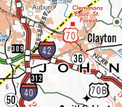
In June 2008 (NCDOT), US 70 was given its bypass of Clayton by duplexing with I-40 from Exit 306 to a new freeway at Exit 309 east around Clayton. The old route through Clayton became US 70 Business. About May 2025, US 70 was removed from I-40 and the newly posted I-42 and placed back onto US 70 Business through Clayton.
Wayne, Lenoir, Jones, Craven, Carteret Counties
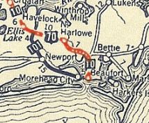
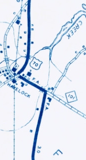
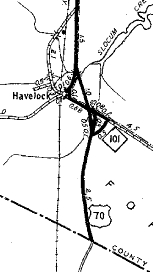
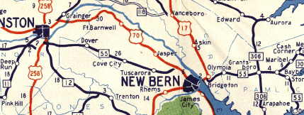
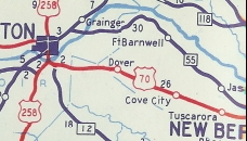
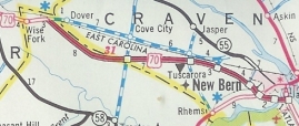
By 1936, US 70 was removed from Beaman Rd near Clarks. In 1941, US 70 swapped routes with NC 55 from Kinston to west of New Bern. US 70 followed today's US 70 Business and modern 70 east of Kinston, then essentially Sunset Blvd through Dover, Cove City, Tuscarora and Clarks. Between 1939-44, US 70 was removed from SR 1763 Church/Miller/Crocker/SR 1737 Roosevelt Blvd in Havelock and put on its current routing.
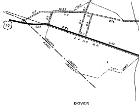
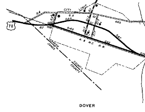
Between 1945-49, US 70 was moved from SR 1270 Wilson St to Kornegay St in Dover.
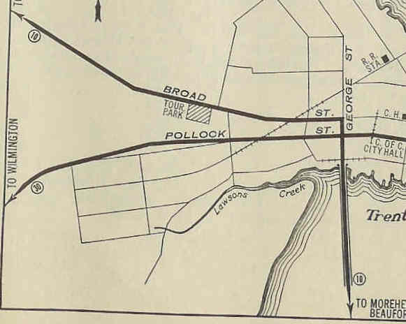
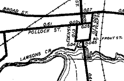
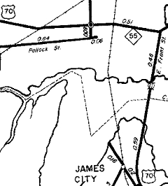
Between 1950-53, US 70 appears to have been rerouted in New Bern to use Pollock and either Eden or Metcalf and Front Sts to connect between Segments of George St. It is possible this was a one-way pair through a square.
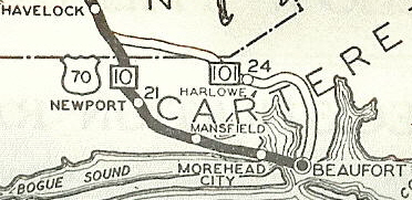
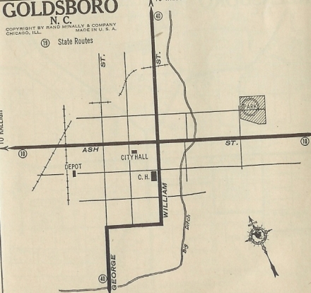
Also between 1954-57, US 70 was removed from SR 1176 Bridges St/W 4th St and placed on Arendell all the way through Morehead City. In 1957, US 70 was given its bypass of Goldsboro, leaving behind US 70-A (now US 70 Business).
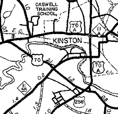
Also in 1957, US 70 was given its bypass of Kinston, leaving behind US 70-A (now SR 1295 Vernon Ave and NC 58 Queen St).
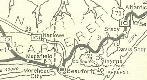
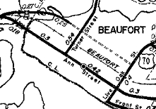
In 1957, US 70 was rerouted in New Bern to use Broad to E. Front St to cross the Trent River, then onto newly built alignment (current 70) instead of Trent Villa Landing Rd and SR 1113 Old Cherry Point Rd. This was when I believe US 70 was also removed from Green Ave and SR 1162 near Neuse Forest. Around 1958, US 70 was removed from Ann St to use Cedar St over to Live Oak.
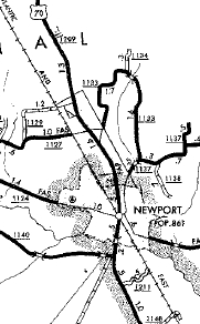
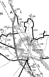
About 1964 (bridge date), US 70 was given its new bridge/causeway over the Newport River between Morehead City and Beaufort leaving behind SR 1205 Old Causeway Rd. About 1968, US 70 was given its bypass of Newport leaving behind SR 1247 Chatham St.
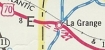
In September 1969 (NCDOT), US 70 was given its bypass of La Grange leaving behind SR 1788 Fussell Rd and SR 1603 Washington St.
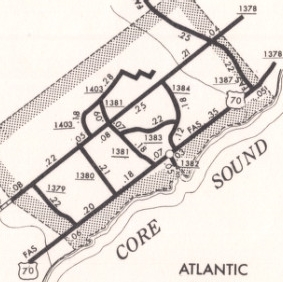
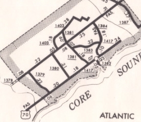
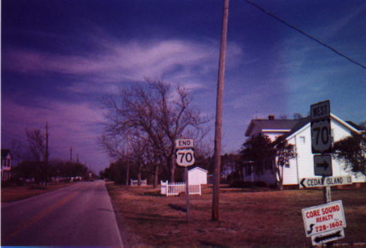
In March 1973, US 70 was truncated in Atlantic from SR 1387 Core Sound Loop Rd to its current ending at SR 1380 School Rd leaving behind SR 1417.
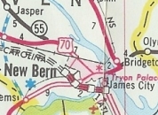
In March 1978 (NCDOT), US 70 was given its bypass of New Bern by using Gleburnie Rd south to a new freeway east around New Bern. The old route through New Bern became US 70 Business.
In July 1978 (NCDOT), US 70 was placed on new freeway from west of Dover to the recent New Bern freeway. Much of the old route became SR 1005 Sunset Blvd, but some remained NC 55 and Glenburnie became part of US 70 Business.
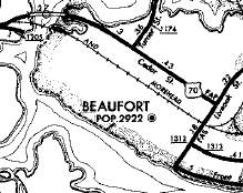
About 1985, US 70 was given a new causeway and high rise bridge over Salters Creek just west of NC 12. A fair amount of the old causeway on both sides is still accessible. In August 2013, US 70 was removed from SR 2032 Sanderson Way west of Kinston. In January 2018, US 70 was placed on a new crossing between Morehead City and Beaufort, which skirts around the north and bypasses Beaufort entirely. The Morehead City side became a short access road for businesses; the old drawbridge was closed permanently; Cedar St in Beaufort west of Turner St became SR 1907; the rest of Cedar St and Live Oak St northeast out of Beaufort became US 70 Business (since downgraded to city street and SR 1493 Live Oak St). In December 2025, US 70 was placed on a new freeway bypass around the west of Havelock. The old route became US 70 Business. |
Comments: |
US 70 is 4-lane or freeway the entire route from Durham to Morehead City and is popular way to head to the coast.
US 70 is no longer posted east of NC 12...a sign directs you to turn right and that's the last shield now. Freewayization is ongoing along US 70 from Raleigh to at least Havelock for posting as I-42. US 70 is a viable alternative from Asheville to Newport, TN as the route has few winding sections remaining. On the freeway west of New Bern there are signs telling you to watch for bears! |