U.S. 64
< 52 | Home | 64-A | 64 Bus | 64 Byp | 70 >
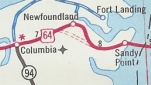
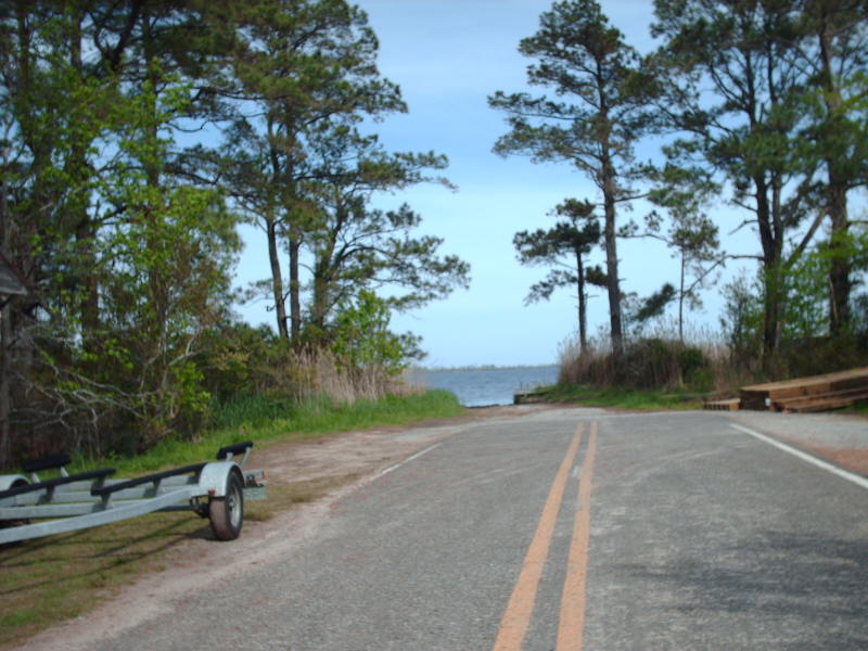
Photo: US 64's original east end at Fort Landing (Mapmikey)
| U.S. 64 609 miles | |||
| The Road: | Enters from Tennessee near Wolf Creek (Cherokee County) and ends at US 158/NC 12 in Whalebone (Dare County). Nationally the road runs from Whalebone to US 160 at Tec Nos Pos, AZ. | Towns and Attractions: | Cherokee Co.: Murphy
Clay Co.: Hayesville, Chatuge Lake Macon Co.: Nantahala Nat'l Forest, Franklin, Cullasaja Falls, Highlands Jackson Co.: Cashiers Transylvania Co.: Pisgah Nat'l Forest, Brevard Henderson Co.: Hendersonville Rutherford Co.: Chimney Rock, Lake Lure, Rutherfordton McDowell Co.: None Burke Co.: Morganton Caldwell Co.: Greenwell, Lenoir Alexander Co.: Taylorsville Iredell Co.: Statesville Davie Co.: Mocksville Davidson Co.: Lexington Randolph Co.: Asheboro, Ramseur Chatham Co.: Siler City, Pittsboro, B Everett Jordan Lake Wake Co.: Apex, Cary, Raleigh, Knightdale, Wendell, Zebulon Franklin Co.: None Nash Co.: Nashville, Rocky Mount Edgecombe Co.: Tarboro, Princeville Martin Co.: Williamston, Jamesville Washington Co.: Plymouth, Creswell Tyrell Co.: Columbia Dare Co.: Alligator River Nat'l Wildlife Refuge, Manteo |
History: |
An original US Highway, US 64 originally ended in Arkansas. AASHO floated the idea to extend US 64 to the east coast of North Carolina in March 1932. North Carolina requested this in June 1932 but AASHO objected to the proposed routing of Morganton to Statesville via Lenoir. North Carolina agreed to AASHO's desire for it to run directly with US 70 and US 64 was approved June 16, 1932.
US 64 joined NC 28 from Tennessee to Old Fort; US 70/NC 10 to Statesville, and NC 90 east to end at Fort Landing in Tyrell County. Here is a closer look geographically: Cherokee and Clay Counties
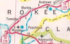
US 64 original routing west of NC 60. 1938 Cherokee County
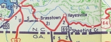
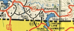
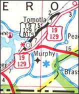
US 64 modern routing west of NC 60. 1949 Cherokee County In 1956 (bridge date), US 64 was placed on its current route from the NC 141 area to just outside Hayesville. The old route used SR 1548/1100 Old Hwy 64 through Brasstown, Ogden and Warne just north of the Georgia State line.
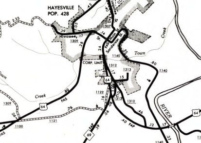
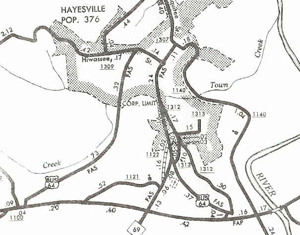
In May 1971 (NCDOT), US 64 was given its bypass of Hayesville (partial upgrade to SR 1121), leaving behind US 64 Business.
Between 1969-72, US 64 was placed on new alignment east of Chatuge Lake to Shooting Creek, leaving behind an extended NC 175 and a lengthy SR 1353 "Old Hwy 64 E". At this time US 64 used SR 1168 in Shooting Creek to get from new 64 to original 64. About 1973, US 64 was given its modern routing from Shooting Creek to the Macon County Line, leaving behind more SR 1353 and SR 1349 "Old Hwy 64 E"; also National Forest Rd and Deep Gap Rd. In January 1979 (NCDOT), US 64 was placed on its bypass of Murphy, leaving behind US 19 Business and Peachtree St.
In Dec 2009 (NCDOT), US 64 was moved onto new construction along the south of the Hiawassee River east of Murphy, leaving behind SR 1687 "US 64 ALT", a bit of NC 141, and SR 1685 Family Church Rd. In March 2009 NCDOT requested the old route become US 64 ALT but AASHTO turned them down. Macon, Jackson, and Transylvania Counties
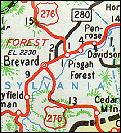
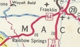
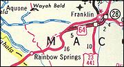
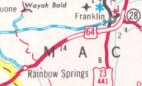
About 1969 (bridge dates), US 64 was rebuilt from Franklin to Gneiss. Surviving pieces are: SR 1571 Crane Cir in Franklin; SR 1669 Dutton Dr; a bit of SR 1668 Dutton Rd; Jake Rd/River Rd; SR 1564 Fuchs Dr; SR 1697 Old Highlands Rd; SR 1565 Dean Farm Cir; SR 1566 Lullwater Rd In March 1974 (NCDOT), US 64 was given its Franklin bypass, leaving behind NC 28 east of Downtown and the lengthy SR 1442 Patton Rd/Old Murphy Rd into Franklin which becomes Palmer St coming from the west. In December 1978 (NCDOT), US 64 was placed on new alignment in the Rainbow Springs area, leaving behind the circuitous and lengthy SR 1448 W. Old Murphy Rd/Charles Nolan Rd, plus SR 1451 Bill Dalrymple Rd
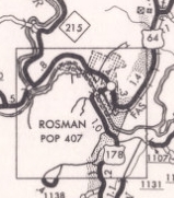
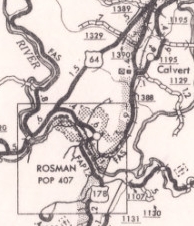
In July 1979 (NCDOT), US 64 was given its Rosman Bypass, leaving behind a short lived US 64 Business (now US 178 and SR 1388 Old Rosman Hwy). About 1981, US 64 was rebuilt between Rosman and Brevard. Surviving pieces: SR 1392 Cherryfield Loop Rd/SR 1196 Avian Ct; SR 1393 Catheys Creek Church Rd; a bit of SR 1159 Old Country Home Rd; SR 1338 Selica Rd
Henderson County to Morganton
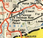
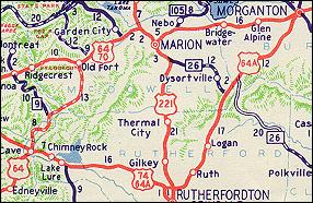
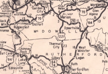
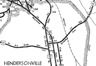
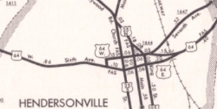
Between 1954-57, US 64 was placed on new alignment in the Etowah and Horse Shoe areas. The old route used SR 1203 "Old US 64"/McKinney Rd through Etowah to (no longer connects to) Cheerful Circle and SR 1324 Morgan Rd; part of Horseshoe Bend Rd/abandoned road along RR/Old Brevard Hwy/SR 1314 Banner Farm Rd to Horse Shoe About 1964 (bridge date), US 64 was removed from SR 1898 Old Chimney Rock Rd at I-26 location. In December 1971 (NCDOT), US 64 was placed on its one-way splits in Hendersonville. EB used 6th Ave all the way through to Martin Luther King Jr Blvd, while WB used MLK Jr Blvd to 7th Ave to Buncombe Ave south to 6th. US 64 was removed from Church St which it used to go from 6th to 7th for 40 years. US 64 was also removed from SR 1647 7th Ave east of town.
Morganton to Statesville
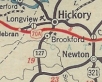
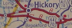
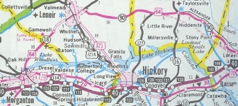
About 1948, US 64 was placed on the existing bypass of Hickory and Conover in a route swap with US 70-A. This left behind a new US 70A (now SR 1007 1st Ave to Hickory and SR 1007 Highland Ave/1st St to Conover).
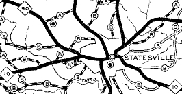
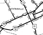
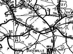
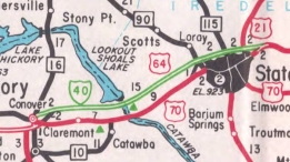
About 1954, US 64 was given a bypass north around Statesville using today's SR 1617 Westminster Drive and I-40 east to today's US 64 interchange east of I-77. The old route through Statesville became US 64-A.
About 1956, US 64 was placed on a bypass of Morganton using today's US 70 Bypass east of Burkemont Ave. The route through town is shown as unnumbered on the 1957 Burke County map but was US 64 Business on the 1962 Burke County Map (this is now just Burkemont Ave and Union St). Around 1960, US 64 was removed from Westminster Drive and instead continued along I-40 west to today's Exit 133 Rock Barn Rd SR 1709. US 64 followed this southwest (turns into 7th Ave NE) to today's US 70 Conover. About 1963, US 64 was removed from I-40 from Conover to Statesville and was placed back on US 70 east of Conover and eliminating US 64 Business through Statesville, reverting to its its 1944 routing.
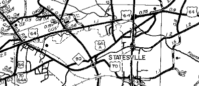
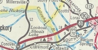
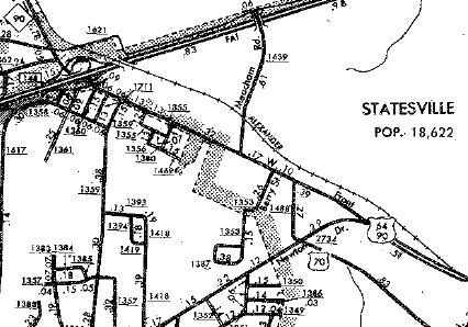
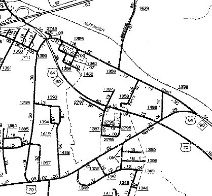
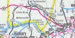
In December 1987 (AASHTO), US 64 was rerouted entirely from Morganton to Statesville: Followed US 70 Byp west to US 70 Business Union St, then continued as new primary routing on Sanford Dr around to NC 18, then followed NC 18 to Lenoir. US 64 then followed NC 90 east through Taylorsville and Stony Point back to Statesville. The old route via Hickory was briefly designated as US 64-A and has remained part of US 70 ever since. In Aug 1992 (NCDOT), US 64/NC 90 was removed from Front St west of Newton Dr and instead uses Newton Dr and Carner Bagnal Blvd in western Statesville.
In May 1996 (NCDOT), US 64 was placed on new Super-2 routing from roughly NC 127 east to I-40. NC 90 remains on the old routing.
Statesville through Chatham County
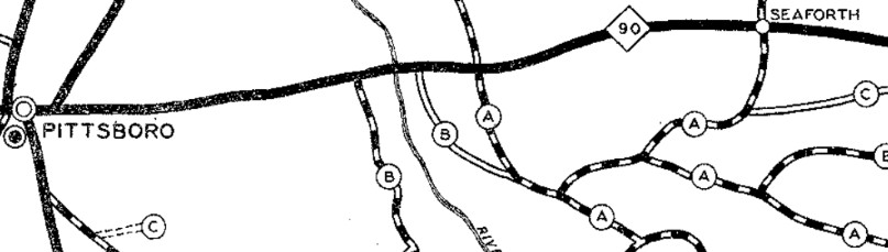
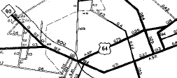
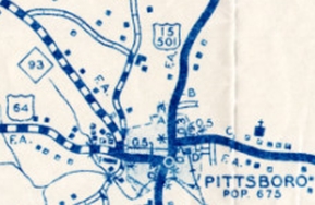
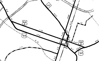
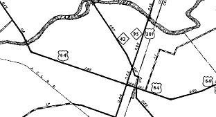
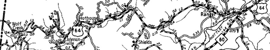
This map shows the 1927 routing of NC 90...notice the intersections around the Haw River crossing and where they are on the 1938 map 1930 Chatham County
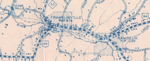
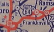
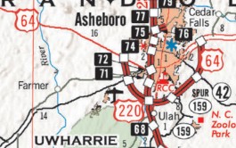
US 64 on direct routing...as you can see, the 1930 map is poorly drawn 1938 Chatham County US 64 may have used Martin Luther King Dr in eastern Asheboro, which was bypassed by Salisbury St between 1931-36. About 1939, US 64 was straightened out at the NC 703 (now NC 150) Reeds Crossroads area. The abandoned route was north of SR 1192 Old US 64 and crossed NC 150 nee 703 south of Reeds Baptist Church Rd. About 1941, US 64 was given its current routing bypassing Franklinville over to Ramseur, leaving behind US 64-A (now SR 2235 Andrew Hunter Rd to Franklinville and NC 22 to Ramseur).
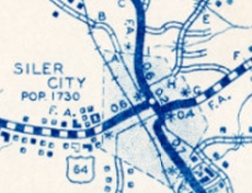
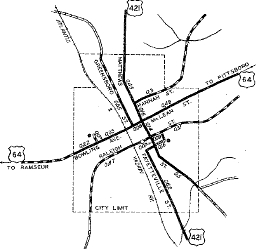
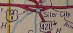
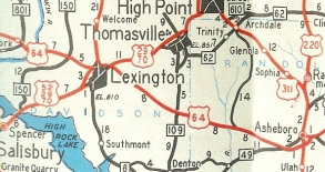
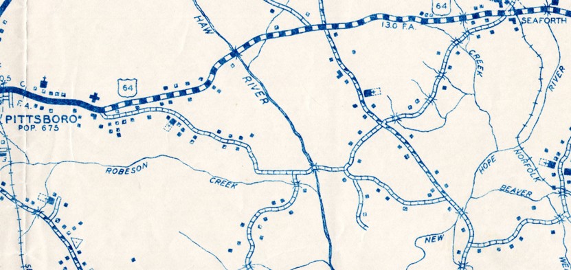
Between 1939-44, US 64 was moved from SR 2103 Raleigh St and US 421 (now SR 2113) 2nd Ave to SR 1107 3rd St east out of Siler City; also in this timeframe, US 64 was given its modern alignment between Siler City and the Pittsboro Bypass, leaving behind SR 1503 Stage Coach Rd, SR 2234 Stage Coach Trail, SR 1503 Harold Hart Rd, lengthy abandoned loops, a bit of SR 1506 Pleasant Hill Church Rd, more lengthy abandoned loops, Harlands Creek Dr, SR 1648 Wagon Trace, SR 1564 Old Siler City Rd. About 1949, US 64 was rerouted in Mocksville routing. Previously it used Wilkesboro St, Salisbury St, Depot St and Main St to Lexington Rd. Now it used Wilkesboro St and Salisbury St to Lexington Rd. Around 1949, US 64 was put on its current routing in the Siler City area, leaving behind SR 1169 Graham Moore Rd, SR 1370 Benjie Williams Rd, and US 64-A (now SR 1107 Old Hwy 64/3rd St).
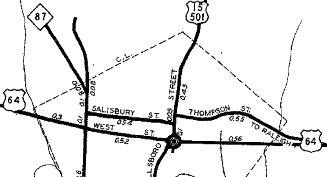
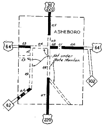
Between 1950-53, US 64 was moved from SR 1701 Thompson St and a bit of SR 2552 Hillsboro St to today's US 64 Business east out of Pittsboro. About 1953, US 64 was put on mostly new constructed route from the Davie-Davidson line to Asheboro, giving US 64 its current routing through Davidson County, Lexington Bypass, western Randolph County, and its Asheboro bypass. The old route became SR 1192 Old US 64 to Lexington which becomes 5th Ave; US 29A-70A (now just Main St) through Lexington; SR 2205 Raleigh Rd (Davidson County) and SR 1344 Old Hwy 64 (Randolph County); SR 1390 Gallimore Town Rd; SR 1335 Rush Mtn Rd; abandoed bridge over Uhwarrie River; SR 1382 Tabernacle School Rd; SR 1333 Robbins Cir/Old Road Dr; SR 1416/1004 Old Lexington Rd which becomes Salisbury St in Asheboro; a bit of NC 49A on Salisbury St (now NC 42); east of US 220-311 (now just Fayetteville St), it *may* have become US 64A briefly. State Officials 1953-56 imply a US 64A using US 220 from the new US 64 to Salisbury St then east out to the new US 64. The 1953 Randolph County map shows no route number and the 1957 Randolph County map shows NC 902 (now NC 42) on Salisbury west of the NC 42 turnoff and secondary routing (now SR 2237) east of there.
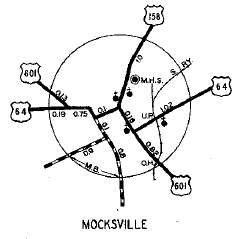
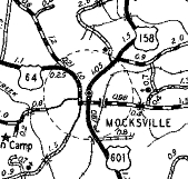
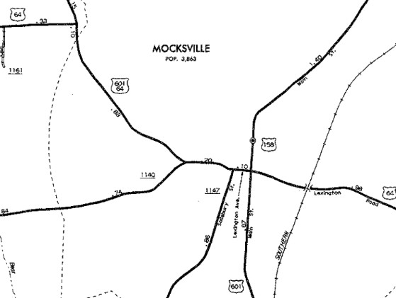
In July 1974 (NCDOT), US 64 was placed on new alignment and bridges over the arms of B. Everett Jordan Lake. The previous alignment is north of the current one, angling up to about 1000 feet away and most of it underwater. About 1988 (bridge dates), US 64 was removed from SR 2713 Trogdon Hill Rd In January 1991 (NCDOT), US 64 was placed on a bypass of central Mocksville, using Valley and Sanford Sts which turn into Lexington St. Wilkesboro/Salisbury became city streets.
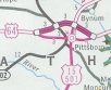
The 2002 Official Map shows the Pittsboro Bypass complete, although NCDOT documents don't officially designate the Bypass-Business routings until Dec 2005. The old route became US 64 Business and SR 1991 Foxfire Trace.
In Dec 2020, US 64 was placed on the new freeway bypass around the south of Asheboro, with the old route becoming US 64 business.
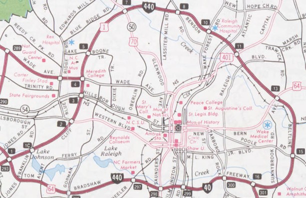
Wake County
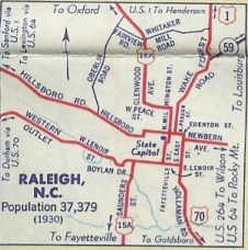
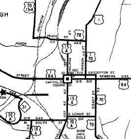
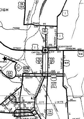
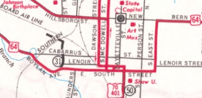
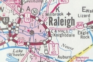
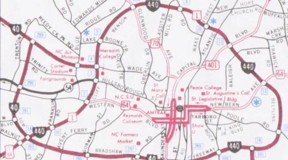
Between 1945-49, US 64 was placed on one-way splits in central Raleigh from Hillsborough St: EB went south on Salisbury, then east on Morgan St, north on Wilmington St, then east on New Bern as before. WB used the previous US 64 alignment (Salisbury St/Edenton St/E. East St/New Bern Avenue). Between 1950-53, US 64 was removed from central Raleigh altogether by following then-US 70A, Chatham Ave/Western Blvd from the Cary area east into southern Raleigh, then Boylan Ave northeast to South St. US 64 then split into one-way alignments at Saunders St: EB used South St east to East St north to New Bern Ave. WB used East St south from New Bern Ave, then west along Lenoir St to Saunders St south to W South St. The old routing via Method remained US 1 (this is now partly NC 54).
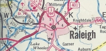
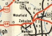
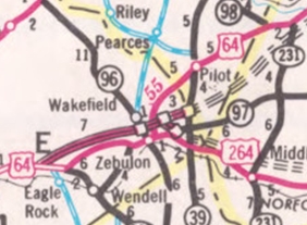
In 1960, US 64 was placed on a bypass around Wendell utilizing existing county roadway. The old route through Wendell became US 64 Business. In 1962, US 64 WB was removed from Lenoir St and two-way traffic was placed on South St. In 1963 or 1964, US 64 was removed from SR 2946 Farmwell Rd just east of the Neuse River. In 1965, US 64 was given its current routing from Apex to US 1 and was routed with US 1's current routing west and north of Raleigh on the Beltline all the way around to today's I-440/US 64 Business interchange. The old routing is SR 5878 N. Salem St and SR 1011 Old Apex Rd into Apex; SR 1011 Chatham St to Cary; SR 1011 Hillsborough St/Western Blvd into Raleigh.
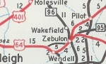
In August 1975 (NCDOT), US 64 was placed on new freeway from northwest of Wendell into Franklin County. This left behind an extended US 64 Business from western Wendell, an extended NC 97 over the original Wendell bypass to Zebulon, and SR 2406 Shepard School Rd.
In April 1984 (NCDOT), US 64 was removed from the northern arc of the Beltline and instead placed on the newly completed Beltline around the south of Raleigh. In July 1991 (NCDOT), US 64 was removed from the southern arc of the Raleigh beltline and instead was routed again through the city. This was mostly along the decommissioned US 64 Business routing, but with more one-way pairs. It replaced SR 1012 Western Blvd from US 1 to Cabarrus Ave; EB over SR 1012 Dorothea Dr/Boylan Dr/South St/Person St/New Bern Ave to Poole St; WB over SR 2298 Edenton St, SR 2299 Blount St, SR 2596 Lenoir St/Cabarrus St to Western Blvd; US 64 replaced SR 2911 New Bern Ave east out to I-440.
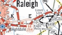
In Nov 1994 (NCDOT), US 64 was again removed from the streets of Raleigh and restored to the south and east parts of the beltline. In Nov 2006 (NCDOT), US 64 was placed on new freeway from the Beltline over to the previously constructed freeway end near Eagle Rock, leaving behind an extended US 64 Business.
Franklin County to the Beach
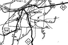
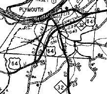
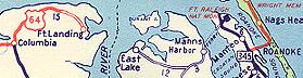
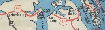
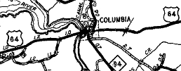
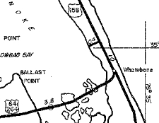
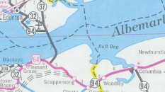
In September 1950 (AASHO), US 64 was rerouted at Columbia to instead head directly east via Newfoundland to a ferry across the Alligator River. Then US 64 was extended east along what had been a county road for decades to Manns Harbor to another ferry to Roanoke Island, then was added to NC 345 south through Manteo, then replaced US 158 across the Roanoke Sound to end at truncated US 158 Whalebone Jct (current NC 12 jct with South Old Oregon Inlet Rd). The old route to Fort Landing and its former ferry was SR 1209 Road St; SR 1214 New Rd; SR 1209 Soundside Rd/Ft Landing Rd.
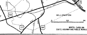
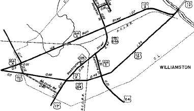
About 1952 (bridge date), US 64 was removed from SR 1331 Quiet Waters Rd over the Tar River (bridge is closed) and SR 1331 Webbs Mill Rd into Spring Hope. Adam Prince has a feature on the old Tar River Bridge here. About 1954, US 64 was given a bypass of Williamston, utilizing the route of current US 64-A. The old route through Williamston became an earlier US 64-A (now SR 1445 Main St; US 17 Bus Haughton St; SR 1446 Jamesville Rd).
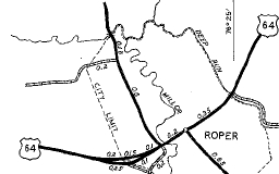
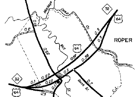
In 1955, US 64 was removed from SR 1122 Buncombe Rd in Roper onto the current NC 32 Roper bypass. An October 1960 letter to AASHO explicitly said US 64-A was renumbered to US 64 Business through Roper. It is unclear if US 64-A went back to the bypass opening or was added later. No county map shows 64-A or 64 Business.
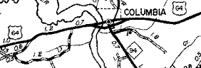
Between 1954-57, US 64 received its bypass of Columbia, leaving behind a secondary route that became US 64 Bus in 1960 (now removed Scuppernong River bridge; SR 1246/US 64 Bus Main St) per an October 1960 letter to AASHO that explicitly did not have a US 64-A renumbered as US 64 Bus.
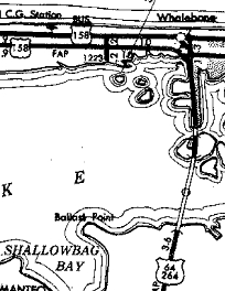
About 1955, US 64's ferry across Croatan Sound was replaced with a bridge. In Manteo US 64 was routed over more NC 345 from Fort Raleigh. On the Manns Harbor side, US 64 was removed from SR 1110 Old Ferry Dock Rd. On the Manteo side, US 64 was removed from SR 1116 Airport Rd. About 1960, US 64 was put on a new bridge across the Alligator River. The west shore ferry landing was immediately adjacent north of the bridge. The old route to the east shore landing in East Lake is SR 1153 Old Ferry Landing Rd. Also about 1960, US 64's east end was truncated to its current endpoint when the US 158 Bypass of Nags Head/Kill Devil Hills was built. The short road east to Whalebone Jct became part of US 158 Business (now part of NC 12).
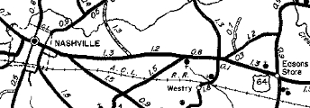
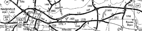
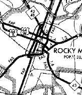
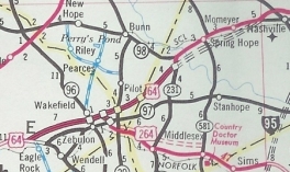
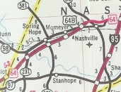
In 1963, US 64 was placed on a new Super-2 bypass of Nashville, following today's US 64 to Exit 467 near Rocky Mount, then current US 64 Business to Sunset Ave. The old route became US 64 Business through Nashville and SR 1770 Eastern/Sunset east to Rocky Mount.
Between 1963-68, US 64 was placed on one-way splits through central Rocky Mount: EB used Sunset/Tarboro/Raleigh Sts while WB used Thomas St.
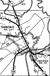
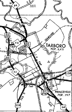
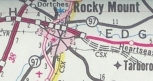
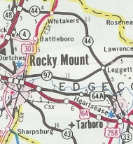
In 1968, US 64 was given its original bypass around the west of Tarboro, following the current route of US 64-A. The old route through Tarboro and Princeville became US 64 Business (now SR 1577 and NC 33).
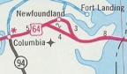
Between 1969-72, US 64 was removed from SR 1169 Robertson Landing Rd/abandoned route and also the Creef Cut Trail between East Lake and US 264. In May 1971 (NCDOT), US 64 was removed from SR 1229 Old US 64 through Newfoundland east of Columbia.
In August 1975 (NCDOT), US 64 was moved to its current freeway from Wake County to NC 39. US 64 briefly used NC 39 north to Pilot. This left behind SR 1770 Old Hwy US 64. In October 1976 (NCDOT), US 64 was placed on its current freeway from NC 39 to NC 231, then north on new construction back to US 64. The old route was more SR 1770 Old Hwy US 64 plus Nash SR 1336 Old Hwy US 64, plus an extended NC 98. In September 1978 (NCDOOT), US 64 was placed on its current freeway between NC 98/231 and the Nashville Bypass, leaving behind a short-lived lengthy NC 98 extension (now US 64-A). The connector between the NC 231 interchange and NC 98 became NC 231 (now also US 64-A).
In August 1983 (NCDOT), US 64 was placed on its freeway bypass of Rocky Mount, leaving behind US 64 Business. About 1987, US 64 was placed on its freeway between east Rocky Mount and the US 64-258 jct in Tarboro, leaving behind US 64-A.
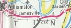
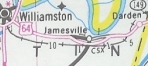
In November 1993 (AASHTO), US 64 was given its Jamesville Bypass leaving behind US 64 Business and also removed from SR 1592 Old US 64 through Dardens.
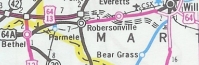
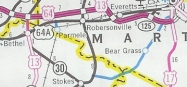
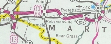
In 1996, US 64 was placed on new freeway from Princeville to NC 11, then routed on Roberson School Rd/Carson Rd southeast back to original US 64. This left behind US 64-A through Conetoe and Bethel. In 2000, US 64 was placed on more new freeway from NC 11 to NC 903, then routed down NC 903 to Robersonville. This left behind more US 64-A. In 2001 or 2002, US 64 was placed on more new freeway from NC 903 to US 17, then routed on US 17 north to the original Williamston Bypass. This left behind more US 64-A. In 2004, US 64 was placed on more new freeway from US 17 east around to the current US 64 near Sweetwater Creek.
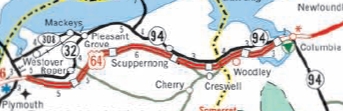
About 2006, US 64 was placed on new freeway from NC 45 east to Columbia, leaving behind NC 32; NC 94 except: through the interchange at Benson Rd Exit 554; SR 1219/1158/1199 "US 64" through Creswell; around the overpass with Woodley Station Rd; through the interchange at Travis Rd Exit 562; SR 1250/abandoned causeway/SR 1249.
In November 2012 (AASHTO), NCDOT requested from FHWA that US 64 from I-40 Raleigh to Williamston be assigned as I-44 as part of a Raleigh to Norfolk interstate. In February 2013, NCDOT requested US 64 from Raleigh to Rocky Mount be designated as I-495, which was approved in Dec 2013. In May 2016 (NCDOT), US 64 from Raleigh to Williamston was re-designated as I-87. Work is ongoing to upgrade interstate-deficient segments of the freeway. |
Comments: |
US 64 is the longest route in North Carolina.
US 64 is 4-lane or freeway the entire route from Asheboro to Columbia. A sizable (80+ miles!) US 64 TRUCK exists that runs from Hendersonville to Franklin via I-26, I-40, US 74 and US 23-441. Although 64 has been modernized most everywhere, it is still a mountainous drive between Franklin and Rosman. Quite pretty, but not a quick journey. US 64 is not the shortest nor fastest way to get from Murphy to the Outer Banks. Instead US 19 to I-40 to Raleigh then US 64 would do much better. US 64 was the last North Carolina US Route to have an unpaved segment...the last 4 miles to Fort Landing were still gravel when it was removed from that location. |