< VA 38 | Home | VA 40 >
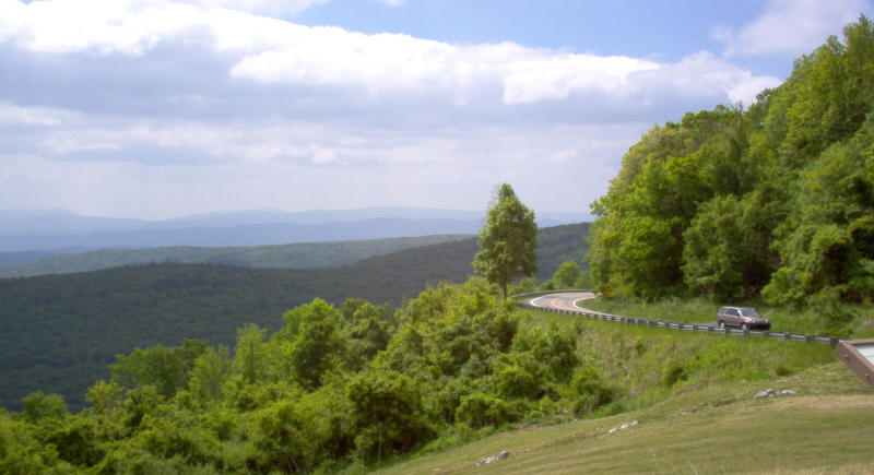
Photo: VA 39 as seen from a scenic overlook east of Warm Springs (photo by Mapmikey 5/20/06)
|
|
|
| ROUTE LOG |
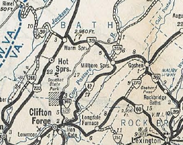
US 11: 0 - 0 VA 252: 7.55 - 7.55 VA 39 ALT: 11.11 - 18.66 VA 42 NB: 0.26 - 18.92 VA 39 ALT: 0.25 - 19.17 Bath-Rockbridge Line: 2.22 - 21.39 VA 42 SB: 5.73 - 27.12 US 220 NB: 13.05 - 40.17 US 220 SB: 0.19 - 40.36 WV STATE LINE: 17.50 - 57.86
|
Creation: Appeared in Oct 1940 as a renumbering of VA 501. Ran essentially as it does today except is east end was at the current US 11-SR 631 jct at the Maury River. This is the 3rd VA 39.
|
VA 39 is one of the longer primary routes in Virginia with no multilane segments. | Previous VA 39's:
1932 ROUTE LOG US 60 EB, BEGIN VA 39: 0 - 0 VA 512: 1.5 - 1.5 VA 514: 2.5 - 4 VA 511: 1.7 - 5.7 Warwick-Elizabeth City Line: 2.4 - 8.1 VA 39Y: 3 - 11.1 VA 39Y: 0.8 - 11.9 US 17 SB, VA 503: 0.5 - 12.4 US 17 NB, VA 515: 2.5 - 14.9 VA 517 WB: 7.4 - 22.3 VA 517 EB: 0.1 - 22.4 VA 514: 5 - 27.4 VA 519: 1.4 - 28.8 James City-Warwick Line: 0.1 - 28.9 York-James City Line: 3.1 - 32 James City-York Line: 2.5 - 34.5 Williamsburg-James City Line: 1.4 - 35.9 VA 542: 0.6 - 36.5 VA 510: 1.1 - 37.6 VA 510Y: 0.1 - 37.7 James City-Williamsburg Line: 1.4 - 39.1 VA 534: 10 - 49.1 VA 53: 3.4 - 52.5 New Kent-James City Line: 5.2 - 57.7 VA 413: 8.3 - 66 VA 424: 6 - 72 VA 415: 4.8 - 76.8 Henrico-New Kent Line: 0 - 76.8 VA 414 SB: 2.1 - 78.9 VA 414 NB: 4 - 82.9 Richmond-Henrico Line: 4.6 - 87.5 VA 41 EB: 1.5 - 89.0 VA 429: 0.5 - 89.5 US 60 WB, VA 13: 0.3 - 89.8 US 1 SB, VA 31 SB: 0.5 - 90.3 VA 41 WB: 0.3 - 90.6 Henrico-Richmond Line: 3.3 - 93.9 VA 421: 0.2 - 94.1 Hanover-Henrico Line: 5.9 - 100.0 US 1 NB, VA 31 NB, VA 50: 5.7 - 105.7 VA 420: 12.5 - 118.2 Louisa-Hanover Line: 6.2 - 124.4 VA 49 SB: 11.9 - 136.3 VA 49 NB: 4.2 - 140.5 VA 46 SB: 6.1 - 146.6 VA 46 NB: 0.1 - 146.7 US 15, VA 32: 10.8 - 157.5 Albemarle-Louisa Line: 3.8 - 161.3 VA 701: 3.6 - 164.9 VA 41: 3.0 - 167.9 Charlottesville-Albemarle Line: 8.0 - 175.9 VA 714: 1.0 - 176.9 US 29, VA 28: 2.0 - 178.9 Albemarle-Charlottesville Line: 0.5 - 179.4 VA 716: 9 - 188.4 VA 704: 3 - 191.4 VA 716: 1.5 - 192.9 Nelson-Albemarle Line: 7.5 - 200.4 VA 18: 0.3 - 200.7 Augusta-Nelson Line: 1.1 - 201.8 Waynesboro-Augusta Line: 2.9 - 204.7 VA 809 NB: 1.5 - 206.2 VA 831: 0.2 - 206.4 Augusta-Waynesboro Line: 0.1 - 206.5 VA 809 SB: 0.4 - 206.8 VA 832: 4.0 - 210.8 Staunton-Augusta Line: 6.3 - 217.1 US 11 SB, VA 33 SB: 0.4 - 217.5 VA 810, VA 831: 0.4 - 217.9 US 11 NB, VA 33 NB: 0.3 - 218.2 Augusta-Staunton Line: 0.4 - 218.6 VA 808: 3.2 - 221.8 VA 17 SB: 4.5 - 226.3 VA 17 NB: 0.5 - 226.8 VA 829: 10.1 - 236.9 Highland-Augusta Line: 6.6 - 243.5 VA 803 SB: 8.9 - 252.4 VA 803 NB: 0.3 - 252.7 VA 800 NB, VA 835: 9.2 - 261.9 VA 800 SB: 3.8 - 265.7 WV STATE LINE: 15.8 - 281.5 1939 ROUTE LOG US 15, US 360: 0 - 0 VA 40 WB: 13 - 13 VA 40 EB: 1 - 14 US 460: 19 - 33 |
VA 39 #1: Appeared as a renumbering of VA 9 except west of Monterey was likely new primary routing.
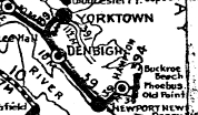
More specifically, VA 39 began at Fort Monroe, then used Ingalls Rd, and VA 143 to leave the post. VA 39 followed Water St to County St through Phoebus. VA 39 picked back up VA 143 and followed it to Tyler St then E Queen St which is where the Hampton River crossing was. VA 39 picked up Queen St to Armistead Ave, then Victoria Ave (now Settlers Landing) and Jackson St (now Kecoughtan). Heading for Newport News, VA 39 used Kecoughtan Rd hich turned into 25th St.
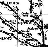
 VA 39 picked back up US 60 through Lightfoot, Norge and Toano. West of VA 30, VA 9 used "old US 60" through Edwards Swamp; US 60 then SR 649 from Lanexa through Walkers. VA 39 may also have used SR 629 north of US 60 but definitely used it through Providence Forge. After more US 60, VA 39 used SR 631 through the Roxbury area (no longer exists west of VA 106). VA 39 used the Old Williamsburg Rd which criss-crosses US 60 from Bottoms Bridge west to Sandston (cutoff by I-295 today). 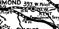 VA 39 used US 60 to eastern Richmond, using Williamsburg Rd to National Cemetery Rd ro 36th St to Broad St. VA 39 used Adams St to Chamberlayne, then Norwood to Brook Rd north. It appears, VA 39 (with VA 31) used Hungary Rd to Purcell Rd, then north through Glen Allen onto Old Washington Hwy which turns into SR 626 at Hanover County. VA 39 used SR 626 to VA 54 (avoiding Ashland), then west (used SR 669-666 north of VA 54) to SR 686 Horseshoe Bridge Rd. VA 39 followed this to SR 785 west back to VA 54 at Negro Foot, where VA 1 split north. VA 39 continued on VA 54 to Montpelier, then US 33 to Cuckoo. VA 39 followed US 522 to Mineral, then VA 22 through Louisa, Trevillians, Boswell Tavern, Cobhams, Cismont to Shadwell.
VA 39 picked up US 250, then US 250 Business to Charlottesville. VA 39 used 4th and/or 5th Sts to move to Main St which it used west out of town along with SR 601 Old Ivy Rd. West of the US 29 Bypass, VA 9 used an abandoned alignment to the north side of 250 for much of the way to Ivy. VA 39 then used SR 738 and more abandoned routing north of US 250. VA 39 then used VA 240 through Crozet, and picked back up US 250. VA 39 used SR 797 through Yancey Mills (now cutoff by I-64). VA 39 used US 250, then SR 796 loop near VA 151. VA 39 then used SR 750 Old Turnpike Rd to ascend to Afton. VA 39 used VA 6 across the railroad, then SR 600 to complete the ascension of the mountain (no longer connects to US 250 near Afton Wayside). VA 39 used US 250's corridor to descend to Waynesboro (several old alignments are evident). VA 39 used a couple brief loops down to Waynesboro, then US 340 Main St through downtown. VA 39 picked back up US 250 then used SR 641 through Fishersville. It appears VA 39 followed US 250 into Staunton but used Main to Central north back to current US 250. VA 39 used Old Churchville Rd out towards VA 262. VA 39 used US 250, then SR 840, then SR 721 south where VA 39 crossed the Middle River in line with SR 722 which VA 39 followed north back to 250 then west to Churchville. VA 39 followed US 250 to Monterey except it used SR 645 through McDowell. VA 39 used SR 636 south from Monterrey, then US 220 and VA 84 to the West Virginia Line. 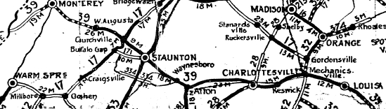 In 1924, VA 39 was rerouted at Richmond to follow today's US 1 to Ashland, then VA 54 over to Negro Foot This left behind CR 9 (now SR 626); CR 15 (now SR 669); CR 120 (now SR 666); CR 119 (now SR 686). In 1927, VA 39 bypassed McDowell leaving behind CR 6 (now SR 645). By 1929, VA 39 used Warwick all the way to 25th instead of zig-zagging around in Newport News. In 1930, VA 39 was rebuilt south of Monterrey to current US 220's alignment, leaving behind CR 102 (now SR 636). Sometime before 1932, VA 39 bypassed Fishersville, leaving behind CR 200A (now SR 641) In July 1933, VA 39 was renumbered as VA 271 from West Virginia to Vanderpool; VA 18 from Vanderpool to Monterey; VA 5 from Monterey to Shadwell; VA 22 from Shadwell to Boswells Tavern; VA 4 from Boswells Tavern to Montpelier; VA 54 from Montpelier to Ashland; US 1 from Ashland to Richmond; US 60 from Richmond to Old Point Comfort.
|
||||||||||||
|
|
|
| ROUTE LOG |
VA 39: 0 - 0 VA 39, VA 42: 0.35 - 0.35
|
|
The Williamsburg Bypass was referenced as VA 39 throughout 1931-33. Although I presume it would've been VA 39-A or VA 39-Y through town, the bypass didn't open until 1934 after VA 39 was removed altogether. |
|||||||
Previous: VA 38 |
Next: VA 40
Top | Virginia Hwy Index
Home
Page last modified 22 February 2015