VA 175-Y
< VA 174 | Home | VA 175 | VA 176 >
VA 175Y
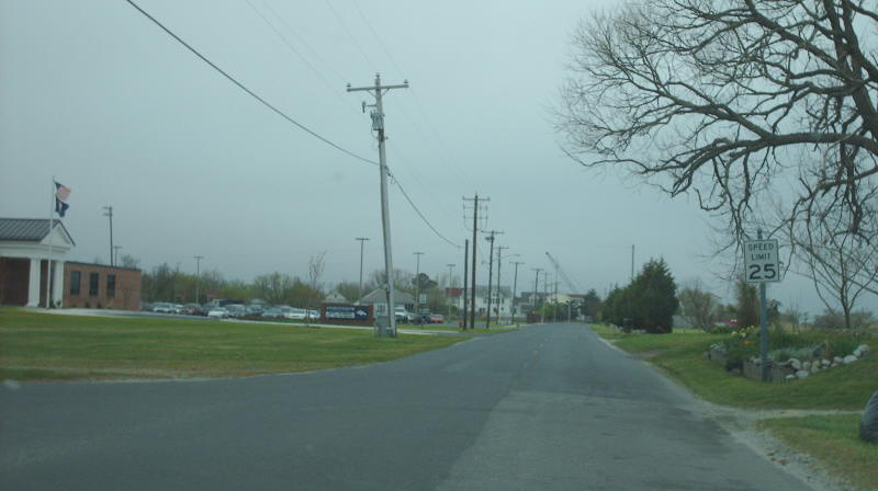
Photo: Former VA 175Y southbound leaving its northern endpoint (photo by Mapmikey, 4/26/07)
VA 175-Y  not currently assigned
Previous VA 175-Y's:

1991 ROUTE LOG
VA 175: 0 - 0
END VA 175: 0.94 - 0.94

VA 175-Y: Appeared in Aug 1935 (CTB) as an upgrade to SR 717, running from VA 175 north on Main St to then-NCL of Chincoteague, 0.94 miles away (in the vicinity of Community Dr).
In June 1992 (CTB), VA 175Y was decommissioned to just unnumbered Main St.
Up to the mid-1990s, VA 175Y was posted at VA 175 with a white border shield.
VA 175Y did not appear on Officials until 1970 but is on VDOT County maps back to 1935.
VA 175 (1935 Accomack County)
VA 175Y appears
1935 Accomack County

Previous: VA 174  |  Next: VA 175 | VA 176
Top  |  Virginia Hwy Index Home

Page last modified 29 December 2017