< VA 179 | Home | VA 180 | VA 181 to VA 200 >
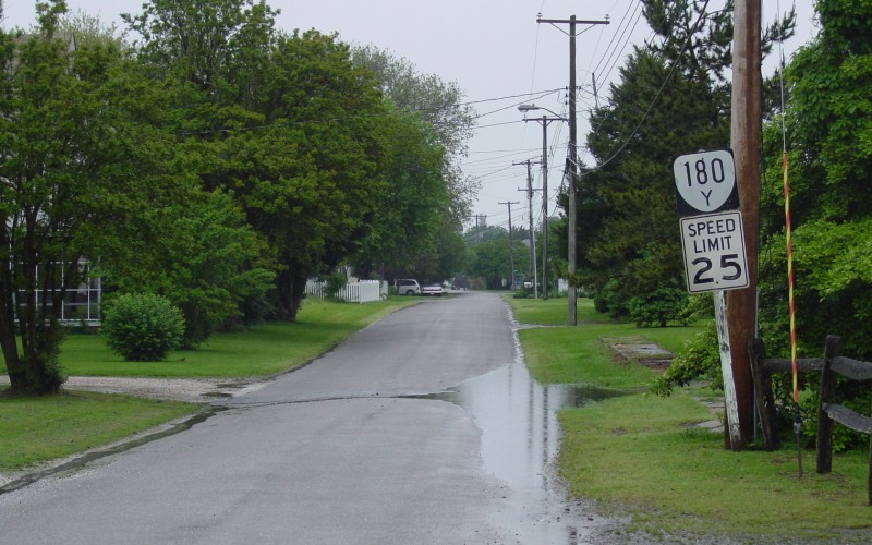
Photo: VA 180-Y in Wachapreague (photo by Adam Froehlig, 5/22/03)
| |||||
| ROUTE LOG VA 180: 0 - 0 SR 624: 0.55 - 0.55 |
Creation: Appeared Aug 1933 (CTB) as new routing, running as it does today.
Adjustments: The 1933 CTB and County maps though at least 1961 show VA 180Y as 0.50 miles. It is unclear when or how it is now 0.55 miles. Perhaps SR 624 was reworked to make 180Y a skosh longer. Improvements: Paved upon designation; no multilane segments Posting: Not posted from VA 180 or SR 624. However there is one reassurance shield leaving VA 180. At cross streets through Wachapreague, there are white rectangles with 180 (no Y). Multiplexes: None Legislative names: None Other names: Brooklyn Ave/Richardson Ave Scenic Byway: No segments Comment: VA 180Y is shown but not labeled on 1930s officials. |
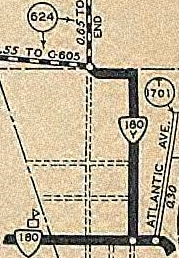 VA 180-Y 1936 Accomack County |
|||
Previous: VA 179 |
Next: VA 180 | VA 181 to VA 200
Top | Virginia Hwy Index
Home
Page last modified 30 December 2017