< VA 275 | Home | VA 277 >
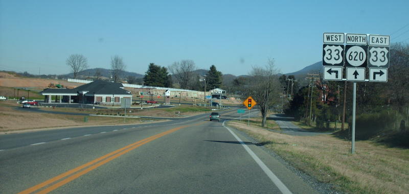
Photo: VA 276 approaching US 33 (photo by Mapmikey, January 2007)
| |||||
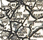
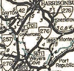
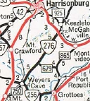
| ROUTE LOG VA 256: 0 - 0 Rockingham-Augusta Line: 1.77 - 1.77 VA 253: 5.46 - 7.23 US 33: 2.20 - 9.43 |
Creation: Created May 1943 (CTB Minutes) as an upgrade to
SR 620. Initially ran only from VA 256 (current SR 2002 Click Rd) north
to the Rockingham County Line. This is the 2nd VA 276.
Adjustments: In April 1944 (CTB), VA 276 was extended north past US 33 to Keezletown (again upgrading SR 620), then replaced VA 253 west back to US 33 (now just Country Club Rd) in Harrisonburg. In May 1954 (CTB), VA 276 was truncated north of US 33, leaving behind SR 925 and a little SR 620. Sometime after 1958 (my guess is around the time I-81 came through), VA 276 was extended slightly to meet a rerouted VA 256. This replaced a small bit of VA 256 and also SR 750. Improvements: Paved upon inception; no multilane sections Posting: Fully posted Multiplexes: NONE Legislative names: NONE Other names: Cross Keys Rd (Rockingham County); Keezletown Rd (Augusta County)portion) Scenic Byway: No segments Comments: VA 276 can be used as a way to get from the Massanutten area to the Staunton area without entering the Harrisonburg suburbia on US 33 trying to get to I-81.
| ||||
| Previous VA 276's:
1940 ROUTE LOG US 50: 0 - 0 SR 606: 2.00 - 2.00 |
VA 276 #1: Appeared July 1933 as a renumbering of the southern piece of VA 839, running from US 50 near the Shenandoah River north to the Frogtown area.
In May 1943 (CTB), VA 274 was downgraded to SR 606.
| ||||