< VA 277 | Home | VA 279 >
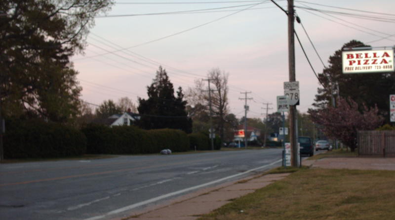
Photo: VA 278 beginning southward (photo by Mapmikey, April 2008)
| |||||||||
| ROUTE LOG US 258: 0 - 0 END VA 278: 1.64 - 1.64 |
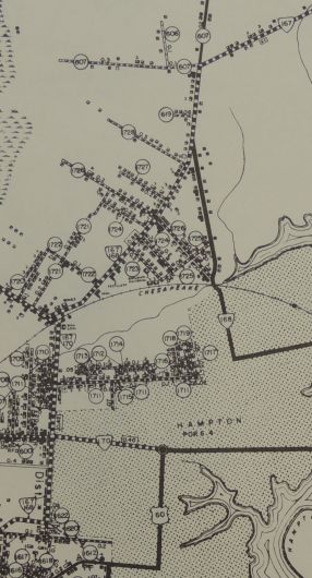
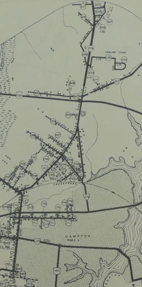
Creation: Appeared in March 1942 (CTB). Began at VA 167
(now just Old Fox HIll Rd) and went north on today's King St replacing
SR 607 up to Little Back River Rd, and continuing north to the bridge
over the Back River which was not state maintained to that point.
At the same time, a second piece of VA 278 was christened, running from VA 170 (now just Armistead Ave) east on what is now Sweeney Blvd to end at Hammond Ave in Langley. There would be a gap of roughly 3/4 mile between the two VA 278 segments on Langley AFB. This is the 3rd VA 278. Adjustments: In 1945 or 1946, VA 278 was extended south along King St to end at US 60 which was using Queen St at the time. In March 1946 (CTB), the section from Armistead Ave to Hammond was rescinded, as the US Gov't acquired all the land abutting the state highway, making construction impossible. Although the original 1942 description of the southern piece of VA 278 didn't mention it, there was a small gap in VA 278 from VA 167 (now Old Fox Hill Rd) north 0.05 miles that was a part of SR 607. This gap was placed into the primary system between 1947-58. In October 1966 (CTB), VA 278 south was truncated to its current ending at US 258. Improvements: Paved upon inception; the southern half is 4-lane undivided back to at least 1963. Posting: Fully posted at US 258. Only other posting is a reassurance shield SB leaving Langley. VA 278 has been erroneously identified at the I-64 overpass of King St. for 30+ years... Multiplexes: None Legislative names: None Other names: N. King St (entire route) Scenic Byway: No segments Comment: VA 278 is pretty quiet and largely residential. Official maps from 1967-74 incorrectly implied VA 278 continued south of US 258.
| ||||||||
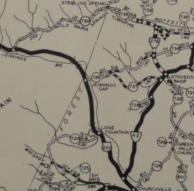
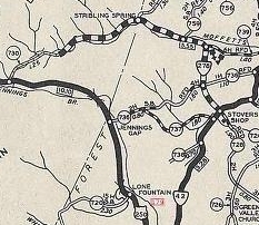
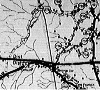
| Previous VA 278's: 1939 ROUTE LOG US 250: 0 - 0 VA 42: 6.80 - 6.80 |
VA 278 #1: Appeared in July 1933 as a renumbering of VA 840. Initially ran as a stub west off VA 42 Stover.
In July 1936, VA 278 was extended west 3.26 miles, probably as an upgrade to SR 739. In May 1938, VA 278 was extended to US 250 as an upgrade to SR 730. In 1940, VA 278 was downgraded to SR 728. I drove this VA 278 in early 2008 and found the middle third was still unpaved.
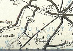
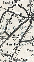
VA 278 #2: Appears on the July 1940 Official map, replacing VA 56 from VA 254 near West View south to near Summerdean, then east to VA 252 Middlebrook as an upgrade to SR 670. This VA 278 is not mentioned in the CTB, but they do mention around this time that the General Assembly eliminated the piece of VA 56 that extended further southwest through Summerdean to McKinley. The October 1940 Official map shows VA 278 renumbered as VA 56 again. Today it is SR 876.
| ||||||||