< VA 284 | Home | VA 286 >
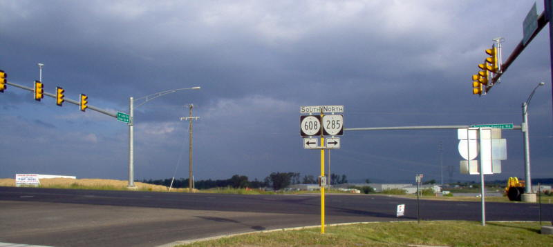
Photo: SR 631 at VA 285/SR 608 just south of I-64 (Mapmikey, May 2006)
|
|
|
| ROUTE LOG |
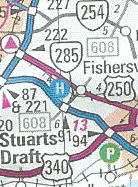
US 250: 0 - 0 I-64 (exit 91): 1.71 - 1.71 SR 608/935: 0.14 - 1.85
|
Creation: Appeared in 1999 as an upgrade to SR 608. Ran as it does today. This is the 2nd VA 285.
| Adjustments: None Improvements: Paved upon inception; In late 2015, VA 285 was multilaned from Ladd Rd to the northern SR 625 junction. Posting: Fully posted; It is Cosigned with SR 608. Multiplexes: NONE Legislative names: NONE Other names: Tinkling Spring Rd (entire route) Scenic Byway: No segments Comments: This was once part of original VA 273 According to TS Smith, VA 285 ends 0.2 mile south of I-64 at the junction of SR 608 and SR 935, and may extend to Stuarts Draft in the future.
|
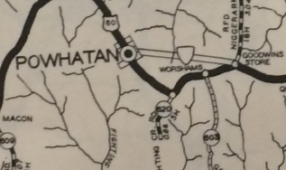
2000 Official | Previous VA 285's:
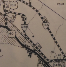
1941 ROUTE LOG US 60: 0 - 0 SR 641: 1.0 - 1.0 |
VA 285 #1: Appeared Aug 1933 (CTB) as a newly numbered route, as a spur that ran from US 60 Williamsburg eastward. In 1938 it was not connected to the new VA 168 (curr VA 143) when it was built 0.1 mile to the east and never was.
In May 1943 (CTB Minutes), VA 285 was decomissioned to SR 641. Was there a VA 285 between July 1933 and Aug 1933?
|
||||||||