< VA 285 | Home | VA 287 >
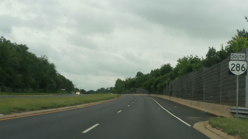
Photo: VA 286 leaving VA 7 (Mapmikey, May 2013)
|
|
|
| ROUTE LOG |
US 1: 0 - 0 I-95 (exit 166): 3.10 - 3.10 GAP IN ROUTE VA 289: 0 - 3.10 VA 123: 7.27 - 10.37 US 29: 5.37 - 15.74 I-66 (exit 55): 0.96 - 16.70 US 50: 1.83 - 18.53 VA 267: 6.27 - 24.80 VA 7: 4.41 - 29.21
|
Creation: Appeared February 15, 2012 (CTB) as an upgrade to SR 7100. Ran as it does today. There is a gap between I-95 and VA 289. This is the 2nd VA 286.
| Adjustments: None Improvements: Paved upon inception; no 2-lane segments. VA 286 has a number interchanges along its path but is not really controlled access or a true freeway for any real length. VA 286 is 6 laned from VA 289 to Gambrill Rd; US 29 to I-66; Sunrise Valley Dr to Baron Cameron Ave Posting: VA 286 postings appeared in June 2012. VA 286 is prominently posted on the gap. Multiplexes: NONE Legislative names: John F (Jack) Herrity Parkway, entire route (3-14-95 designation predates VA 286 designation). Other names: Fairfax County Parkway (entire route) Scenic Byway: No segments Comments: The Fairfax County Parkway was constructed over a 20+ year period, starting with the piece between I-66 and US 50 which was in place by 1988. The 1989 Official Map was the first to show the route in its entirety, as dotted lines minus the short opened section. By 2000, only the gap between I-95 and SR 7900 (now VA 289) remained, which was opened in September 2010. The Fairfax County Parkway is a bit harrowing to drive - the speed limit is mostly 50, with interchanges inviting higher speeds while traffic lights still exist in many locations. The road has a fair amount of accidents.
|
VA 286 in Fairfax County 2016-18 Official | Previous VA 286's:
1941 ROUTE LOG US 60: 0 - 0 SR 604: 1.0 - 1.0 |
VA 286 #1: Appeared Aug 1933 (CTB) as a spur north from US 60 west of Williamsburg.
VA 286 never connected to the new VA 168 (curr VA 30) and was downgraded to SR 604 in Sept. 1942 (CTB Minutes). Was there a VA 286 between July 1933 and Aug 1933?
|
||||||||