< VA 324 | Home | VA 326 >
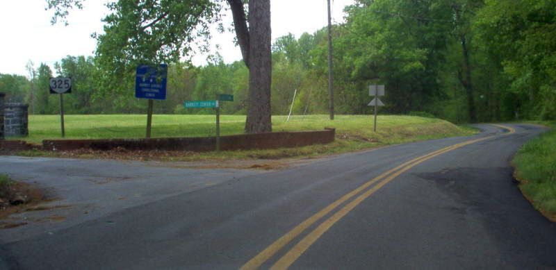
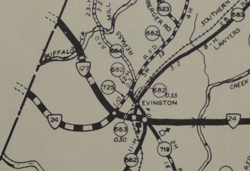
Photo: VA 325 from SR 651 (photo by Mapmikey, April 2006)
| ||||||
|
Creation: The Virginia Industrial School for Colored Girls
received 0.80 miles of state routing in 1932. The facility did not receive a
number until about 1938. This is the 3rd VA 325.
Adjustments: In May 1945 (CTB), 0.19 miles of VA 325 were removed from the system and a 0.46 mile piece was added for a net gain of 0.27 miles to VA 325. Posting: There was a reassurance marker in a shield at SR 651 that was removed between 2014-18 and is now not posted at all. Comments: Does not appear of VDOT official maps, though there has been room; Barrett was integrated in 1965, went coed in 1977, then went to being an all male facility in 1978. Barrett was closed and vacated April 30, 2005. The facility was still being used by law enforcement when I visited in 2013 and placed on the historic register of places in Oct 2016. |
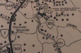
1946 Hanover County |
|||||
| Previous VA 325's: 1926 ROUTE LOG BEGIN VA 325: 0 - 0 VA 36 WB: 5 - 5 VA 36 EB: 1 - 6 VA 376: 6 - 12 VA 32: 26 - 38 GAP IN ROUTE BEGIN VA 325: 0 - 38 VA 25: 2.4 - 40.4 1933 ROUTE LOG VA 43: 0 - 0 Bedford-Campbell Line: 2 - 2 |
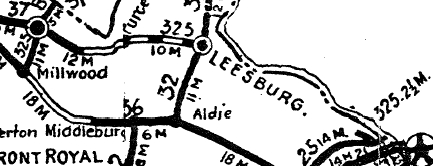
VA 325 #1: Created in June 1923 as an upgrade to CR 4; Originally ran from VA 32 (curr US 15 Bus) Leesburg west to Purcellville.
In January 1924 (CTB), a second segment was created running from VA 37 (current US 340-VA 7 Bus jct) Berryville east to the Shenandoah River, another upgrade to CR 4. In March 1924 (CTB), the two pieces were connected. Also, sometime in 1924, VA 325 was extended south from Berryville to VA 36 (current SR 723) Millwood, replacing VA 361. This extension created the 1 block long VA 376 in Berryville as today's SR 616 was the route south from Berryville. In January 1925 (CTB), a new piece of VA 325 was created running from VA 25 (current VA 123) Tyson's Corner northwest 2.6 miles along what was CR 2.
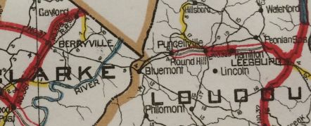
In May 1926 (CTB), VA 325 was extended west along VA 36 to Boyce, then south as new routing (upgrading CR 2) 5 miles to south of White Post. In October 1926, VA 325 was replaced by the original VA 251. Today it is parts of SR 658, US 340, SR 617, SR 616, VA 7 Bus Berryville, VA 7 over the mountain and the VA 7 Business's in Purcellville and Leesburg. VA 325 is erroneously shown as VA 328 on the 1927 Clasons Atlas. 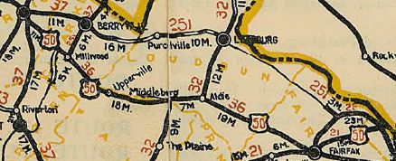
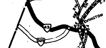
VA 325 renumbered as part of VA 251 1926 Official VA 325 #2: Created in June 1932 (CTB Minutes) as an unidentified new primary route. The 1932 VDOT County Atlas shows VA 325 running from VA 43 (current VA 24-SR 811 jct) Evington northwest to the Bedford County Line. In July 1933 this became part of VA 24.
|
|||||
Previous: VA 324 |
Next: VA 326
Top | Virginia Hwy Index
Home
Page last modified 24 May 2020