< SC 6 | Home | SC 7 ALT | SC 8 >
|
|
|
| ROUTE LOG |
US 17: 0 - 0 I-526 (exit 9): 0.1 - 0.1 SC 61: 1.3 - 1.4 SC 171: 1.7 - 3.1 I-26 (exit 216): 2.1 - 5.2 US 52, US 78: 0.8 - 6.0
|
|
| Previous SC 7's:
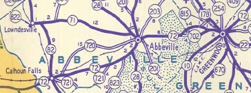
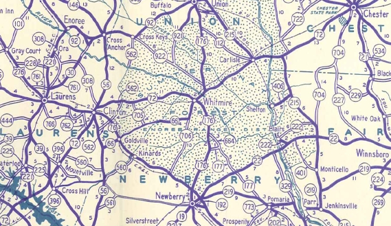
1941 ROUTE LOG GA STATE LINE: 0 - 0 SC 82: 3.0 - 3.0 SC 823: 11.4 - 11.4 SC 28 SB: 1.6 - 13.0 SC 28 NB: 2.1 - 15.1 SC 203: 0.5 - 15.6 SC 702: 7.3 - 22.9 Greenwood-Abbeville Line: 1.2 - 24.1 SC 702: 3.6 - 27.7 US 25, US 178, US 221 BEGIN: 1.8 - 29.5 SC 22 ALT: 0.2 - 29.7 SC 254: 0.2 - 29.9 SC 246: 5.9 - 35.8 Laurens-Greenwood Line: 2.5 - 38.3 US 221 NB: 0.9 - 39.2 SC ??: 0.2 - 39.4 SC 39: 4.0 - 43.4 SC 396: 3.5 - 46.9 SC 560: 1.9 - 48.8 SC 762: 5.1 - 53.9 SC 56 SB: 1.8 - 55.7 US 76 EB, SC 2 EB: 0.9 - 56.6 US 76 WB, SC 2 WB: 0.1 - 56.7 SC 308: 0.5 - 57.2 SC 56 NB: 0.4 - 57.6 SC 705: 6.2 - 63.8 Newberry-Laurens Line: 8.5 - 72.3 SC 706: 2.6 - 74.9 SC ??: 0.2 - 75.1 US 176 SB: 0.3 - 75.4 Union-Newberry Line: 0.5 - 75.9 US 176 NB: 1.0 - 76.9 SC 7 ALT: 0.2 - 77.1 SC 215 NB: 8.9 - 86.0 SC 215 ALT: 0.3 - 86.3 Chester-Union Line: 2.5 - 88.8 SC 215 SB: 1.2 - 90.0 SC 72: 1.4 - 91.4 US 21, SC 9: 12.1 - 103.5 |
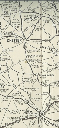
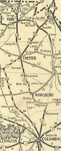
SC 7 #1: An original state route. Ran from SC 16 (now S-12-1) Chester northeast through Rock Hill and Fort Mill to enter North Carolina near Pineville NC.
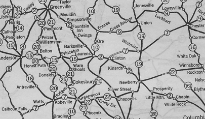
In 1923, SC 7 was extended southwest as new primary routing through Whitmire, Clinton, Greenwood, Abbeville, and Calhoun Falls before entering Georgia. If SC 7 ever used S-46-284 Eden Terrace northeast out of Rock Hill it appears to have stopped doing so by 1923. In 1928, SC 7 east was truncated to Chester in favor of US 21. Today this is S-12-275 in Chester; SC 72 to Rock Hill; Saluda St/Main St/Charlotte Ave; SC 322 out of Rock Hill; briefly US 21; US 21 Business through Fort Mill; US 21; SC 51 into NC.
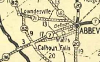
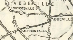
In 1931, SC 7 was given a newly constructed alignment from Calhoun Falls to Abbeville such that it avoided Watts but instead came into Abbeville with SC 28 from the south. The old route today is a little SC 72 in Calhoun Falls; S-1-78; abandoned routing across McKenley Creek; S-1-308 to Watts; S-1-83; S-1-32 into Abbeville. Note that the S-1-32 portion was part of SC 720 in the 1940s.
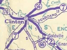
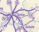
In 1935, SC 7 was removed from S-36-570 Satterwhite Rd in Whitmire and also S-36-451 Lovers Lane west of Whitmire. About 1940, SC 7 was removed from Adair St leaving Clinton and instead placed on current SC 72 Business. It is unclear if SC 7 used Main St or US 76/SC 2 Caroline Ave into central Clinton.
By 1940, SC 7 was given a hypotenuse at the US 176/SC 7 split northeast of Whitmire. This left behind US 176 and SC 7 ALT (now US 176-SC 72 CONN). In 1942, SC 7 was renumbered as SC 72. Today it is SC 72 from GA to Calhoun Falls; S-1-579 Savannah St in Calhoun Falls; SC 72 to SC 28; S-1-1 into Abbeville; SC 203 for a bit; S-1-133 east of Abbeville; SC 72; S-1-3 and S-24-1; SC 72; SC 72 Business through Greenvwood; SC 72 from Greenwood to Clinton except Christian Rd loop near Coronaca; SC 72 Business through Clinton; SC 72 from Clinton to Chester except S-12-276 inside the Chester bypass.
|
|||||||||||||||||
Previous: SC 6 |
Next: SC 7 ALT | SC 8
Top | South Carolina Hwy Index
Home
Page last modified 5 June 2016
