< SC 11 | Home | SC 13 >
|
|
|
| ROUTE LOG |
US 1: 0 - 0 US 378: 2.8 - 2.8 Richland-Lexington Line: 0.3 - 3.1 US 21, US 176, US 321: 0.5 - 3.6 SC 48: 0.6 - 4.2 US 76: 0.4 - 4.6 SC 555: 0.6 - 5.2 US 1: 0.3 - 5.5 SC 16: 1.6 - 7.1 I-77 (exit 13): 3.9 - 11.0 I-77 (exit 15): 1.0 - 12.0 Kershaw-Richland Line: 9.3 - 21.3 I-20 (exit 92), US 601: 7.4 - 28.7
|
Creation: Appeared in 1940 as new primary routing running from US 21-76/SC 2-5-215 (now SC 48) Columbia to Fort Jackson, then replaced part of SC 760 from Jackson Blvd to central Fort Jackson before continuing on as more new primary routing to end at SC 26 (now US 601). This is the 3rd SC 12.
|
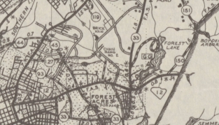
Adjustments: In 1947, SC 12 was truncated to US 1 leaving behind a bit of US 1 plus Taylor St. Also in 1947, SC 12 east was truncated to SC 760 Jackson Blvd/Forest Rd/Dixie Rd jct, leaving behind S-40-22 out to SC 760's original 1939 end point below Lake Barstow and S-40-25 the rest of the way to SC 26. Note that SC 12 did NOT use Artillery Rd/Johnson Rifle Rd but instead a mostly unpaved road directly to Messers Pond then used Messers Pond Rd and Colonels Creek Rd. SC 12 then followed Century Division Rd, Statue of Liberty Rd, and Red Diamond Rd which no longer connects to S-40-25 Shady Grove Rd.
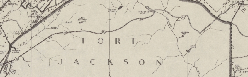
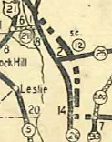
SC 12's non-direct routing in eastern Fort Jackson and Messers Pond, downgraded to S-40-22 and S-40-25. 1948 Richland County
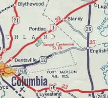
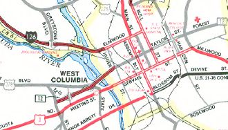
In 1958, SC 12 was re-extended west over Taylor St to end at SC 555. In 1959, SC 12 was extended west on Taylor St to end at US 76 Bull St. In 1977, SC 12 was extended west on Taylor St then as new construction to 12th St, then used 12th St south to US 1. In this extension, SC 12 was placed on split one-way streets (Hampton/Taylor Sts) between Williams St and Park St. In 1981, SC 12 was removed from 12th St (now SC 35) and extended as more new construction southwest to US 1.
Improvements: SC 12 was paved from Columbia out to SC 760 upon designation. In 1941, SC 12 was paved several miles further east into Ft. Jackson. All parts of SC 12 have been paved since 1948. In 1963, SC 12 was multilane from US 76 east out through Forest Acres to its old route into Fort Jackson. The 1977 and later extensions west from US 76 were multilane, including limited/controlled access west of US 21-176-321 to US 1. The 2015 Official shows SC 12 multilane from Decker Blvd to I-77 Exit 15. GMSV shows this to be true back to at least 2008 and could go back to when I-77 was built through that area in the mid 1990s. Comment: SC 12 serves as a quick way to access Downtown Columbia from US 1 in West Columbia, as well as provide access to Fort Jackson. SC 12's routing to US 601 from Columbia doesn't make much sense with I-20 very close by, and even before that US 1 is not far north. Strom Thurmond Blvd from Percival Rd to I-77 is labeled on City Maps as SC 12 SPUR though I do not believe there are any postings to that effect. | Previous SC 12's:
1927 ROUTE LOG GA STATE LINE: 0 - 0 SC 27 WB: 16.3 - 16.3 SC 27 EB: 0.1 - 16.4 SC 39: 22.0 - 38.4 SC 24, SC 391: 4.3 - 42.7 SC 6: 19.4 - 62.1 SC 121: 10.0 - 72.1 SC 2: 2.2 - 74.3 1937 ROUTE LOG SC 26: 0 - 0 NC STATE LINE: 1.8 - 1.8 |
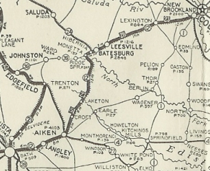
SC 12 #1: An original state route. Ran from the Georgia State Line at Augusta east to Aiken then northeast via Batesburg and Lexington to SC 2 (now SC 35) West Columbia.
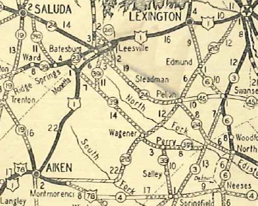
In 1924, SC 12 was rerouted away from Moneta leaving behind SC 39. It is unclear if today's SC 23 east from SC 39 became a primary route (1926 Official implies it but no designation was shown). Between 1924-28, SC 12 was removed from S-2-67 Anthony Dr in Bath; S-2-225 Dibble Rd west out of Aiken In 1928, SC 12 was eliminated in favor of US 1. Today it is US 1 CONN; abandoned routing; US 1-78; SC 421; US 1-78; S-2-3 Hayne/Park Ave and S-2-31 York Ave in Aiken; US 1; S-2-1470/S-41-230 Holston St near Moneta; SC 23; US 1
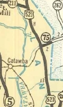
SC 12 #2: Created as new primary routing in 1929 connecting SC 26 (now US 521) to nearby NC 25 (now NC 75). In 1938, SC 12 was renumbered as SC 75.
|
|||||||||||||||||||


Previous: SC 11 |
Next: SC 13
Top | South Carolina Hwy Index
Home
Page last modified 5 June 2016