< SC 10 | Home | SC 11 ALT | SC 11 Bus | SC 12 >
|
|
|
| ROUTE LOG |
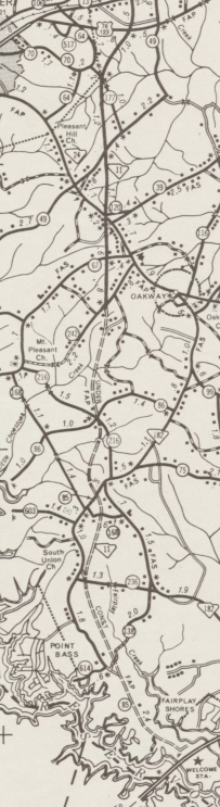
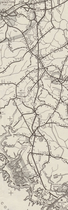
I-85 (exit 1): 0 - 0 SC 24: 9.6 - 9.6 US 76, US 123: 3.3 - 12.9 SC 28: 6.3 - 19.2 SC 183: 4.2 - 23.4 SC 130: 9.0 - 32.4 Pickens-Oconee Line: 4.9 - 37.3 SC 133: 1.5 - 38.8 US 178: 8.5 - 47.3 SC 8 SB: 9.2 - 56.5 SC 8 NB: 0.5 - 57.0 Greenville-Pickens Line: 1.3 - 58.3 US 276 NB: 0.2 - 58.5 US 276 SB: 5.7 - 64.2 US 25: 4.5 - 68.7 SC 101: 7.2 - 75.9 SC 14: 7.7 - 83.6 Spartanburg-Greenville Line: 0.5 - 84.1 US 176: 3.7 - 87.8 I-26 (exit 5): 3.4 - 91.2 SC 9: 3.8 - 95.0 US 221, US 221 ALT Begin: 12.7 - 107.7 Cherokee-Spartanburg Line: 0.3 - 108.0 US 221 ALT NB, SC 110: 1.9 - 109.9 I-85 (exit 92): 9.9 - 119.8 SC 18 NB: 1.8 - 121.6 US 29: 0.1 - 121.7 SC 18 SB, SC 150: 0.1 - 121.8
|
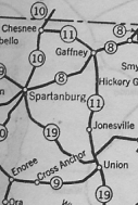
Creation: An original state route that originally ran from SC 19 (now SC 18-215 CONN) Union north to Gaffney then west to SC 10 (now US 221 ALT) near Chesnee. This is the only SC 11.
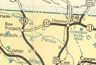
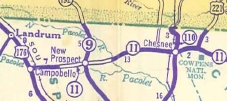
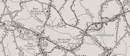
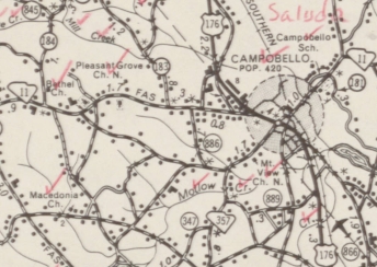
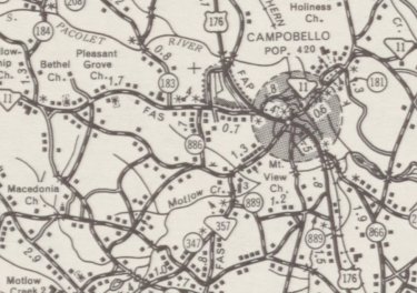
| Adjustments: In 1939, SC 11 was extended with US 221 to Chesnee, then replaced SC 112 to SC 9 New Prospect then continued as new primary routing to end at US 176 Campobello.
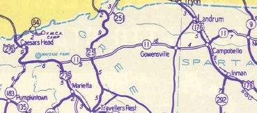
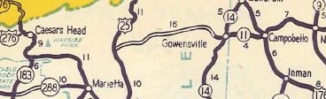
In 1940, SC 11 was extended west as more new primary routing through Gowensville and past US 25 to end at US 276 Cleveland. In 1947, SC 11 west was truncated back to US 25 leaving behind S-23-25. In 1949, SC 11 west was re-extended back to US 276 Cleveland.
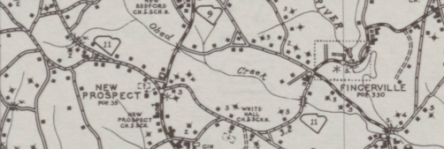
Also in 1949, the other end of SC 11 was truncated to end at US 176/SC 9 Jonesville with the route to Union becoming US 176. By 1952, SC 11 was removed from S-42-943 Halls Bridge Rd/S-42-211 Cooley Cir; S-42-168 Carmen Cir and S-42-169 Old Hwy 11 in New Prospect; Main St and Bullman St in Fingerville
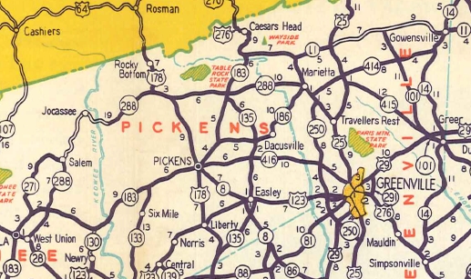
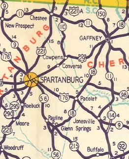
In 1956, SC 11 west was extended west with US 276, then replaced SC 183 to Pumpkintown, then replacing SC 288 through Jocassee and Salem before ending at SC 28 (now S-37-5) West Union. Between 1954-57, SC 11 was removed from Old Old SC 11 at Cleveland (not a typo). In 1960, SC 11 east was truncated to its current end in Gaffney with the road to Jonesville becoming part of SC 18.
In 1964 (bridge date), SC 11 was removed from S-42-20 Depot St and US 176 within Campobello.
In 1970, SC 11 was removed from S-23-912 Old State Hwy 11 from SC 101 westward; Gosnell Farmer Rd near Gowensville
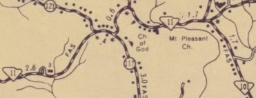
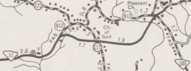
In 1971, SC 11 was placed on a much more direct alignment from northeast of West Union to US 276, using new construction to SC 183; replacing SC 271 to 2 miles west of Salem with straighter alignments and a bypass of Tamassee; east of here SC 11 was on new construction except for S-39-49. The old route became S-37-24 (some of this is now SC 130); the northern half of SC 11 Bus (now S-37-190) in Salem; S-37-25 plus some became buried under Lake Jocassee; S-39-100; US 178 remained on the previous overlay; SC 288 east to Pumpkintown; SC 8 north to US 276.
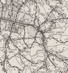
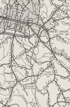
In 1973, SC 11 west was extended out to the new routing of SC 28 in West Union.
In 1975, SC 11 was extended southwest as more new construction to end at US 76-123. In 1976, SC 11 was extended southwest as more new construction to S-37-242 just south of SC 24. In 1979, SC 11 was extended southwest to I-85 Fair Play. The last 2 miles to I-85 were a replacement for S-37-85 with the rest new construction.
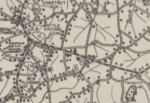
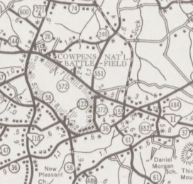
Between 1983-86, SC 11 was placed on new construction along the north edge of Cowpens Battlefield. The original routing is now the Historic 1781 Green River Rd within the battlefield park.
Improvements: SC 11 was paved from Union to Jonesville in 1928. By 1929, SC 11 was paved over about 15 miles centered around Gaffney. In 1934, SC 11 was paved from Jonesville to Gaffney. In 1937, SC 11 was paved from Gaffney to Cowpens Battlefield. This made SC 11 totally paved for its routing in 1937. In 1939, SC 11's extension westward was NOT paved for 8 miles centered around SC 9 New Prospect. In 1940, SC 11's second extension was ONLY paved around Gowensville. Between 1943-48, SC 11 was fully paved except US 25 to Gowensville. In 1949, SC 11 was paved from US 276 to US 25. In 1952, SC 11 was paved between US 25 and Gowensville, again making SC 11 100% paved. But wait... When SC 11 was extended west again in 1956, the stretch between Jocassee and Eastatoe was not paved. SC 11 was finally 100% paved to stay in 1959. SC 11 was multilaned from I-85 to Gaffney in 1974. No other multilane segments shown on the 2015 Official map. Comment: SC 11 is also known as Cherokee Foothills National Scenic Highway for its entire length except I-85 to Gaffney. SC 11 passes right by Table Rock State Park, a picturesque locale in what little mountanous area South Carolina has. SC 11 also serves Cowpens Battlefield. SC 11 follows the edge of the mountains without ever getting into them, on a modern fast-paced route which passes through no actual towns west of Gowensville. SC 11 has grade-separated junctions with SC 24, US 76-123, SC 28, SC 183, and US 25. | |||||||||||||||||||||||||||||


Previous: SC 10 |
Next: SC 11 ALT | SC 11 Bus | SC 12
Top | South Carolina Hwy Index
Home
Page last modified 18 June 2016