< SC 57 | Home | SC 59 >
|
|
|
| ROUTE LOG |
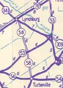
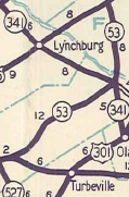
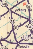
US 301, US 378: 0 - 0 Sumter-Clarendon Line: 2.2 - 2.2 SC 53 EB: 4.0 - 6.2 I-95 (exit 141): 0.1 - 6.3 SC 53 WB: 0.3 - 6.6 Lee-Sumter Line: 2.8 - 9.4 SC 341: 3.2 - 12.6
|
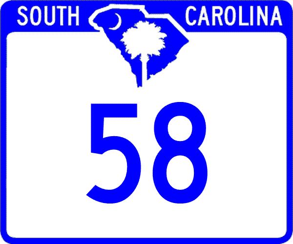
Creation: Appeared in 1940 as new primary routing, running the way it does now. This is the 2nd SC 58.
| Adjustments: In 1947, SC 58 was downgraded to S-14-22, S-43-23, and S-31-18. In 1949, SC 58 was restored to the primary system. About 1967, SC 58 was rerouted to accommodate the I-95 interchange, leaving behind S-43-64 (no longer in the secondary system at all).
Improvements: Paved upon resurrection in 1949; no multilane segments Comment: SC 58 provides a direct connection from I-95 to Turbeville, although it is not advertised this way. | Previous SC 58's:
1937 ROUTE LOG SC 163: 0 - 0 SC 59: 0.2 - 0.2 NC STATE LINE: 2.4 - 2.6 |
SC 58 #1: Appeared in 1929 as new primary routing, running from SC 163 (now SC 49) north to North Carolina
In 1942, SC 58 was renumbered as SC 274.
|
|||||||||||

Previous: SC 57 |
Next: SC 59
Top | South Carolina Hwy Index
Home
Page last modified 26 December 2015