< SC 178 | Home | SC 179 ALT | SC 180 >
|
|
|
| ROUTE LOG |
US 17: 0 - 0 NC STATE LINE: 0.9 - 0.9
|
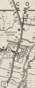
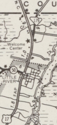
Creation: SC 179 appeared in 1980 as an upgrade to S-26-118, running the way it does now. This is the 2nd SC 179.
| Adjustments: None Improvements: paved upon inception; no multilane segments Comment: SC 179 is the shortest SC state route and serves US 17 traffic trying to reach Calabash NC and several oceanfront communities in that area.
| Previous SC 179's:
1949 ROUTE LOG US 52: 0 - 0 SC 402: 0.2 - 0.2 SC 45: 13.7 - 13.9 SC 511: 3.8 - 17.7 |
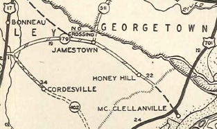
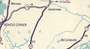
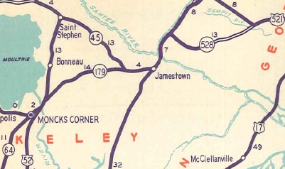
SC 179 #1: Appeared in 1933 as a renumbering of SC 178, running from US 52 near Moncks Corner to 2 miles short of US 701.
In July 1936 (SCDOT), SC 179 was extended into the village of McLellanville just east of US 701 (now US 17). The route east of US 701 is shown as primary but unlabeled from 1932-36 on official maps and it is not known if this was already 179 or a 70x route.
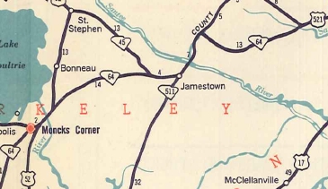
In 1947, SC 179 east was truncated to SC 511 (now SC 41) Jamestown, leaving behind S-8-4, S-10-10, S-10-11, a bit of US 17-701, and S-10-9. West of US 17 is now SC 45. In 1949, SC 179's west end was moved to the current US 52-17 ALT split north of Moncks Corner, and straightened out east to SC 45. The original SC 179 used today's S-8-343, S-8-342, S-8-360, and Spring Pond Rd at SC 45. In 1950, SC 179 was renumbered as part of SC 64. Today it is part of US 17 ALT.
|
|||||||||||||
Previous: SC 178 |
Next: SC 179 ALT | SC 180
Top | South Carolina Hwy Index
Home
Page last modified 22 July 2017
