< SC 187 | Home | SC 188 ALT | SC 190 >
|
|
|
| ROUTE LOG |
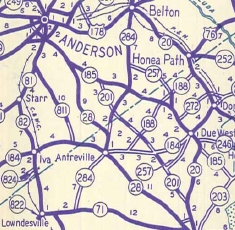
SC 28: 0 - 0 SC 183: 7.8 - 7.8
|
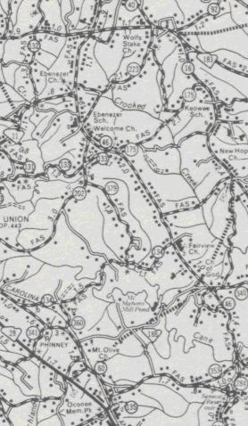
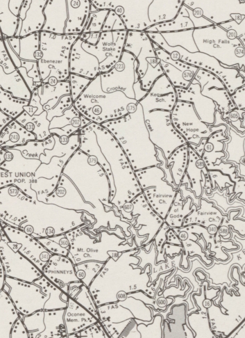
Creation: SC 188 appeared in 1971 (shown explicitly as dotted line on the 1969 Oconee County map) as an upgrade to S-37-60; new construction; upgrade to S-37-16; and replaced a bit of SC 183, running as it does today. This is the 2nd SC 188.
| Adjustments: None Improvements: SC 188 was fully paved upon creation; no multilane segments Comment: S-37-60 was once part of SC 2 and S-37-16 was once SC 134. SC 188 does not seem to be a useful corridor if you ask me.
| Previous SC 188's:
1946 ROUTE LOG SC 184: 0 - 0 SC 201: 2.5 - 2.5 SC 185: 4.3 - 6.8 SC 257: 0.4 - 7.2 US 178, SC 20: 4.4 - 11.6 |
SC 188 #1: Appeared in 1940 as new primary routing, running from SC 185 to US 178/SC 20 in northeastern Abbeville County
In 1942, SC 188 was extended west as new primary routing through Level Land to end at SC 184 near Antreville. In 1947, SC 188 was downgraded to S-1-36 west of SC 185 (east of Level Land is now S-1-24) and S-1-24 east of SC 185.
|
||||||||||
Previous: SC 187 |
Next: SC 188 ALT | SC 190
Top | South Carolina Hwy Index
Home
Page last modified 29 August 2015