< SC 510 | Home | SC 511 Bus | SC 512 >
| SC 511 not currently assigned | ||||||||||||||||||||
| Previous SC 511's: 1951 ROUTE LOG US 17, US 701: 0 - 0 Berkeley-Charleston Line: 5.2 - 5.2 SC 402: 12.0 - 17.2 SC 45, SC 64 WB: 15.2 - 32.4 Georgetown-Berkeley Line: 1.6 - 34.0 SC 64 EB: 3.8 - 37.8 Williamsburg-Georgetown Line: 1.4 - 39.2 Georgetown-Williamsburg Line: 0.9 - 40.1 SC 511 Bus: 3.3 - 43.4 US 521: 2.9 - 46.3 SC 511 Bus: 1.3 - 47.6 Williamsburg-Georgetown Line: 0 - 47.6 SC 527: 1.7 - 49.3 SC 513: 12.0 - 61.3 SC 512: 1.3 - 62.6 SC 51, SC 175: 7.3 - 69.9 |
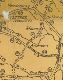
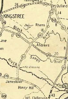
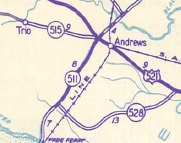
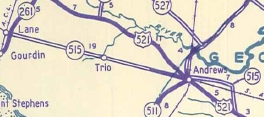
SC 511: Appeared in 1925 or 1926 as new primary routing, running from SC 413 (now US 17 ALT/SC 45) Jamestown north through Andrews and Rhems to end 5 miles past SC 51 (now SC 261) Outland at Smiths Mills.
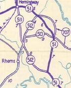
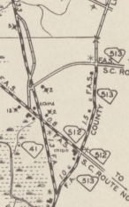
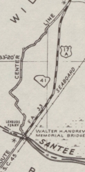
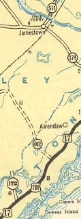
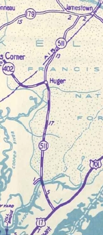
By 1929, SC 511 north was truncated to SC 51 (now SC 261) Outland. The road north from Outland is partly S-22-5 and partly non-system dirt road. About 1937 (bridge date), SC 511 was placed on new causeway and bridge over the Black River, leaving behind what is now Reds Landing Rd. In 1939, SC 511 was exended west with SC 179 (now US 17 ALT/SC 45) from Jamestown a couple miles, then south as new primary routing via Bethera to SC 402 Huger, then south as projected routing to the Cainhoy area, then south replacing SC 172 to end at US 17-701 Whitehall Terrace. The 1939 Official erroneously shows the mdern SC 41 routing south of Jamestown. In 1940, SC 511 was rerouted to head to Hemingway as new primary routing. The old route to Outland became SC 512 (now SC 513 and S-22-5).
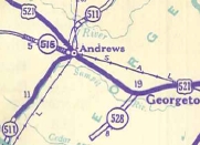
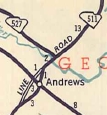
Also in 1940, SC 511 was routed around Andrews. The old route through Andrews became secondary for a time. In 1941, SC 511 was put back through Andrews. The old route around Andrews became secondary again (now it is SC 41 Bypass).
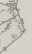
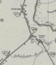
Also in 1941, SC 511 was placed on new construction south of the Wando River bridge, leaving behind today's Gregory Ferry Rd; Joe Rouse Rd; and undrivable dirt roads. In 1943, SC 511 was put on new construction in the Rhems area, leaving behind secondary routing (now S-22-37) and part of SC 502 (now part of SC 51).
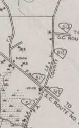
Also in 1943, SC 511 was put on new construction south of Jamestown to run very directly south. The old route remained SC 179 (now US 17 ALT/SC 45); still-unpaved Gumville Rd, unpaved Calestown Rd, unpaved Strawberry Rd to Bethera; now S-8-125 (except it used unpaved Tanner Rd); extended SC 402. Between 1944-47, SC 511 was put on new construction to avoid Union Crossroads north of Rhems, leaving behind what is now SC 513 and SC 512, plus unpaved Pinellas Rd and Flagler loop.
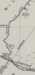
In 1949, SC 511 was put on newly constructed alignment and the first bridge over the Santee River at Jamestown. Prior to this, SC 511 had "no crossing" (1932-33; 1942; 1948) or free ferry (1935-41; 1943-47). On the north side of the river, SC 511 used Browns Ferry Rd which itself has been straightened out and is now also partly submerged under man-made ponds.
In 1950, SC 511 was placed on the bypass of Andrews again, leaving behind SC 511 Bus (now SC 41 Bus). In 1952, SC 511 was renumbered as SC 41.
SC 511 was the highest number in use until 1928. | |||||||||||||||||||
Previous: SC 510 |
Next: SC 511 Bus | SC 512
Top | South Carolina Hwy Index
Home
Page last modified 16 May 2015
