ROUTE LOG
TN 21 Begin: 0 - 0
TN 22 NB, TN 78: 3.1 - 3.1
Obion-Lake Line: 4.6 - 7.7
TN 22 SB: 1.0 - 8.7
TN 183: 7.1 - 15.8
TN 184: 7.9 - 23.7
US 51 SB, TN 3 SB: 0.4 - 24.1
US 51 NB, TN 3 NB: 0.4 - 24.5
US 45W SB, TN 5 SB: 4.9 - 29.4
TN 216: 1.1 - 30.5
US 45W NB, TN 184, TN 431: 3.9 - 34.4
TN 5 NB: 0.8 - 35.2
TN 214: 0.2 - 35.4
US 51, TN 3: 1.8 - 37.2
TN 690: 1.5 - 38.7
KY STATE LINE: 2.5 - 41.2
|
|
Creation: Appeared in 1923 as an original state route, running from TN 78 (now Cedar/Main intersection) Tiptonville to TN 3 (now TN 184) Troy
Adjustments: By 1928, TN 21 west was truncated to the current alignment of TN 78 on Carl Perkins Pkwy.
In 1935 or 1936, TN 21 was extended west to the Mississippi River.
In 1939 or 1940, TN 21 was extended northeast with US 51 to Union City, then north as new routing to Kentucky.
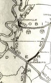
TN 21 Tiptonville to Troy
1924 Official
|
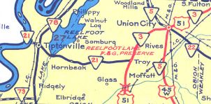
TN 21 extended to Mississippi River
1938 Official
|
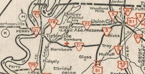
TN 21 extended through Union City to Kentucky
1940 Official
|
It is unclear, but I believe it was in the late 1950s that TN 21 was removed from 5th St in Union City and instead used 1st St to reach Main St.
In 1960, TN 21 was rerouted at Troy to continue east briefly, then north to Union City with the newly constructed US 51 alignment. The old route became Old Troy Rd (now TN 184).
In 1983, TN 21 was rerouted at Troy to continue east of US 51 to US 45W near Rives, then north to Union City.
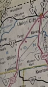
TN 21 moved with US 51 to modern alignment
1964 Official
|
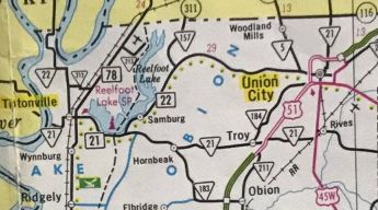
TN 21 rerouted via US 45W Rives
1986 Official
|
Posting: TN 21 is posted as primary only on its TN 22 overlay (and only TN 21 is posted for the most part) and secondary everywhere else.
TN 21 is posted on its US 51 overlay but not on its US 45W and TN 5 overlays.
Secret US Route Overlay: None
Comment: TN 21 used to have a ferry across the Mississippi to connect with MO 162 until it closed in 1976.
|