< TN 90 | Home | TN 92 >
|
|
|
| ROUTE LOG |
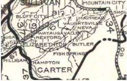
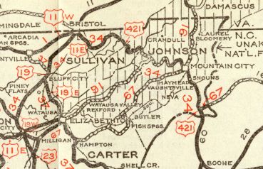
US 11E, TN 34: 0 - 0 TN 400: 0.4 - 0.4 I-26 (exit 23), US 19W, US 23, TN 36: 0.7 - 1.1 Carter-Washington Line: 2.1 - 3.2 US 321 SB, TN 67 WB: 2.7 - 10.4 TN 362: 0.3 - 10.7 TN 400: 3.3 - 14.0 US 19E SB, US 321 SB, TN 37 SB, TN 67 EB: 0.8 - 14.8 US 19E NB, TN 37 NB: 0.4 - 15.2 Johnson-Carter Line: 18.3 - 33.5 US 421 NB, TN 34 WB, TN 133: 3.6 - 37.1 US 421 SB, TN 34: 10.3 - 47.4 VA STATE LINE: 10.9 - 58.3
|
Creation: Appeared in 1927 or 1928 running from US 11E (now just Roan St) to the Johnson-Carter Line.
| Adjustments: In 1930, TN 91 was extended to TN 34 (now US 421) then followed TN 34 to Mountain City, then extended noth to the Virginia line above Laurel Bloomery.
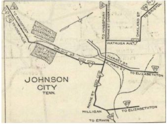
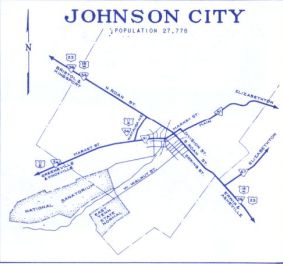
Also in 1930, North Carolina tried to get US 421 extended west from Boone to Johnson City. In Tennessee this would've followed TN 91 from Elizabethton to Johnson City. North Carolina then thought US 421 should be renumbered as US 44or US 72, as they apparently didn't own any maps to consult). Between 1941-51, TN 91 was extended west to the rerouted US 11E (now TN 400) at Wautauga St. Also changed to use Market-Division-Main. Between 1952-55, TN 91 was extended west to the rerouted US 11E-411 at John Exum Pkwy. Also in this timeframe, TN 91 was given one-way splits in Johnson City. EB used Watauga St to Main. WB used Division St to Market. In the 1950s, TN 91 was put on one way splits in Elizabethton. EB used the original routing on Elk Ave and WB used N. Sycamore and E St. About 1961, US 321 was added to TN 91 from Johnson City to Elizabethton. In 1965, TN 91 was removed from Broad St east out of Elizabethton and placed on its current routing (US 19E hadn't been moved yet though). Between 1965-71, TN 91 was given its more direct routing through Elizabethton via Broad St. East of the Doe River TN 91 had used Elk Ave to Main St to Broad St.
Also by 1971, the one-way splits in Johnson City were extended east to Legion St and west to Exum Pkwy.
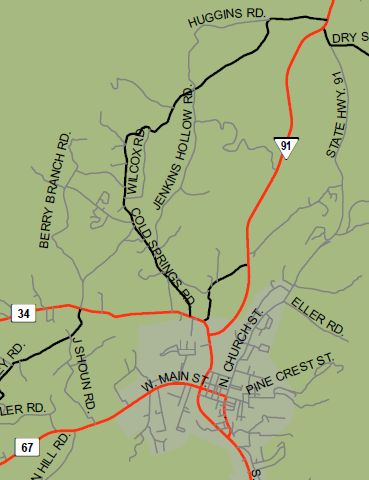
About 2009, TN 91 was given a bypass of Mountain City as mostly new construction. This left behind a bit of US 421, an extended TN 418 on Main St and Church St north out of town.
Posting: Posted as secondary everywhere The overlays with US 321 and US 19E are not posted Secret US Route Overlay: None - despite the US 321-TN 67-TN 91 routing fully posted as TN 67, the mile markers are TN 67 Comment: TN 91 from Shady Valley to Damascus VA is twice the distance as TN 133. | ||||||||||||||