< US 27 | Home | US 31 Bus | US 31A | US 31A Bus | US 31E >
|
|
|
| ROUTE LOG |
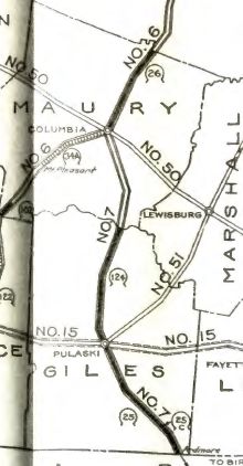
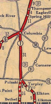
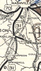
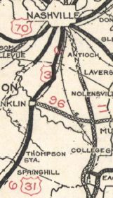
AL STATE LINE: 0 - 0 I-65 NB (exit 1), TN 7 SB: 1.5 - 1.5 TN 273 WB: 2.9 - 4.4 TN 273 EB: 0.5 - 4.9 US 64, TN 15: 10.5 - 15.4 TN 11 SB: 2.7 - 18.1 US 31 ALT, TN 11 NB: 0.3 - 18.4 TN 129: 12.4 - 30.8 Maury-Giles Line: 4.1 - 34.9 TN 50: 11.6 - 46.5 US 412 Bus WB, TN 99 WB: 1.9 - 48.4 US 43, US 412, US 412 Bus END, TN 6 SB, TN 7 NB, TN 99: 1.8 - 50.2 TN 246: 2.5 - 52.7 TN 396: 5.9 - 58.6 TN 247: 1.4 - 60.0 Williamson-Maury Line: 0.3 - 60.3 I-840 (exit 28): 5.1 - 65.4 TN 248: 0.9 - 66.3 US 31 Bus, TN 6 NB, TN 397 Begin: 4.2 - 70.5 US 431 SB, US 431 Bus, TN 106: 1.8 - 72.3 TN 96: 1.3 - 73.6 US 31 Bus, US 431 NB, US 431 Bus, TN 6 SB, TN 397 NB: 2.5 - 76.1 TN 246: 2.0 - 78.1 US 431 Bus, TN 96 WB, TN 106: 0.1 - 78.2 TN 96 EB: 0.1 - 78.3 US 31 SB, US 31 Bus END, US 431, TN 397: 1.9 - 80.2 TN 441: 2.1 - 82.3 TN 253: 2.3 - 84.6 TN 252: 2.6 - 87.2 Davidson-Williamson Line: 0.2 - 87.4 TN 254: 0.1 - 87.5 TN 255: 3.7 - 91.2 TN 155: 1.6 - 92.8 US 31 ALT, US 41 SB, US 41 ALT SB, US 70S EB, TN 1 EB, TN 11 SB: 3.1 - 95.9 US 70, US 70S WB, US 431 SB, TN 1 WB, TN 24: 0.3 - 96.2 US 41 ALT NB, TN 12: 0.7 - 96.9 I-24 (exit 48): 1.2 - 98.1 US 31E, US 31W, US 41 NB, US 431 NB, TN 6 NB, TN 11 NB: 0.1 - 98.2
|
Creation: An original US route which ran generally as it does now plus extended north through Gallatin and Westmoreland and on into Kentucky.
|
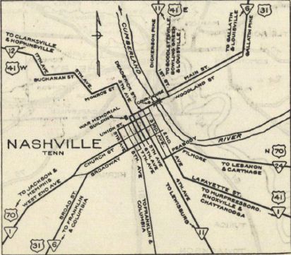
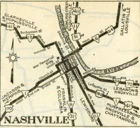
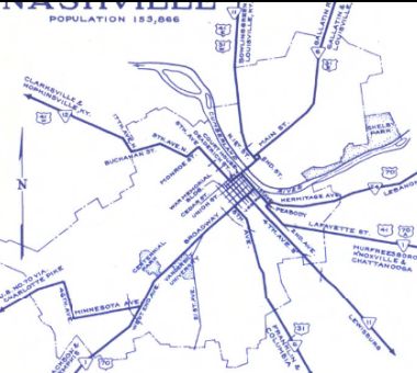
Adjustments: In July 1929, US 31 north was truncated to US 70 (Union at 6th) in Nashville. The route through Gallatin and Westmoreland became US 31E (US 31E and US 31W were cosigned to their split near Edenwold at Rivergate Pkwy and Gallatin Pike). US 31 was never posted on this part, as Tennessee didn't start posting their US routes until 1929. Today this is still US 31E except: Main St/Gallatin Pike out of Nashville; Rockland Rd in Hendersonville; TN 25/E Main St in Gallatin; Sideview Rd in Shiloh; 3 short Old Hwy 31E loops up through Bethpage; the lengthy Old US Hwy 31E through Westmoreland and Sugar Grove; The northern bit of TN 174. The 1930 Official shows US 31 using TN 247/US 431 to go from Spring Hill to Franklin and the 1930 issue shows it using current US 31. This may have been a temporary routing during construction, as the 1906 topo shows a road where US 31 runs now. Also in 1930, US 31 was placed on its current path from Franklin to Nashville. The old route became TN 106.
About 1935, US 31 north was truncated to the relocated US 70, at 8th and Broadway, leaving behind an extended US 31E-31W.
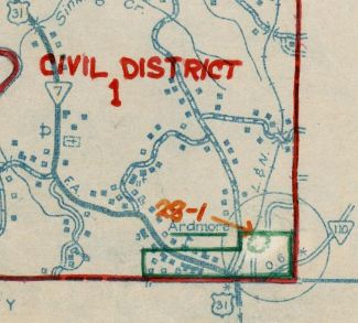
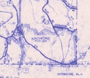
Around 1947, US 31 was moved onto the current alignment in Columbia, leaving behind S Main St to the courthouse; Main St/E 5th/Riverside Dr north from there. Between 1940-51, US 31 was removed from Union Hall Rd/Delap Rd north of Ardmore; Gowan Rd/footprint of I-65; Old Hwy 31 south of Elkton and Bluff/Market Sts within Elkton; Newman Rd north of TN 273 About 1954, US 31 was removed from Old Hwy 31 south of TN 396 About 1957, US 31 was moved to I-65's eventual footprint. It is unclear if TN 7 moved with it but by 1959 the road to Ardmore was definitely TN 7.
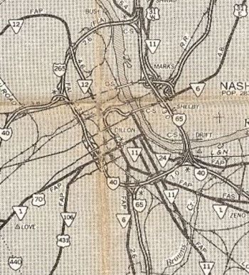
Between 1959-67, though I suspect this may have occurred when all routes N-S routes were moved to James Robertson Pkwy, US 31 was extended north past US 70, replacing US 31W on the parkway to 1St St where US 31E-31W spilt out.
About 1978, US 31 was truncated slightly to the end of Gallatin Pkwy, leaving behind a slightly extended US 31W.
Posting: Fully Posted, though spotty in Nashville. Secret TN Route Overlay: TN 7 (50.2 mi) TN 6 I (20.3 mi) TN 397 (5.6 mi) TN 6 II (22.1 mi) Comment: Essentially usurped by I-65. | ||||||||||||||||||

Previous: US 27 |
Next: US 31 Bus | US 31A | US 31A Bus | US 31E
Top | Tennessee Hwy Index
Home
Page last modified 25 July 2021