ROUTE LOG
Begin US 441, TN 71 SB: 0 - 0
US 321 NB, TN 73 EB: 0.9 - 0.9
TN 449: 6.3 - 7.2
US 321 SB, TN 73 WB: 2.2 - 9.4
US 411 NB, TN 35 NB, TN 66: 4.7 - 14.1
US 411 SB, TN 35 SB TN 338: 12.5 - 26.6
Blount-Sevier Line: 1.9 - 28.5
Knox-Blount Line: 0.5 - 29.0
TN 168: 3.1 - 32.1
TN 33 SB: 5.0 - 37.1
TN 62: 1.8 - 38.9
TN 33 CONN: 1.6 - 40.5
I-640 (exit 6), US 25W, TN 9: 2.3 - 42.8
TN 331: 0.2 - 43.0
TN 33 NB, TN 131 NB: 4.5 - 47.5
TN 131 SB: 0.4 - 47.9
TN 170 SB: 4.8 - 52.7
Anderson-Knox Line: 1.2 - 53.9
TN 170 NB: 1.7 - 55.6
TN 61 NB: 3.1 - 58.7
TN 61 SB: 0.2 - 58.9
Campbell-Anderson Line: 5.3 - 64.2
Anderson-Campbell Line: 0.8 - 65.0
Campbell-Anderson Line: 0.3 - 65.3
Anderson-Campbell Line: 0.2 - 65.5
Campbell-Anderson Line: 1.3 - 66.8
Anderson-Campbell Line: 1.3 - 68.1
I-75 (exit 128): 0.8 - 68.9
US 25W, US 441 END, TN 9, TN 116: 0.4 - 69.3
|
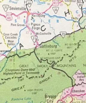
Creation: Approved for extension into Tennessee in late 1951, running generally as it does today plus extended south to the North Carolina line at Newfound Gap. All of this was an addition to TN 71. Tennessee had tried several times over 20+ years to get a US route designation through the Great Smoky Mountains National Park
Adjustments: In Dec 1952, AASHO fielded and discouraged a request directly from the US 441 Highway Association to extend US 441 north with US 25W as part of an overall extension to Louisville KY.
In 1953, AASHO rejected Tennessee's request to renumber US 441 from Gatlinburg to Knoxville via Sevierville as US 441N.
In 1956, AASHO rejected Tennessee's request to extend US 441 north with US 25W to La Follette, then northeast with TN 63 to US 25E, then north with US 25E to end at US 58 Cumberland Gap.
In 1958, US 441 was reconstructed to be on both sides of the Pigeon River from the southern end of Pigeon Forge south to the north end of the Gatlinburg Bypass. The original route used today's SB roadway to Beech Branch then crossed the river and used today's NB roadway the rest of the way south.
In 1960, AASHO rejected a 2nd request to extend US 441 north to Cumberland Gap.
In Dec 1970 (AASHO), US 441 south was truncated to the GSMNP boundary at Gatlinburg so that the Park Service could exclude through truck traffic.
US 441 from GSMNP to Lake City
1956 Goshua
|
US 441 markings removed from GSMNP
1971 Official
|
In 1971, US 441 was removed from Old Broadway at the I-640 and TN 33 interchanges area.
In 1979, Tennessee presented AASHO a proposal, as part of eliminating US 25W, that would have rerouted US 441 at Knoxville to replace US 25W to its I-75 interchange at Rocky Top. Knoxville to Halls Crossroads would have become part of an extended US 129 and the Norris Freeway would've been a state route.
In 2002 or 2003, US 441 markings were restored to official maps through GSMNP, although there are no US 441 postings.
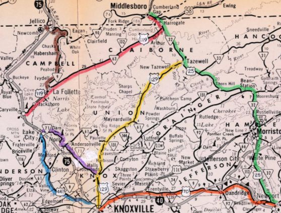
US 441 proposed reroute north out of Knoxville
1979 TDOT Correspondence to AASHO
|
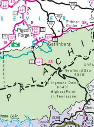
US 441 markings restored within GSMNP
2004 Official
|
Posting: Fully posted
Secret TN Route Overlay: TN 71 (entire length)
Comment: US 441's bypass of Gatlinburg is actually part of a spur of the Foothills Pkwy and not a Tennessee primary highway.
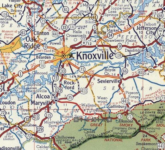
US 441 passes through the severely commercialized areas of Pigeon Forge and Gatlinburg on its way to Great Smoky Mountains National Park.
US 441 crosses Norris Dam; the "Norris Freeway" designation from TN 33 near Knoxville to US 25W is confusing with respect to today's understanding of the word freeway. However, the Norris Freeway moniker goes back to the 1930s then TVA built this road in 1934 to access the dam area.
US 441's elimination through GSMNP was met with immediate controversy including from the US Congress. AASHO was accused of unilaterally making this change (they said NC and TN highway departments did concur). The concern was that the Park Service would close the road entirely, which to me wouldn't have made much sense. A secondary concern is that people would be confused by the lack of 441 postings in the park, but really, other than the road to Townsend there isn't even any other way to get out of the park on a paved road.
There is correspondence in the AASHO archives as late as August 1977 trying to undo the US 441 truncation. Evidently North Carolina changed their mind almost immediately after the truncation but never told AASHO. In the end AASHO noted that the road itself was deeded to the Park Service in 1938 in exchange for the Park Service building and maintaining the road; thus AASHO was not inclined to foist US 441 back onto the road if the Park Service didn't want that.
|