< US 441 | Home | US 641 >
| US 511 early exit | |||
| Previous US 511's:
|
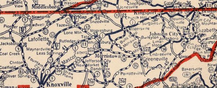
US 511: First establisjed in the 1925 Bureau of Public Roads plan for the US Highway System and was adopted in Dec 1926 as an official US route running from US 70 Knoxville (Magnolia at Chestnut) via Morristown and Johnson City to US 11 Bristol
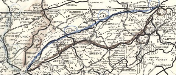
 US 70 and US 511 from Knoxville to Bristol via Morristown and Johnson City 1927 Nat'l Map Company Tennessee acknowledged on Feb 16, 1927 to AASHO that the US 511 description was accurate but later sent a map dated Nov 1927 showing US 511 as US 11E. In 1927, US 511 was removed from TN 344/Old Russellville Pike through Russellville; Stagecoach Rd/Old Stage Rd around Whitesburg and Bulls Gap In 1927 or 1928 (per official route log), US 511 was extended southwest replacing US 70 to the new US 70 alignment (now Carter School Rd) in Trentville. In 1929, US 511 was removed from Philippi Church Rd west of I-81 Also in 1929, US 511 was placed on Blue Springs Pkwy and removed from N Mohawk Rd/Pottertown Rd; Pecan Ridge Rd; Main St through Mosheim; Emerald Rd; Baughard Hill Rd; Mt Pleasant Cir; Old Knoxville Hwy to Greeneville AASHO eventually noticed US 11E on Tennessee maps and accepted their belated request to make this change in mid-1929.
 US 11E from Knoxville to Bristol via Morristown and Johnson City 1929 Official Today, the route US 511 followed is US 11E only in a few places and instead used: Chestnut St, Biddle St, Boyds Plains Pike out of Knoxville; Strawberry Plains Pike through Trentville; abandoned routing/Old Strawberry Plains Pike just west of the Jefferson County line.
| ||