< WV 48 | Home | WV 50 >
|
|
|
| ROUTE LOG |
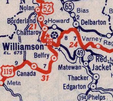
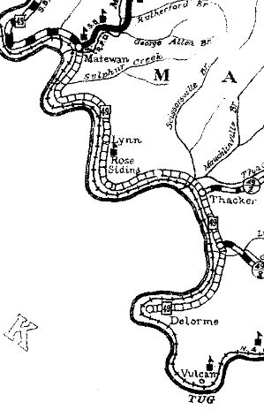
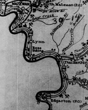
Kentucky State Line: 0 - 0 WV 65: 6.9 - 6.9 US 52: 11.9 - 18.8
|
Creation: Appeared about 1935 as new primary routing running as it does now although the 1935 Mingo County map seems to suggest it did not cross the river into Kentucky out of Delorme (topo maps suggest crossings did exist early than this so I don't know). This is the 2nd WV 49.
| Adjustments: By 1937, WV 49 did connect into Kentucky.
Improvements: Essentially paved by 1939; no multilane segments Comment: serves the southern communities of Mingo County along the Tug Fork. | Previous WV 49's:
1930 ROUTE LOG Virginia State Line: 0 - 0 US 340: 7 - 7 WV 48: 7 - 14 US 11: 7 - 21 |
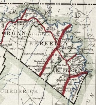
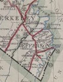
WV 49 #1: Appeared 1922 as new primary routing running from WV 50 (now WV 51) Charlestown northwest to WV 52 (now US 11) Martinsburg.
In 1925, WV 49 was extended southeast to the Virginia State Line at Clarks Gap. Between 1929-31, WV 49 was renumbered as part of WV 9. Today it is approximated by: WV 9 from Virginia; WV 115 to WV 9 north of Ranson; CR 115/5 to Berdene; WV 115 to Baker Heights; CR 9/59 Charlestown Rd; WV 9; CR 9/60 Charlestown Rd; CR 9/31 and 9/32 Hack Wilson Blvd; WV 9 in downtown Martinsburg
|
||||||||||||