< WV 8 | Home | WV 10 >
|
|
|
|
| ROUTE LOG |
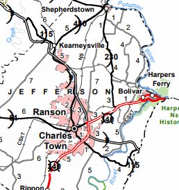
Maryland State Line: 0 - 0 Hampshire-Morgan Line: 3.4 - 3.4 WV 29: 0.5 - 3.9 Morgan-Hampshire Line: 1.0 - 4.9 US 522 NB: 20.5 - 25.4 US 522 SB: 0.4 - 25.8 Berkeley-Morgan Line: 11.6 - 37.4 WV 901: 6.4 - 43.8 I-81 (exit 16): 4.6 - 48.4 US 11 NB: 1.5 - 49.9 WV 45 EB: 0.7 - 50.6 US 11 SB: 0.9 - 51.5 WV 45 WB: 1.0 - 52.5 WV 115: 3.1 - 55.6 Jefferson-Berkeley Line: 2.0 - 57.6 WV 115: 6.5 - 64.1 US 340 NB, WV 51: 2.3 - 66.4 US 340 SB: 1.5 - 67.9 WV 115: 4.4 - 72.3 Virginia State Line: 0.2 - 72.5
|
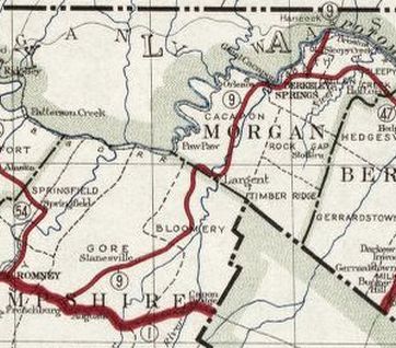
Creation: Created in 1922 as new primary routing, running from WV 1 (now US 50) Frenchburg to the Maryland State Line above Berkeley Springs. This is the only WV 9.
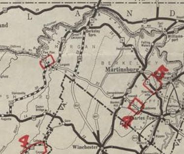
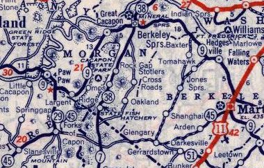
| Adjustments: In 1930 (bridge date), WV 9 was placed on newly constructed alignment from Slanesville southwest to US 50, which moved WV 9's endpoint from Frenchburg to the Pleasant Dale area. The old route became CR 50/9, CR 50/10, and CR 45/9. About 1931, WV 9 was rerouted at Berkeley Springs to head for Charlestown (replacing WV 47) instead of southwest to US 50 (became WV 29). In 1935, WV 9 from Berkeley Springs to Maryland became part of WV 38 (Today it is US 522 except within Berkeley Springs it used Wilkes Ave (still original concrete!) north of Fairfax which used to continue north out to current US 522 at roughly Jimtown Rd; near the Potomac River, WV 9 used a bit of CR 1, a little CR 19, and all of CR 19/1). Instead WV 9 replaced WV 29 southwest into Hampshire County, then replaced WV 51 northwest to Maryland at Paw Paw as it does today.
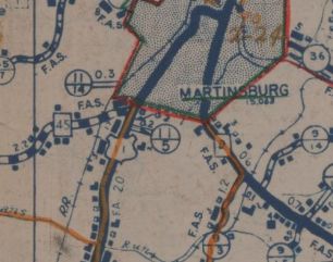
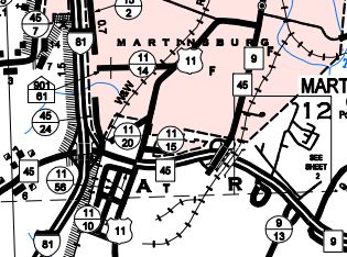
In 1938, WVDOH studied requesting replacing WV 9 from Berkeley Springs to Martinsburg with an unspecified US route number. It is unclear if they formally requested this or not but it obviously did not happen. About 1959 (bridge date), WV 9 was rerouted to accomodate the I-81 interchange. The old route is completely gone except a few hundred feet of Rock Cliff Dr. About 1960(?) (guessing based on a bridge date...by map/satellite data I can find it was between 1948-72), WV 9 was removed from Wilkes and Fairfax Sts in Berkeley Springs to instead use its current routing. Between 1950-63, WV 9 was removed from CR 7 and CR 9/2 at the Cacapon River crossing in southern Morgan County. About 1968, WV 9 was removed from CR 9/31 and 9/32 Hack Wilson Rd (no longer connects to Queen St) in southern Martinsburg.
|
||||||||||