ROUTE LOG
CR 35/11: 0 - 0
END WV 17 ALT: 0.3 - 0.3
|
|
Creation: Based on it being 17 ALT instead of 35 ALT, I guess this is older than 1970. This is the only WV 17 ALT.
Adjustments: None?
Improvements: Paved upon inception; no multilane segments
Comment: Recent county maps don't completely agree to how this exactly runs but the better question is why it exists at all. There is nothing there but the underneath of the current WV 2 bridge and this did not connect to WV 2 when the previous bridge was in place either. This may have been part of the ferry approach before the the previous WV 2 bridge came into existence.
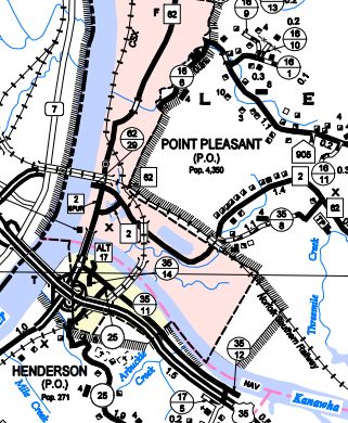
WV 17 ALT shown this way on 2004 and 2014 county maps
2014 Mason County
|
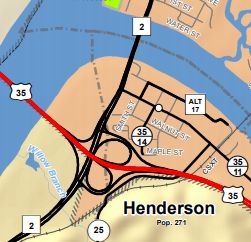
WV 17 ALT shown this way on 2017 county map
2017 Mason County
|
|
