< WV 15 | Home | WV 16 ALT | WV 17 >
|
|
|
| ROUTE LOG |
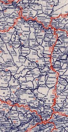
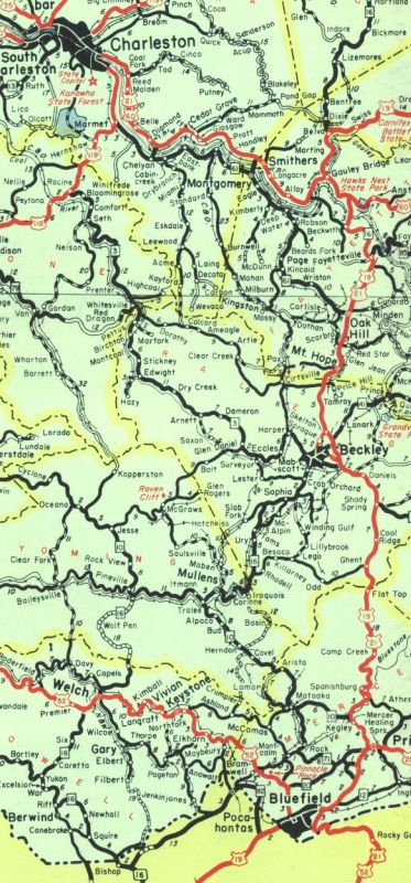
Virginia State Line: 0 - 0 WV 161: 0.1 - 0.1 WV 83: 17.9 - 18.0 US 52 NB: 8.8 - 26.8 US 52 SB, BEGIN US 52 ALT, WV 103: 0.9 - 27.7 US 52 ALT SB: 1.3 - 29.0 WV 16 ALT: 0.1 - 29.1 US 52 SPUR: 0.1 - 29.2 Wyoming-McDowell Line: 10.2 - 39.4 WV 10 NB: 11.5 - 50.9 WV 10 SB: 11.0 - 61.9 WV 54: 2.4 - 64.3 Raleigh-Wyoming Line: 7.6 - 71.9 WV 54, WV 97 EB: 12.0 - 83.9 WV 121: 0.4 - 84.3 I-64, I-77 (exit 42), WV 97 END: 3.7 - 88.0 WV 3 ALT: 1.5 - 89.5 WV 3: 0.2 - 89.7 WV 16 ALT: 0.1 - 89.8 WV 210: 0.9 - 90.7 US 19 SB: 1.5 - 92.2 US 19 NB, US 19 ALT: 3.3 - 95.5 Fayette-Raleigh Line: 2.5 - 98.0 WV 211: 0.9 - 98.9 WV 61 SB: 0.8 - 99.7 WV 61 ALT: 0.3 - 100.0 US 19 SB: 4.7 - 104.7 US 19 NB: 0.6 - 105.3 WV 61 NB: 0.4 - 105.7 US 19: 0.5 - 106.2 US 19 SB: 2.9 - 109.1 US 19 NB: 0.7 - 109.8 US 19: 3.5 - 113.3 US 60 EB: 8.4 - 121.7 US 60 WB, BEGIN WV 39: 4.8 - 126.5 WV 39 EB: 5.5 - 132.0 Nicholas-Fayette Line: 1.7 - 133.7 Clay-Nicholas Line: 2.6 - 136.3 WV 4 WB: 20.4 - 156.7 WV 4 EB: 11.2 - 167.9 I-79 (exit 40): 6.3 - 174.2 Calhoun-Clay Line: 4.2 - 178.4 US 33 WB, US 119 SB: 15.0 - 193.7 US 33 EB, US 119 NB: 1.7 - 195.4 WV 5: 11.4 - 206.8 Ritchie-Calhoun Line: 9.9 - 216.7 WV 47 EB: 4.5 - 221.2 WV 47 WB: 0.1 - 221.3 WV 31: 12.8 - 234.1 US 50: 5.0 - 239.1 Pleasants-Ritchie Line: 5.6 - 244.7 WV 2: 8.5 - 253.2
|
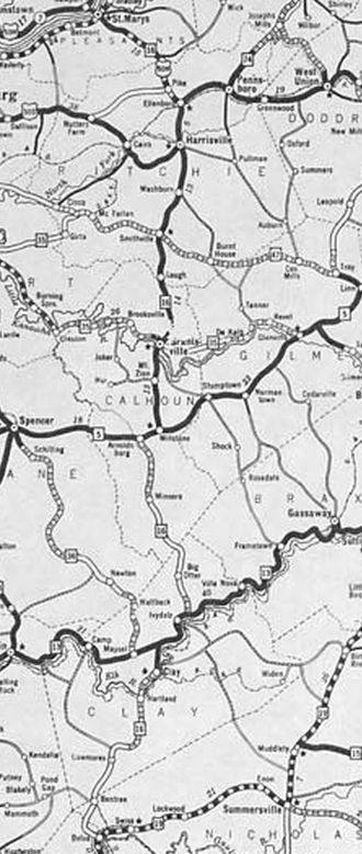
Creation: Created in 1922 as new primary routing, running from WV 5 (now US 33-119) Millstone to WV 1 (now CR 50/39) Ellenboro. This is the only WV 16.
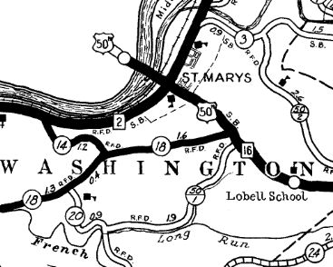
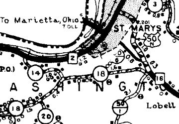
| Adjustments: In 1926 (WVDOT Annual Report), WV 16 was extended both directions: north replacing WV 59 to WV 2 St Marys and south by following WV 5 to Arnoldsburg then replacing WV 60 south to WV 13 (now WV 4) Ivydale. Also in 1928, the first bridge over the Ohio River at St Mary's was opened. Since US 50N wasn't designated yet, WV 16 may have extended over it to the Ohio State Line. Between 1929-31, WV 16 was extended south replacing WV 13 to end at US 19 (now WV 39) Belva.
In December 1934 (AASHO), West Virginia and Ohio requested a new US Route from US 21-60 Gauley Bridge WV north to St. Mary's WV (replacing all of WV 16) then crossing the Ohio River to then follow OH 7 north to US 20 Ashtabula OH. In January 1935, AASHO declined to approve this because the route "is not of interstate importance." No number was suggested. In 1936 or 1937, WV 16 was removed from CR 16/34 and CR 16/19 below Smithville. In 1938, WVDOH studied requesting replacing all of WV 16 with an unspecified US route number. It is unclear if they formally requested this or not but it obviously did not happen. In 1941, WV 16 was extended with US 19 south to Beckley, then replaced WV 12 all the way to Virginia at Bishop.
Between 1938-46, WV 16 was removed from CR 50/6 out of St. Marys
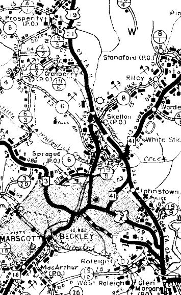
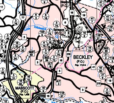
Between 1950-57, WV 16 was straightened out in Pleasants County leaving behind CR 16/8 and CR 16/9 loops below Maxwell; CR 16/5 and CR 16/7 loops above Maxwell; CR 16/4 and CR 16/6 at Cloverdale Church As early as 1955, WV 16 was placed on the new Mt. Hope Bypass - WVDOT reported that WV 211 through Mt. Hope was a renumbering of US 21 in 1968, so the bypass appears to have been US 21 BYP or US 21 ALT and WV 16. Between 1959-62, WV 16 was given its current Robert Byrd Dr routing around central Beckley which was partially new construction. The old route became Neville St, Main St, and US 21 ALT (now WV 210) remained on N. Kanawha St.
About 1963, WV 16 was rerouted at Grantsville with a new bridge over the Little Kanawha River, the old route used CR 16/34, then crossed the river becoming Main St, then used a bit of WV 5 to High St. Between 1963-70, WV 16 was removed from CR 21/5 north of Beckley. In November 1967 (per History of Beckley website), WV 16 was removed from CR 16/14 between Sophia and Crab Orchard. Although maps consistently show WV 16 with US 50N (later US 50 ALT) from Ellenboro to St Marys throughout the US route's designation until 1975, it is unclear if this included the original bridge over the Ohio River. However, the 1928 bridge was permanently closed in 1969 and torn down in 1971 because of fears it could collapse the same way the Silver Bridge in Point Pleasant had earlier. So this might have been when WV 16 north was truncated to WV 2 as the new bridge opened in 1977 south of town as WV 807. Improvements: By 1928, WV 16 was paved from Smithville to Ellenboro and the last few miles into St Marys Between 1929-31, WV 16 was paved from Arnoldsburg to Smithville In 1932, WV 16 was paved from Clay to Ivydale; Minnora to Arnoldsburg By 1938, WV 16 was paved from Belva to Clay; Ivydale to Minnora; Ellenboro to Pike The 1941 extension to Virginia was paved except from Pineville south to the McDowell line. Between 1947-50, WV 16 was paved from Pike to St Marys WV 16 was paved from Pineville to the McDowell line between 1951-56. WV 16 was multilaned on its Beckley bypass when completed by 1962. WV 16 was multilaned from Sophia to WV 3 in 1967. Comment: WV 16 is part of the very long multi-state route 16 that extends from St Marys all the way to a few miles short of the South Carolina border southeast of Charlotte NC. WV 16 was definitely posted with US 50N/50 ALT. Here is a 1942 picture showing this. WV 16 is on split alignments in Welch with NB using Wyoming St and SB using the original route on McDowell St. There is a posted WV 16 TRUCK in Welch to avoid a low railroad underpass. It is one of the shortest TRUCK routes you will ever see. |
||||||||||||||
