< WV 1 | Home | WV 2 | WV 2 SPUR | WV 3 >
|
|
|
| ROUTE LOG |
WV 2: 0 - 0 WV 2: 3.0 - 3.0
|
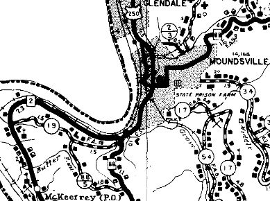
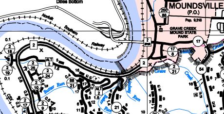
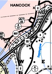
Creation: WV 2 ALT was an upgrade to CR 19. Since official state maps only started implying this route existed recently, I really don't know how long this has been here. It does appear on the 1961 Topo map. The next oldest detailed map I have is 1949 Marshall County which shows it as CR 19.
| Adjustments: None Improvements: Fully paved upon designation; no mulitlane segments. Comment: One would think that WV 2 ALT was an old WV 2 alignment from some point in the past but it definitely was not. In fact, WV 2 used to use CR 21 south from WV 2 ALT's east end!
| Previous WV 2 ALT's:
1973 ROUTE LOG US 250, WV 2: 0 - 0 US 250, WV 2: 2 - 2 |
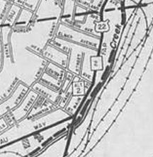
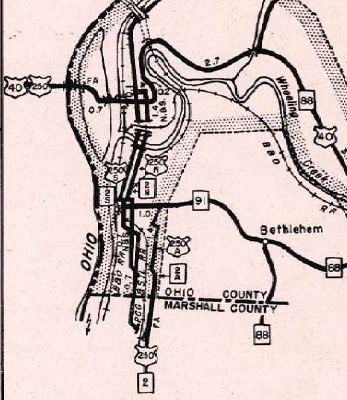
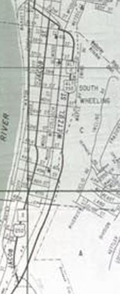
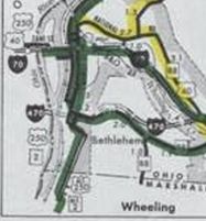
WV 2 ALT #1: Appeared in the mid-1940s as new primary routing in South Wheeling, running on Wetzel St from Jacob St northeast skirting the edge of downtown S. Wheeling then connecting back to US 250/WV 2 using WV 91
By 1964, it appears WV 2 ALT was truncated to cut back west at 33rd St. In 1974 or 1975, mainline US 250/WV 2 was placed on this routing which was upgraded to freeway. A ittle bit of Wetzel St still exists from 41st to 33rd.
|
|||||||
Previous: WV 1 |
Next: WV 2 | WV 2 SPUR | WV 3
Top | West Virginia Hwy Index
Home
Page last modified 8 April 2022