N.C. 55
< 54 | Home | 55-A | 55 Bus | 56 >
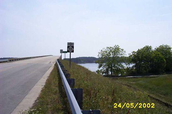
Photo: NC 55 ends at the Greens Creek bridge (Thomas Cole)
| N.C. 55 197 miles | |||
| The Road: | Begins at US 501 Business Durham (Durham County) and ends the village of Oriental (Pamlico County). | Towns and Attractions: | Durham Co.: Durham
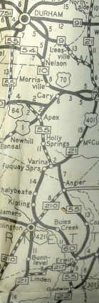
Wake Co.: Cary, Apex, Holly Springs, Fuquay-Varina Harnett Co.: Angier, Coats, Dunn Sampson Co.: None Johnston Co.: None Sampson Co.: Newton Grove Wayne Co.: Mount Olive, Seven Springs Lenoir Co.: Kinston Craven Co.: New Bern Pamlico Co.: Bayboro, Oriental |
History: |
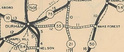
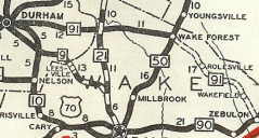
NC 55 first appears on VDOT official maps and Rand Mcnally maps from 1929 which show NC 55 running from US 1/NC 50 (current US 1-A) Franklinton west to Durham.
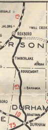
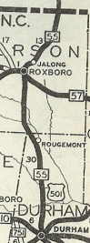
The 1929 NCDOT Official shows no route on this corridor. The 1930 Official Map shows this as part of NC 91 and shows NC 55 having replaced NC 13 from Durham north to Virginia along with US 501.
I have not found a map that shows NC 55 on both segments at the same time, so it is possible today's NC 55 is technically NC 55 #2.
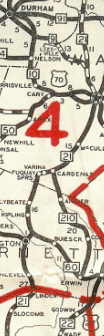
In 1932, NC 55 was extended south with US 15/NC 75 through Durham, Apex and Fuquay Springs. NC 55 then jogged east with US 401/NC 21 to Cardenas, then replaced NC 210 #2 south through Angier and Erwin, then south as new routing to US 301/NC 22 Godwin.
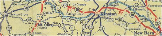
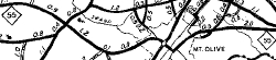
In the Great Renumbering in 1934, NC 55 was removed from US 501 from Durham northward. This route is still US 501 today except it used Main St through Roxboro and US 501 Business in northern Durham. Also during the renumbering, NC 55 was rerouted at Erwin to continue east with US 421 to Dunn, then as new primary routing to Newton Grove, then replacing NC 117 through Mt. Olive and Kinston before ending at US 70 (now part of NC 55) Jasper. The Erwin to Godwin route became NC 82.
NC 117 Newton Grove to Jasper 1932 Gousha
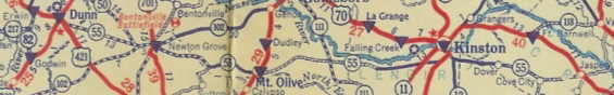
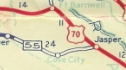
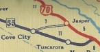
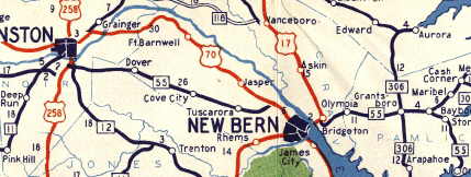
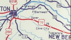
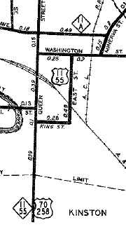
NC 55 replacing NC 117 1935 Gousha In 1938, NC 55 was rerouted at Cove City to connect further east on US 70 near Clarks. Cove City to Jasper became secondary and is today N. Main St and Old Dover Rd.
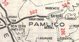
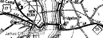
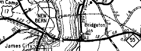
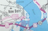
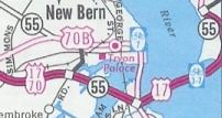
In 1940, NC 55 was rerouted between Mt. Olive and Seven Springs to its current route. Initially NC 55 used SR 1744 Indian Springs Rd. In 1940, NC 55 was extended east with US 70 from Jasper to New Bern, then with US 17 across the Neuse River to Bridgeton. NC 55 then replaced NC 302 through Bayboro and to its end at Oriental. In 1941, NC 55 and US 70 swapped routes between Kinston and Clarks.
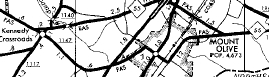
Between 1958-62, NC 55 was rerouted around the north side of Mt. Olive, leaving behind SR 1147 Smith Chapel Hwy, SR 1141-1004 Main St, and SR 1969 Church St.
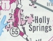
In December 2002 (mtr post from John Lansford), NC 55 was put on a new bypass west around Holly Springs, leaving behind NC 55 Bus. The new routing was signed as NC 55 BYPASS while the route through town (since donwgraded to SR 6107 outside town limits and the rest is no longer in the state highway system) was signed as bannerless NC 55.
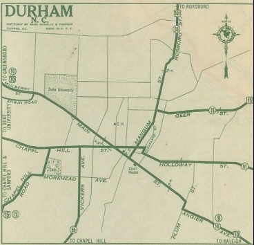
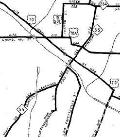
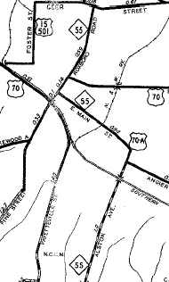
Durham changes:
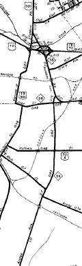
Kinston changes:
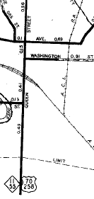
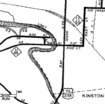
New Bern changes: Initially (i.e. 1940), NC 55 used Neuse Blvd to Front St, then north to Queen St then northeast across the Neuse River to Bridgeton.
|
Comments: |
Adam Prince profiles the town of Oriental here. Although NC 55 has a substantial N-S segment, it is signed as E-W everywhere. |

Last Update: 23 November 2019
Previous: N.C. 54 | 55-A | 55 Bus
Next: N.C. 56
Top | NCRoads.com
Home