< VA 35 | Home | VA 37 >
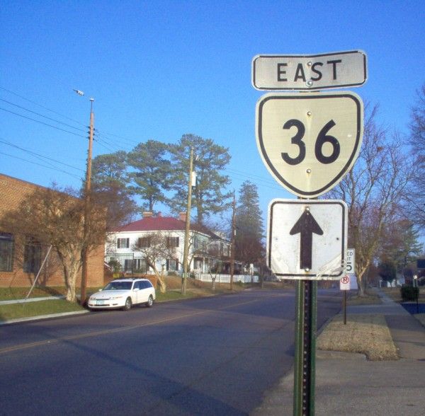
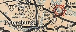
Photo: VA 36 in Hopewell (photo by Mapmikey 1/30/06)
|
|
|
| ROUTE LOG |
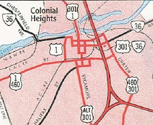
SR 669: 0 - 0 VA 327: 5.66 - 5.66 Petersburg-Chesterfield Line: 0.20 - 5.86 US 1 SB, US 460 Bus WB: 1.15 - 7.01 US 301 ALT: 0.20 - 7.21 US 1 NB: 0.20 - 7.41 I-95 (exit 52): 0.20 - 7.61 US 301, US 460 Bus EB: 0.30 - 7.91 Prince George-Petersburg Line: 1.88 - 9.79 VA 144: 2.01 - 11.80 Hopewell-Prince George Line: 0.20 - 12.00 I-295 (exit 9): 0.82 - 12.82 VA 156 Bus SB: 1.77 - 14.59 VA 156 Bus NB: 0.25 - 14.84 VA 10: 1.86 - 16.50
|
Creation: Appeared in July 1933 as a renumbering of:
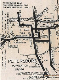
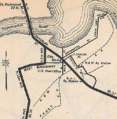
| VA 409 from SR 602-635 western Chesterfield County to Petersburg VA 408 from Petersburg to Hopewell VA 407 east from Hopewell VA 435 across the James River Ferry to VA 5 in Charles County. This is the 2nd VA 36. Adjustments: About 1934, VA 36 was rerouted in Hopewell. Initially it used today's VA 36 routing to Randolph St (then-VA 37). Now it used 15th St north to City Point Ave east to Randolph. By 1941, it appears VA 36 was placed on one-way splits in Petersburg: EB used the original routing - Grove/Sycamore/Bank; WB used Bank/Crater/Bollingbrook/Sycamore/Old/Grove
In May 1946 (CTB), VA 36 west was truncated to SR 669. The several miles out to SR 635 became more SR 602. In March 1948 (CTB), VA 36 was rerouted in Hopewell to what I believe is current VA 156 Bus east to VA 10. In March 1958 (CTB), VA 36 east was truncated to VA 10 Hopewell. The route over the ferry to VA 5 became VA 156. Today the Charles City portion is SR 658.
In Feb 1961 (CTB), VA 36 was removed from Bank St between Crater and Washington St. VA 36 was instead placed on Washington St and Crater Rd. This did not alter the one-way splits in downtown Petersburg. In Apr 1961 (CTB), VA 36 was given its one-way splits in Hopewell. Also, VA 36 was given its current routing back on 15th/Broadway/6th Ave routing.
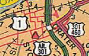
It appears in June 1979 (CTB), VA 36 was given its current one-way routings through Petersburg as Wythe St east of Crater Rd was added as a primary street. WB VA 36's routing did not change but EB was removed from most of central Petersburg.
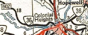
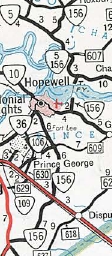
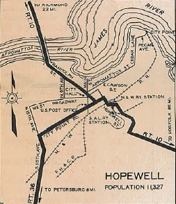
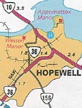
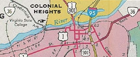
Improvements: Paved upon its inception. VA 36 was first multilaned in 1941 when placed on one-way splits in Petersburg VA 36 was 4-laned from Petersburg to Ft Lee in 1961 In 1963, VA 36 was multilaned from Ft Lee to VA 156. In 1992, VA 36 was multilaned in the Ettrick area Posted: Fully posted; At last check (2007) there were still 3 cutouts in Hopewell An error US 36 shield is posted WB approaching the Appomattox River. White border unisign on VA 36 EB approaching VA 156. For some time until 2005 there were no VA 36 signs directing you on some of the Hopewell turns! Multiplexes: US 1, US 460 Bus (0.40 mi) US 460 Bus (0.50 mi) VA 156 Bus (0.25 mi) Legislative names: 555th Parachute Infantry Battalion Airborne Memorial Bridge over CSX Railroad, Ettrick (since 6-21-90) Other names: River Rd (w of Ettrick); Chesterfield Ave (Ettrick); Fleet St/Grove Ave/Market St/Wythe St (EB Petersburg); Washington St/Crater Rd/Bollingbrook/Sycamore/Old (WB Petersburg); Oaklawn Blvd (EB)/Woodlawn St (WB)/Winston Churchill Dr/Arlington Rd/15th Ave/Broadway St/6th Ave (Hopewell) Scenic Byway: No segments Comment: VA 36 connects Petersburg to Hopewell and serves Ft. Lee. VA 36 uses a large traffic circle for a six-way intersection in Hopewell. The 1939 VDOT report on primary system development had recommended that VA 36 be decommissioned from SR 669 to SR 600. | Previous VA 36's:
1932 ROUTE LOG US 1, VA 31: 0 - 0 VA 717: 1 - 1 VA 711: 13.5 - 14.5 VA 25: 0.5 - 15 US 211, VA 21: 1 - 16 US 15 NB, VA 32 NB: 18 - 34 US 15 SB, VA 32 SB: 7 - 41 VA 839: 15 - 56 US 340, VA 811: 4 - 60 VA 54: 2 - 62 VA 37 SB: 9 - 71 US 11, VA 33, VA 37 NB: 1 - 72 VA 822: 1 - 73 VA 834: 14 - 87 WV STATE LINE: 2 - 89 |
VA 36 #1: Appeared in 1923 as a renumbering of VA 6 beginning at VA 31 (most likely now VA 400) Alexandria, using VA 7 west to Diagonal St southwest to VA 236 west to Fairfax. Here VA 36 headed west on US 50 to Middleburg, then used SR 828 loop through Atoka, then crossed over US 50 and crossed Goose Creek near the north end of SR 624. VA 36 picked back up US 50 through Upperville toward Paris, where it used Federal St through the village.
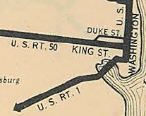
VA 36 then used US 17-50 up to Ashby Gap but used the SR 601 access roads through the gap. VA 36 used US 17-50 more or less (some alignments are visible west of SR 601) to the Shenandoah River, where the crossing was slightly south, along River House Ln. VA 36 followed SR 723 through Millwood and Boyce back to US 17-50. VA 36 used US 50 through Winchester, then SR 803 Round Hill Rd. VA 36 followed US 50 to West Virginia except: SR 817 Magic Mtn Rd; short SR loop west of Hayfield; Gore Rd through Gore; in between the end of US 50 4-lane and west of SR 703 there is an alignment to the northeast of US 50 with notably twisty curves that is now a long driveway; a short loop at the state line 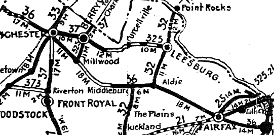 Original VA 36 In late 1926, US 50 was assigned to VA 36 west of Fairfax. In 1928, VA 36 was removed from King St and Diagonal Rd in Alexandria and placed on Duke St to Washington St.
In Dec 1928 (CTB), US 50 was assigned to the rest of VA 36. VA 36 was dropped from US 50 in July 1933. |
||||||||||||||||||
Previous: VA 35 |
Next: VA 37
Top | Virginia Hwy Index
Home
Page last modified 28 February 2015