< VA 45 | Home | VA 47 >
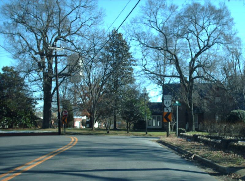
Photo: VA 46 in a nice part of Lawrenceville (photo by Mapmikey 1/21/08)
|
|
.
|
|
| ROUTE LOG |
VA 40: 0 - 0 Brunswick-Nottoway Line: 5.61 - 5.61 VA 137: 7.01 - 12.62 I-85 (exit 27): 5.13 - 17.75 VA 378: 0.20 - 17.95 US 1: 0.19 - 18.14 US 58 Bus EB: 7.00 - 25.14 US 58, US 58 Bus END: 1.00 - 26.14 NC STATE LINE: 16.43 - 42.57
|
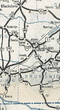
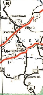
Creation: Appeared Oct 1940 (CTB) as a renumbering of VA 34 running essentially the way it does now. This is the 3rd VA 46.
| Adjustments:In Sept 1946 (CTB), VA 46 was rebuilt in a 2-mile stretch around the Nottoway-Brunswick line, leaving behond abandoned alignments. In 1948, VA 46 was removed from SR 715 and the historic Gholson Bridge and placed on its current direct routing across the Meherrin River south of Lawrenceville.
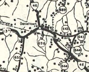
In 1969, VA 46 was given its routing across I-85, leaving behind a brief US 1 duplex, SR 756 Little Doe Rd, and abandoned routing on the west side of I-85. In Aug 1971 (CTB), VA 46 was removed from SR 766 Rock Church Rd, SR 767 Berean Rd, and SR 768 Mason Grove Ln south of Lawrenceville. In April 1979 (CTB), VA 46 was removed from SR 729 New Hope Rd in Danieltown.
Improvements: Fully paved upon designation VA 46 has no multilane segments Posted: Fully posted; Truck Route: A posted VA 46 TRUCK exists at Lawrenceville. It uses the entirety of the US 58 Bypass plus US 58 Business east of downtown. The point is to avoid a couple tight turns in close proximity. Multiplexes: US 58 Bus (1.00 mi) Legislative names: None Other names: Brunswick Rd (Nottoway Co); Christiana Hwy (Brunswick Co); Windsor Ave/Church St/Main St/Hicks St (Lawrenceville) Scenic Byway: VA 43 duplex (since 12/17/92) US 460 east to SR 636 Sliders (since 2/16/95) Comment: VA 46 is one of the quietest routes in Virginia. The 1939 VDOT report on primary system development had recommended that VA 46 (then-VA 137) be decommissioned from Danieltown to Blackstone. | Previous VA 46's:
1932 ROUTE LOG VA 13: 0 - 0 Cumberland-Powhatan Line: 13 - 13 GAP IN ROUTE VA 45: 0 - 13 CR 9: 1 - 14 GAP IN ROUTE CR 7, CR 9: 0 - 14 VA 19 EB: 6 - 20 VA 19 WB: couple blocks - 20 CR 4: 11 - 31 GAP IN ROUTE VA 41: 0 - 31 VA 39 EB: 10 - 41 VA 39 WB: 1 - 42 CR 115: 7 - 49 1940 ROUTE LOG US 15, US 360: 0 - 0 VA 47, VA 49 NB: 8 - 8 VA 49 SB: couple blocks - 8 US 58: 10 - 18 |
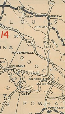
VA 46 #1: Began in Aug 1928 (CTB), running only from VA 19 (now VA 6) Columbia to a mile into Cumberland County
In Dec 1930 (CTB), VA 46 was extended north 4.5 miles to the Stage Junction area; also, a second piece of VA 46 was born, running from VA 45 near Cartersville northwest 0.55 miles towards Columbia; also, a third piece was born, running from VA 13 near Powhatan CH northwest 5.08 miles to Duncan Store; also, a fourth piece was born running from VA 39 (now US 33) Louisa CH south 6.24 miles towards Ferncliff. In June 1931 (CTB), the 4th piece was extended north 3.42 miles towards Orange CH. In July 1932 (CTB), the original piece of VA 46 was extended north 6.5 miles towards Ferncliff and southeast 5.45 miles towards Carterville; the 3rd piece of VA 46 was extended west to the Cumberland line; the 4th piece was extended north to 0.15 miles short of the North Anna River and south to VA 41 (now US 250) Ferncliff. In July 1933, all 4 pieces of VA 46 were renumbered as part of VA 16. Today this is (S to N): a bit of US 60, SR 601, SR 654 (piece 3); SR 690 (piece 2); SR 690, a bit of VA 6, SR 659 (piece 1); VA 208, SR 630, a bit of US 33/VA 22, SR 669
VA 46 #2: Appeared in July 1933 as a renumbering of VA 12 from US 15-360 Barnes Jct to US 58 Boydton. In Oct 1940 (CTB), VA 46 was renumbered as VA 47 from Barnes Jct to Chase City (now VA 92) and VA 92 from Chase City to Boydton. 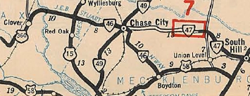
VA 46 #2 1933 Official | ||||||||||
Previous: VA 45 |
Next: VA 47
Top | Virginia Hwy Index
Home
Page last modified 28 February 2015
