  |
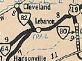
From:  Lebanon (Russell County) Lebanon (Russell County)
To:   Cleveland (Russell County) Cleveland (Russell County)
Total Length: 6.84 miles
|
|
|
|
|
ROUTE LOG
US 19 Bus: 0 - 0
SR 600: 6.84 - 6.84
|
|
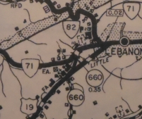
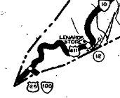
Creation: Appeared in July 1933 as a renumbering of what I believe was VA 131, running from US 19 (now Old Fincastle Rd) Lebanon to Cleveland. This is the only VA 82.
Adjustments: In Apr 1940 (CTB), US 19 was moved from Old Fincastle Rd to today's US 19 Business in Lebanon. Old Fincastle Rd became VA 64. VA 82 was not extended the short distance to today's US 19 Business, instead VA 71 used the 0.02 miles.
In Dec 1953, the CTB turned down a request from the Town Council of Cleveland to extend VA 82 west over SRs 600/615/616 to VA 64 (now VA 63) Hazel.
In Aug 1960 (CTB), Old Fincastle Rd stopped being a primary route (then part of VA 71), so VA 82 was definitely extended to US 19 Business by then.
Improvements: Paved upon designation; no multilane segments
Posted: Fully posted
Multiplexes: None
Legislative names: John Counts Memorial Bridge over the Clinch River, since 8-26-52.
Other names: Cleveland Rd
Scenic Byway: None
Comment: VA 82 is very twisty crossing the Copper Ridge.
SR 600/664/615 from Cleveland to VA 63 is a pretty decent corridor.
The 1939 VDOT report on primary system development had recommended that VA 82 be decommissioned in its entirety.
VA 82
1933 Official
|
VA 82 ending at Old Fincastle Rd
1946 Russell County
|
|
 |
From:
 Pound (Wise County) Pound (Wise County)
To: West Virginia State Line near Stacy (Buchanan County)
Total Length: 62.71 miles
The route continues 17 miles as WV 84 to end at WV 16 Susanna, WV.
|
|
|
|
|
ROUTE LOG
US 23 Bus: 0 - 0
Dickenson-Wise Line: 3.57 - 3.57
VA 361: 0.10 - 3.67
VA 72: 3.81 - 7.48
VA 63 SB: 8.04 - 15.52
VA 63 NB: 4.94 - 20.46
VA 80 SB: 7.23 - 27.69
VA 63: 0.34 - 28.03
VA 80 NB: 1.09 - 29.12
Buchanan-Dickenson Line: 3.46 - 32.58
US 460 EB: 10.38 - 42.96
US 460 WB: 3.95 - 46.91
WV STATE LINE: 15.80 - 62.71
|
|
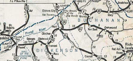
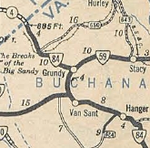
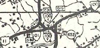
Creation: Appeared in Oct 1940 (CTB) as a renumbering of VA 59, running generally the way it does today, plus extended 5 miles west of Pound towards Gilley. This is the 2nd VA 83.
current VA 83 appears
1941-42 Official
Adjustments: In Jan 1943 (CTB), VA 83 was rerouted in Clintwood to its current path on Mullins Ave, leaving behind SR 1001 McClure St and an extended SR 607 Main St.
In Apr 1944 (CTB), VA 83 west was truncted to US 23 Pound, leaving behind its brief US 23 duplex and SR 671.
In March 1953 (CTB), VA 83 was removed from SR 1003 Walnut St in Grundy.
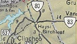
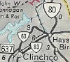
In March 1961 (CTB), VA 83 was added to the primary system to run from Clinchco to Haysi along its current route and when the road is built, the old route to Haysi is to become VA 63.
In 1966, VA 83 between Clinchco and Haysi was placed on the new road and the old route was renumbered to VA 63.
VA 83 Clinchco to Haysi
1965 Official
|
VA 83 rebuilt
1966 Official
|
In Nov 1973 (CTB), VA 83 was built on new alignments from Georges Fork westward, leaving behind some abandoned alignments plus SRs 765 and 766.
In May 1976 (CTB), VA 83 was rebuilt in eastern Wise County, leaving behind abandoned alignments plus SRs 850, 851, 852 and 853.
In Sept 1976 (CTB), VA 83 was rebuilt onto new alignment west of Clinchco, leaving behind 1.6 miles of abandoned alignments (including this abandoned bridge over the McClure River) plus a bit of VA 63 south.
Around 2003, VA 83 was removed from central Grundy and placed on what had been the US 460 EB/VA 83 WB route that bypassed downtown.
In late 2013, VA 83 was placed on the new US 460 Bypass of a business district along Riverside Dr north of Van Sant, centered around SR 615 Levisa Rd. The old route remains US 460 Business.
Improvements: Fully paved upon inception
VA 83 was multilaned in the Grundy area with its US 460 duplex in 1980.
In 2002, VA 83 was widened from Grundy to Vansant.
VA 83 has several hill climbing sections between Pound and Clinchco.
Posted: Fully posted; last known cutout (HB Elkins) lasted to about 2000; error US 83 shield at Grundy existed in 2008; white I-83 shield on a small green sign was on US 460 EB in Grundy in 2003
Multiplexes: VA 63 (4.94 mi)
VA 80 (1.43 mi)
US 460 (3.95 mi)
Legislative names: Cumberland Scenic Trail, from Pound to Haysi (since 3-31-64)
Other names: Clintwood Hwy (Wise Co); Dickenson Hwy (Dickenson Co); Main St/Mullins ave (Clintwood); Edgewater Dr (Grundy)
Scenic Byway: No segments
Comment: Given the terrain, VA 83 is a pretty good route from Pound to Grundy. East of Grundy the route to West Virginia is a little more winding.
US 121, The Coalfields Expressway is slated to follow the general swath of VA 83 which will lessen the importance of this route.
|
| Previous VA 83's:
1940 ROUTE LOG
VA 80: 0 - 0
Tazewell-Russell Line: 12 - 12
VA 84 WB: 1 - 13
VA 84 EB: 4 - 17
SR 620: 7 - 24
|
|
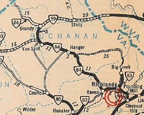
VA 83 #1: Appeared July 1933 as a renumbering of VA 138, running from VA 80 (now Clover Rd) Honaker east several miles, then a separate piece existed from VA 84 (now US 460 Bus) north to Big Creek.
In Sept 1934 (CTB), the western piece of VA 83 was extended east 3.76 miles.
In Sept 1937 (CTB), the Richlands piece of VA 83 was extended north to the Buchanan County line at Jewell Ridge.
In May 1938 (CTB), VA 83 was connected over SR 617 to Raven and a duplex with VA 84 (now US 460) to meet the Richlands piece.
In Oct 1940 (CTB), VA 83 was renumbered as VA 67.
Today, VA 83 is VA 80 leaving Honaker; VA 67 to Jewell Ridge except the SR 637 loops near Gardners
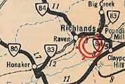
VA 83 #1, with a gap
1933 Official
|
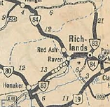
VA 83 connected/expanded
1940 Official
|
|
 |
From:  Vanderpool (Highland County) Vanderpool (Highland County)
To:
West Virginia State Line near Mill gap (Highland County)
Total Length: 14.94 miles
The route continues as WV 84 a short distance to WV 28 Frost, WV.
|
|
|
|
|
ROUTE LOG
US 220: 0 - 0
WV STATE LINE: 14.94 - 14.94
|
|
Creation: Created in Oct 1940 (CTB) as a renumbering of VA 271. This is the 2nd VA 84.
Adjustments: None
Improvements: Fully paved upon inception; no multilane segments
Posted: Fully posted; no cutouts
Multiplexes: None
Legislative names: None
Other names: Mill Gap Rd
Scenic Byway: None
Comment: VA 84 is an easy drive but it is one of the more remote routes in Virginia to get to as is all of Highland County.
VA 84 climbs to 3150 feet at the West Virginia boundary.
The 1939 VDOT report on primary system development had recommended that VA 84 (then VA 271) be decommissioned in its entirety.
|
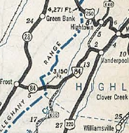
Current VA 84
1941-42 Official
|
|
| Previous VA 84's:
1940 ROUTE LOG
US 19: 0 - 0
VA 83 NB: 6 - 6
VA 83 SB: 4 - 10
VA 59 WB: 24 - 34
VA 59 EB: 4 - 38
KY STATE LINE: 14 - 52
|
|
VA 84 #1: Appeared in July 1933 as a renumbering of VA 126, running from US 19 Claypool Hill to 6.3 miles west of Grundy.
In Aug 1936 (CTB), VA 84 was extended west 8.2 miles to the Kentucky State Line using today's SR 700.
In Sept 1939 (CTB), VA 84 was removed from SR 1006 (now destroyed) in Grundy.
In Jan 1940 (CTB), VA 84 was removed from SR 700 west of Grundy and placed on modern US 460.
In Oct 1940 (CTB), VA 84 was renumbered as VA 4.
Today it is US 460 and US 460 Bus and SR 707/1202/631 through Cedar Bluff; US 460 Bus through Richlands; VA 67/SR 751/SR 806 through Raven; SRs 804/805 Red Ash; SR 727 Grimleysville; SR 721 in Keen Mountain/Marvin; SRs 759 and 1013 in Janney; SR 725 in Tookland. There are innumerable abandoned alignments of US 460 on the big curves following various mountain streams.
VA 84 #1
1933 Official
|
VA 84 extended to Kentucky
1940 Official
|
|
|
VA
85 not currently assigned |
|
|
|
|
Previous VA 85's:
1957 ROUTE LOG
SR 644: 0 - 0
WV STATE LINE: 0.85 - 0.85
WV STATE LINE: 0 - 0.85
WV STATE LINE: 0.20 - 1.05
WV STATE LINE: 0 - 1.05
US 19 NB, US 460 EB: 5.20 - 6.25
US 19 SB, US 460 WB: 0.15 - 6.40
WV STATE LINE: 2.44 - 8.84
|
|
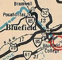
VA 85: Appeared July 1933 as a renumbering of VA 128 and possibly VA 132 as well. Ran from Pocahontas through Bluefield to the West Virginia line at Bluefield College. The WV segments were WV 82.
Sometime after 1936, VA 85 was rerouted in Bluefield. Originally, it duplexed with US 19 south across the Bluestone River, then Fairview St north across the RR to today's SR 802. Now, it went north on US 19 to Thayer St across the RR to Depot St.
The March 1949 CTB rejected a proposal to extend VA 85 over SR 659 north to the West Virginia line towards US 52 Maybeury, WV.
In March 1958 (CTB), VA 85 was renumbered as VA 102. Today it is still VA 102 except in downtwon Bluefield and also SRs 842/843 north of town.
VA 85
1933 Official
|
VA 85 duplexed with US 19 south
1936 Tazewell County
|
VA 85 duplexed with US 19 north
1946 Tazewell County
|
|
 |
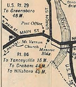
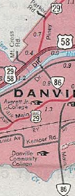
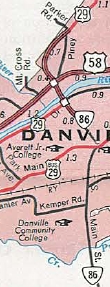
From:
    City of Danville City of Danville
To:
North Carolina State Line in City of Danville
Total Length: 29.57 miles
The road continues a couple hours as NC 86 to end at US 15-501 Chapel Hill, NC.
|
|
|
|
|
ROUTE LOG
US 29 Bus, VA 413: 0 - 0
VA 293: 0.60 - 0.60
US 29, US 58, VA 785: 2.48 - 3.08
NC STATE LINE: 0.25 - 3.33
|
|
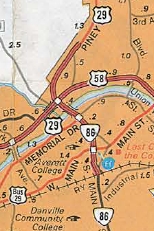
Creation: VA 86 was created July 1933 as a renumbering of part of VA 301, running from US 29 (now VA 293) south to the North Carolina line. This is the 2nd VA 86. Note the 1933 draft route list had this as being part of VA 40.
Adjustments: About 1936 (bridge date), VA 86 was removed from College Park Rd/Old Yanceyville Rd which became SR 1121.
In Sept 1959 (CTB), VA 86 was removed from Walter Mill Rd at the state line.
In Aug 1962 (CTB), VA 86 was assigned to the approved project of extending Broad St across the Dan River to meet US 29 ALT and US 58.
About 1970, VA 86 was extended north along Broad St, then across the Dan River to end at US 29-58 (Riverside Dr at Piney Forest Rd).
About 1971, US 29 was removed from Piney Forest Rd and put on the current US 29 Business routing. VA 86 was likely truncated to US 29 Bus Memorial Dr.
Around 1979, VA 86 was removed from S. Main St north of Flint St and Broad St to instead use the new Central Blvd to reach the Dan River Bridge.
Improvements: paved upon inception;
VA 86 was first multilaned around 1971 at its Dan River bridge approach.
In 1979, VA 86 was multilaned on all of its Central Blvd routing.
The 2004 official shows VA 86 multilaned south to US 58 Bypass.
Posted: Fully posted; There is an END VA 86 North shield on US 29 just south of Piney Forest Rd; also, VA 86 is posted from US 58 Bus.
Multiplexes: None
Legislative names: None
Other names: S. Main St/Central Blvd
Scenic Byway: No segments
Comment: Official documents show the VA 86 endpoint at Memorial Dr despite several postings north of there.
VA 86 is limited access through much of its run.
VA 86 (1933-70)
1933 Official
|
VA 86 (1970-71)
1970 Official
|
VA 86 (1971-79)
1971 Official
|
VA 86 (since 1979)
1979 Official
|
|
| Previous VA 86's:
|
|
|
VA 86 #1: Appeared in the 1933 draft route list running from North Tazewell east to Rocky Gap. When the 1933 map came out, this became VA 61 instead. It is unclear why this needed to be changed from the pattern they were using to assign routes for the 1933 renumbering. VA 61, which DID need to be soemthing else from what the draft list had, could easily have been placed on today's VA 86 corridor.

VA 86 in the Tazewell area
1933 draft route list
|
|
 |
From: Ridgeway (Henry County)
To:
North Carolina State Line, Henry County
Total Length: 4.10 miles
The route continues all day as NC 87 to end at NC 211 Southport, NC.
|
|
|
|
|
ROUTE LOG
US 220: 0 - 0
US 220 Bus: 0.28 - 0.28
NC STATE LINE: 3.82 - 4.10
|
|
Creation: Appeared in Oct 1940 (CTB) as a rennumbering of VA 106 running from Ridgeway to North Carolina. This is the 2nd VA 87.
Adjustments: In 1960 or 1961, VA 87 was extended out to the new US 220 Bypass of Ridgeway.
In May 1965 (CTB), VA 87 was rebuilt almost entirely, leaving behind SR 1011 in Ridgeway, the lengthy SR 750, and the SR 835 loop at the state line.
Improvements: Fully paved upon inception; no multilane segments
Posted: Fully posted;
Multiplexes: None
Legislative names: None
Other names: Morehead Ave
Scenic Byway: None
Comment: VA 87 is a wisp of a road in Virginia but NC 87 is the 2nd longest NC State hwy.
|
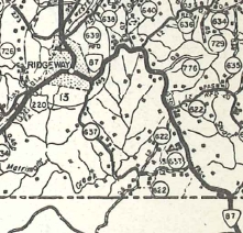
VA 87 original squiggly path
1958 Henry County
|
|
| Previous VA 87's:
1940 ROUTE LOG
VA 61: 0 - 0
SR 623: 8.00 - 8.00
|
|
VA 87 #1: Appeared in July 1933 as arenumbering of VA 136, running from VA 61 to Burkes Garden.
In Oct 1940 (CTB), VA 87 was renumbered as VA 78. Today it is SR 623.
|
VA 87 #1
1933 Official
|
|
|
VA
88 not currently assigned |
|
|
|
|
Previous VA 88's:
1940 ROUTE LOG
US 58: 0 - 0
US 11 SB: 15 - 15
US 11 NB: 0.5 - 15.5
VA 348: 4 - 19.5
VA 42 WB: 11 - 30.5
VA 42 EB: 0.5 - 31
END VA 88: 3 - 34
GAP IN ROUTE
SR 601: 0 - 34
US 19, VA 81: 5 - 39
1947 ROUTE LOG
US 301: 0 - 0
VA 195: 24 - 24
|
|
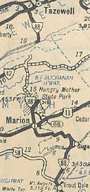
VA 88 #1: Appeared in July 1933 as a renumbering of VA 113, running from US 58 (now SR 650) near Troutdale north past Marion to end at SR 610 before reaching VA 42. A second piece (also replacing VA 113) ran from US 19/VA 81 Frog Level south to the eastern SR 604 junction.
In Aug 1933 (CTB), VA 88 was extended north to VA 42.
In March 1934 (CTB), VA 88 was built on new alignment in the Sugar Grove area, leaving behind the lengthy SR 695.
In Sept 1934 (CTB), VA 88 was extended east with VA 42 briefly, then extended north as new routing 1.3 miles.
In Aug 1936 (CTB), VA 88 was extended north to the Tazewell County line.
In Sep 1937 (CTB), VA 88 was extended north 2.15 miles into Tazewell County.
In May 1938 (CTB), the northern piece of VA 88 was extended south over SR 602 to SR 601 Criggers.
In Oct 1940 (CTB), VA 88 was renumbered as VA 16.
VA 88 used VA 16 to Marion except SR 711, 712 and 740 loops; Prater Ln north from Marion; VA 16 to Tazewell.
VA 88 #1 (erroneous shown
to reach VA 42 from the north
1933 Official
|
VA 88 filling in some of the gap
1940 Official
|
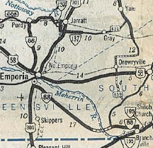
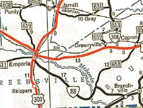
VA 88 #2: Appeared in Oct 1940 (CTB), replacing VA 32 from VA 195 (now VA 186) Branchville to Emporia, then after duplexes with US 301 and US 58 (now US 58 Bus and West End Dr), then replaced more VA 32 to end at VA 137 (now SR 608) Purdy.
In May 1943 (CTB), VA 88 west was truncated to US 301 Emporia, leaving behind SR 619, US 58 and US 301.
In May 1948 (CTB), the rest of VA 88 was downgraded to SR 730.
VA 88 #2
1941-42 Official
|
VA 88 truncated
1947 Official
|
VA 88 #3: Appears in the 1957 VDOT Route Log as an administrative number for the Washington Circumferential Interstate Highway. In May 1957 the CTB Minutes started referring to this route as VA 413. Today we all know it as I-495, The Capital Beltway.
VA 88 #4: Appears in CTB minutes 1972-77 and appears to refer to the piece of today's VA 195 between I-195 and I-95.
VA 88 was officially renumbered as VA 195 in Jan 1976 (CTB).
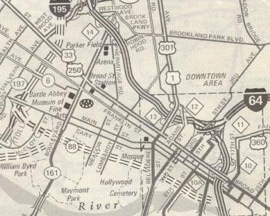
VA 88 assigned to Downtown Expressway
1974 AAA
|
VA 195 replaces VA 88
1976 Official
|
|
  |
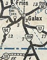
From:   City of Galax City of Galax
To:
North Carolina State Line near Low Gap (Grayson County)
Total Length: 7.84 miles
The route continues 60 miles to US 311 Walnut Cove, NC.
|
|
|
|
|
ROUTE LOG
US 58, US 221: 0 - 0
VA 97: 1.69 - 1.69
Grayson-Galax Line: 1.26 - 2.95
Blue Ridge Pkwy: 4.29 - 7.24
NC STATE LINE: 0.60 - 7.84
|
|
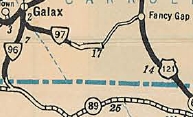
Creation: Appeared in Oct 1940 (CTB) as a renumbering of VA 96, running generally as it does now. This is the 2nd VA 89.
Adjustments: The March 1949 CTB turned down a proposal to extend VA 89 north to VA 94 Fries via SR 606.
In May 1950 (CTB), VA 89 was essentially rebuilt on new alignment from VA 97 south to the state line, leaving behind the lengthy SR 819 (now just Chestnut Dr) and lengthy SR 821
The Aug 1972 CTB turned down a proposal to extend VA 89 north to VA 94 north of Fries utilizing SRs 721, 606 and 758.
Improvements: paved upon inception; no multilane segments
Posted: Fully posted; cutout at VA 97 and also in central Galax; SR 89 shields at the Blue Ridge Parkway; US 89 shield NB just inside Galax City Limit.
Multiplexes: None
Legislative names: None
Other names: Skyline Hwy (Grayson Co); Main St (Galax)
Scenic Byway: No segments
Truck Route: A truck route is posted (with cutouts on US 58-221) in Galax utilizing US 58-221 and Meadow St.
Comment: VA 89 provides easy access to the Blue Ridge Pkwy from the Galax area
|
Current VA 89
1941-42 official
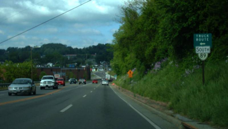
VA 89 Truck
photo by Mapmikey
|
|
| Previous VA 89's:
1940 ROUTE LOG
US 21: 0 - 0
SR 658-667: 4 - 4
|
|
|
|
VA 89 #1: Appeared in July 1933 as a renumbering of VA 114, running on Main St from US 11 Wytheville southwest to the US Fish Hatchery at SR 658-667 jct.
In March 1937 (CTB), VA 89 east was truncated to (and replaced by) a rerouted US 21.
In May 1938 (CTB), VA 89 was downgraded to SR 667 and Cliffside Dr in Wytheville as one of the first primary corridors to be abandoned by the CTB.
|
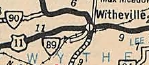
VA 89 #1 from an incorrectly spelled Wytheville
1933 Official
|
|
  |
From:  EXIT 60 (Wythe County) EXIT 60 (Wythe County)
To:
  Rural Retreat (Wythe County) Rural Retreat (Wythe County)
Total Length: 1.74 miles
|
|
|
|
|
ROUTE LOG
I-81 (exit 60): 0 - 0
US 11: 0.47 - 0.47
SR 616: 1.26 - 1.74
|
|
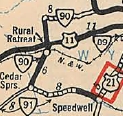
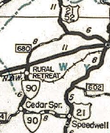
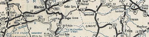
Creation: Appeared in July 1933 (CTB) as a two-piece renumbering of VA 115. One piece ran from US 11 near Rural Retreat south to VA 91 (current SR 619-749 jct) Cedar Springs. The other piece ran from US 21-52 Favonia southwest about 4 miles. This is the only VA 90.
Adjustments: In April 1944 (CTB), the Favonia piece was downgraded to SR 680.
In May 1946 (CTB), VA 90 was extended from Cedar Springs east to US 21 Speedwell, replacing VA 81.
In May 1952 (CTB), VA 90 from Rural Retreat to Speedwell was downgraded to SR 749 "pending allocation of primary funds" which appeared to happen in Dec 1953 (CTB).
In May 1980 (CTB), VA 90 was extended from US 11 out to I-81 over SR 680.
Improvements: Cedar Springs to Rural Retreat was paved upon inception.
The Favonia piece was never paved before decommissioning.
Cedar Springs to Speedwell was paved already when VA 90 started using that road.
No multilane segments
Posted: Fully posted although its Rural Retreat endpoint is not obvious.
Multiplexes: None
Legislative names: None
Other names: Main St
Scenic Byway: Entire route, since 8-19-76
Comment: VA 90 is posted as East-West even though it runs fully north-south today.
Early VDOT maps erroneously show the Favonia piece connected to Rural Retreat.
SR 749 is a really nice ride over to US 21.
VA 90 initial routing
1933 Official
|
VA 90 shifted around to Speedwell
1946 Official
|

VA 90 in its current form
1965 Official
|
|
 |
From:  Frog Level (Tazewell County) Frog Level (Tazewell County)
To:
Tennessee State Line below Damascus (Washington County)
Total Length: 55.12 miles
The road continues about 40 more miles as TN 91 to end at US 19E Hunter, TN.
|
|
|
|
|
ROUTE LOG
US 19 Bus, US 460 Bus: 0 - 0
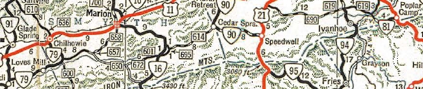
Smyth-Tazewell Line: 23.14 - 23.14
VA 42: 0.54 - 23.68
VA 107: 6.79 - 30.47
Washington-Smyth Line: 1.41 - 31.88
VA 91 Bus: 6.72 - 38.60
VA 91 Bus: 1.37 - 39.97
I-81 (exit 29): 0.28 - 40.25
US 11: 0.23 - 40.48
US 58 WB: 12.09 - 52.51
US 58 EB: 0.99 - 53.50
TN STATE LINE: 1.62 - 55.12
|
|
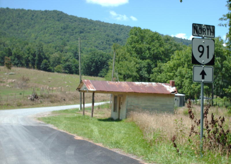
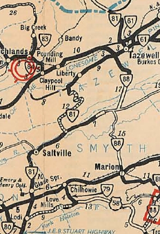
Creation: Appeared in Oct 1940 (CTB) as a renumbering of VA 81 from Frog Level to Lodi; US 58 from Lodi to Damascus, and VA 78 from Damascus to Tennessee. This is the 2nd VA 91.
Adjustments: In Nov 1953 (CTB), VA 91 was rerouted in Damascus to its current US 58 duplex. Before, it used today's SR 1212 Orchard Park Rd.
In April 1958 (CTB), VA 91 was removed from Sanders Ln north of Saltville.
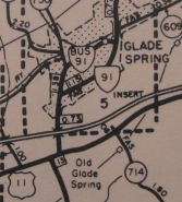
In March 1961, VA 91 was given its bypass of Glade Spring, leaving behind VA 91 Business and SR 1309 Crescent Dr.
In Aug 1980 (CTB), VA 91 was removed from SR 643 and SR 646 loops north of Damascus.
In July 1982 (CTB), VA 91 was removed from SR 842 west of US 19-460.
In Feb 1991 (CTB), VA 91 was rebuilt in the Lodi area, leaving behind the Liberty Hall Dr SR 803 loop and an abandoned segment above SR 762.
Around 2000, the brief duplex with US 11 was eliminated as VA 91 was rebuilt, leaving behind SR 919.
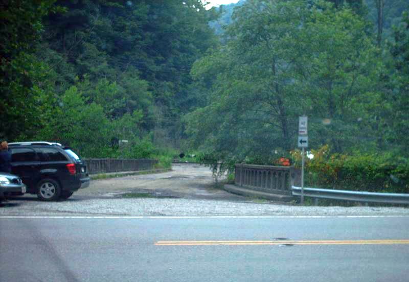
About 2012, VA 91 was given a new alignment to cross Laurel Creek in southern Tazewell County leaving behind SR 728 north of the creek and abandoned routing south of it.
Improvements: Paved upon inception except between SR 601 and SR 604 in Tazewell County. This segment remained unpaved until December 2025 and was the last unpaved normal primary route to be paved in Virginia; no multilane segments
Posted: Fully posted; One cutout existed on the Liberty Hall Rd loop at SR 803 (old VA 80) until about 2010.
Multiplexes: US 58 (0.99 mi)
Legislative names: David Curtis Johnson Memorial Bridge over Laurel Creek (4-19-2017)
Other names: Witten Valley Rd (Liberty area); Maiden Springs Rd (unpaved portion area); Veterans Rd (VA 42 to SR 607); Saltville Hwy (Smyth County); Main St (Saltville); Crescent Rd (btw Glade Spring and Saltville); Monte Vista Dr (Glade Spring bypass); Maple St (Glade Spring); Monroe Rd (Lodi area); Damascus Dr/Douglas Dr (Damascus); Mountain City Rd (s of US 58)
Scenic Byway: I-81 south to the Tenn Line, since 9-21-2000
Comment: VA 91 is an excellent drive south of VA 42.
The recently paved section and up to nearly US 19-460 Bus is unstriped for the most part and looks just like a secondary road.
The unpaved portion was not posted with any signs whatsoever. Mileage signs north of Damascus DID list Tazewell even though it required using the unpaved portion. But it was probably faster than sliding over to white-knuckled VA 16.
My 2007 photo journey of the substandard/unpaved parts of VA 91 is located - here
The 1939 VDOT report on primary system development had recommended that VA 91 (then-VA 81) be decommissioned from VA 42 north to US 19.
|
Current VA 91
1941-42 Official
|
|
| Previous VA 91's:
1940 ROUTE LOG
VA 90: 0 - 0
US 21 SB: 8 - 8
US 21 NB: 5 - 13
SR 690: 10 - 23
GAP IN ROUTE
SR 636: 0 - 23
US 52: 4 - 27
|
|
VA 91 #1: Appeared in July 1933 as a renumbering of part of VA 115, running from VA 90 (now SR 619-749 jct) Cedar Springs to US 21 Speedwell, then duplex with US 21 to Stroupes Store, then headed east about 10 miles. Another piece then ran from SR 636 Austinville to US 121 (now SR 719) Poplar camp.
The 1933 Route Log stated VA 91 continued west from Cedar Springs to VA 88 (now SR 695) Sugar Grove but this was never put into the system. Some maps showed this as well.
About 1934 or 1935, US 21 was rebuilt north of Speedwell onto mostly new alignments, leaving behind a lengthy SR 684 which also means VA 91 was extended west at Stroupes Store out to the new US 21 alignment.
It is unclear when US 52 was removed from SR 719 in Poplar Camp except it was after 1936. So VA 91 may have been extended east to the new US 52 or it may have been VA 81 later on.
In Oct 1940 (CTB), VA 91 was renumbered as VA 81. Today it is SR 749, US 21, SR 690 and VA 69.
VA 91 #1
1933 Official
|
|
|
|
|
ROUTE LOG
VA 91: 0 - 0
VA 91: 1.38 - 1.38
|
|
Creation: VA 91 Business appeared March 1961 (CTB) when VA 91 was placed on new alignment east of Glade Spring. The piece between Crescent Dr and VA 91 Bypass was new construction.
Adjustments: None
Improvements: Paved upon inception; No multilane segments
Posted: Fully posted;
Multiplexes: None
Legislative names: None
Other names: Glade St
Scenic Byway: no segments
Comment: VA 91 Business does not appear on any Official map, but is shown explicitly on DeLorme maps.
|
VA 91 Business
1975 Washington COunty
|
|
|
|
From:  Clover (Halifax County) Clover (Halifax County)
To:
 Boydton (Mecklenburg County) Boydton (Mecklenburg County)
Total Length: 29.17 miles
|
|
|
|
|
ROUTE LOG
US 360: 0 - 0
Charlotte-Halifax Line: 5.89 - 5.89
US 360: 0.70 - 6.59
US 15: 3.80 - 10.39
Mecklenburg-Charlotte Line: 2.11 - 12.60
VA 49 SB: 5.37 - 17.97
VA 47, VA 49 NB: 0.75 - 18.72
US 58: 10.13 - 28.85
US 58 Bus: 0.32 - 29.17
|
|
Creation: Appeared in Oct 1940 (CTB) as a renumbering of VA 46, running from VA 47-49 Chase City to US 58 Boydton. This is the 2nd VA 92.
Adjustments: In Nov 1968 (CTB), VA 92 was extended west as a duplex with VA 47 from Chase City to Barnes Jct, then replaced part of US 360 through Clover to its present end at US 360.
Improvements: Paved upon inception; no multilane segments
Posted: Fully Posted; Circle 92 shields posted on detour signs at US 360.
Multiplexes: VA 49 (0.75 mi)
Legislative names: JEB Stuart Highway, entire route (3-14-28 designation predates VA 92)
Other names: Clover Rd (Halifax Co); Main St/2nd St (Chase City)
Scenic Byway: No segments
Comment: VA 92's bridge over the Roanoke River was closed to traffic in early 2008 due to bridge decrepitude. VDOT has no funds to repair/replace the bridge so for now VA 92 is a discontinuous route.
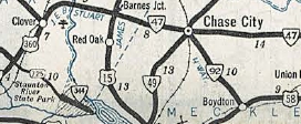
VA 92 Chase City to Boydton
1941-42 Official
|
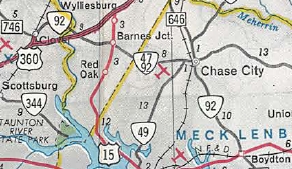
VA 92 extended to Clover
1969 Official
|
|
| Previous VA 92's:
1940 ROUTE LOG
US 58: 0 - 0
NC STATE LINE: 3.8 - 3.8
|
|
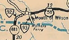
VA 92 #1: Appeared in July 1933 as a renumbering of VA 139 running from US 58 Mouth of Wilson southwest to the North carolina line.
In Oct 1940 (CTB), VA 92 was renumbered as part of VA 16. Today it is VA 16 and SR 858 at the state line area.
|
VA 92 #1
1933 Official
|
|
|
|
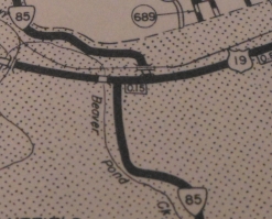
From:
Mouth of Wilson (Grayson County)
To:
North Carolina State Line (Grayson County)
Total Length: 0.92 miles
The route continues several miles as NC 93 to US 221 Twin Oaks, NC.
|
|
|
|
|
ROUTE LOG
US 58: 0 - 0
NC STATE LINE: 0.92 - 0.92
|
|
Creation: Created July 1933 as a renumbering of VA 129, running from US 58 near Mouth of Wilson southeast 1.6 miles to the North Carolina line. This is the only VA 93.
Adjustments: Sometime before 1946, the VA 93 ferry over the New River was shifted eastward, leaving behind a bit of SR 716
In March 1953 (CTB), VA 93 was given a bridge over the New River and a direct connection to US 58. This left behind SR 838 (still unpaved) and abandoned Walkers Ferry.
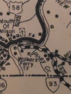
VA 93 on Walkers Ferry east of SR 716
1946 Grayson County
|
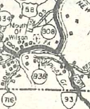
VA 93 onto a bridge
1958 Grayson County
|
Improvements: The first official map to show VA 93 as paved was the 1955 issue. I'm guessing at least some pavement existed when it was rerouted in 1953.
VA 93 has no multilane segments
Posting: Fully posted
Multiplexes: None
Legislative names: J Cam Fields Bridge over New River, since 7-16-87.
Other names: Wilson Hwy
Scenic Byway: No segments
Comments: VA 93's ride is over before it begins...very short and is the shortest multistate route involving Virginia.
The 1939 VDOT report on primary system development had recommended that VA 93 be decommissioned in it entirety.
|
|
|
|
From:
near Galax (Grayson County)
To:  Farmers Store
(Wythe County) Farmers Store
(Wythe County)
Total Length: 28.39 miles
|
|
|
|
|
ROUTE LOG
US 58, US 221: 0 - 0
VA 274: 4.22 - 4.22
Carroll-Grayson Line: 5.92 - 10.14
Wythe-Carroll Line: 9.20 - 19.34
US 52: 9.05 - 28.39
|
|
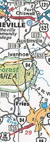
Creation: Appeared July 1933 as a renumbering of VA 58, running generally as it does now, plus extended southwest past Baywood to the SR 626-632 jct. There was a gap in southern Wythe County. This is the only VA 94.
Adjustments: In Aug 1933 (CTB), the gap in southern Wythe County was closed.
In Sept 1939 (CTB), VA 94 was removed from the SR 604/797 loop north of Fries.
In Aug 1941 (CTB), VA 94 was removed from SR 741 near Smiths Crossroads and SR 742 in Ivanhoe.
In Sept 1942 (CTB), VA 94 south was truncated to US 58-221 (now VA 274) Riverside, leaving behind a duplex with US 58-221 and SR 626.
In March 1953 (CTB), VA 94 was rerouted at the Wythe County line, leaving behind an extended SR 739 and abandoned routing into Wythe County.
In Jan 1956 (CTB), VA 94 was rebuilt south of Fries leaving behind SRs 815 and 816 plus an extended SR 805. A few abandoned alignments are also visible.
In Nov 1979 (CTB), VA 94 was extended south to its current endpoint, replacing part of US 58 and US 221.
Around 2000, VA 94 was built on new alignment from Wythe SR 641 near Ivanhoe to the northern SR 605 jct. This left behind a lengthy OSR 94 Sheffey School Rd.
Improvements: Paved upon inception only from Old Town to Fries.
In 1934, VA 94 was paved from Fries to Carroll County Line.
In 1938, VA 94 was paved through Carroll County and north to Wythe SR 619.
In 1939 or 1940, VA 94 was paved from Old Town to its southern end beyond Baywood.
In 1950, VA 94 was paved from SR 619 to US 52.
VA 94 has no multilane segments.
Posting: Fully posted;
Multiplexes: None
Legislative names: JEB Stuart Hwy from VA 274 to US 58-221 (3-14-28 designation predates VA 94); JP Carico Memorial Bridge over New River (since 3-9-42)
Other names: Riverside Dr (s of VA 274); Scenic Rd (Grayson Co n of VA 274); Ivanhoe Rd (Carroll and Wythe Co)
Scenic Byway: no segments
Comment: VA 94 is quite twisty between Fries and Ivanhoe.
VA 94 in 1933
1933 Official
|
VA 94 south truncated
1946 Official
|
VA 94 south extended
1981 Official
|
|
|
VA
95 not currently assigned |
|
|
|
|
Previous VA 95's:
1952 ROUTE LOG
US 21: 0 - 0
VA 94: 11.22 - 11.22
|
|
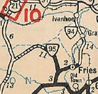
VA 95: Appeared in July 1933 as a renumbering of VA 118, running from US 21 Elk Creek east to VA 94 (now SR 816) near Fries.
In May 1953 (CTB), VA 95 was downgraded to SR 805.
| 
VA 95
1933 Official
|
|
|
|
From:  near Mayo (Halifax County) near Mayo (Halifax County)
To:
North Carolina State Line at Virgilina (Halifax County)
Total Length: 7.83 miles
The road continues as NC 96 nearly 100 more miles to end at NC 55 in the middle of nowhere.
|
|
|
|
|
ROUTE LOG
US 501: 0 - 0
VA 49 NB: 7.70 - 7.70
NC STATE LINE: 0.13 - 7.83
|
|
Creation: Appeared in Oct 1940 (CTB) as a renumbering of part of VA 49. It ran from US 501 to VA 49 Virgilina. This is the 2nd VA 96.
Adjustments: In Mar 1941 (CTB), VA 96 was extended into North Carolina with VA 49.
In Jan 1956 (CTB), VA 96 was removed from SR 862 at Christie.
In March 1963 (CTB), VA 96 was rebuilt west of Virgilina leaving behind a significant abandoned segment (1.7 miles) north of the current route.
Improvements: Paved upon designation; no multilane segments
Posting: Fully posted; In 2001 I found an upside down VA 96 shield at US 501.
Multiplexes: VA 49 (0.13 mi)
Legislative names: None
Other names: Virgilina Rd; Florence Ave (VA 49 duplex)
Scenic Byway: No segments
Comment: VA 96 is not memorable in any way.
| 
Current VA 96
1941-42 Official
|
| Previous VA 96's:
1940 ROUTE LOG
US 58, US 221: 0 - 0
NC STATE LINE: 10 - 10
|
|
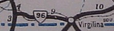
VA 96 #1: Appeared in July 1933 as a renumbering of VA 117 from US 58-221 Galax south to the North Carolina line near Low Gap. See scan under VA 97 entry.
In Oct 1940 (CTB), VA 96 was renumbered as VA 89.
Today it is VA 89 except SR 821 and old SR 819 (Chesnut Dr in Galax).
|
|
|
From:  City of Galax City of Galax
To:
  Drenn (Carroll County) Drenn (Carroll County)
Total Length: 9.16 miles
|
|
|
|
|
ROUTE LOG
VA 89: 0.00 - 0.00
Grayson-Galax Line: 0.11 - 0.11
Carroll-Grayson Line: 0.78 - 0.89
SR 608, SR 620: 8.27 - 9.16
|
|
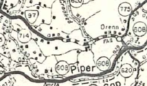
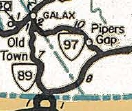
Creation: Appeared in July 1933 as a renumbering of VA 47 from VA 96 (now Chestnut Dr) Galax to 1.3 miles short of SR 620 north. This is the only VA 97.
Adjustments: In May 1946 (CTB), VA 97 was extended to its current endpoint at SR 608 (access to Blue Ridge Pkwy) and SR 620. This was an upgreade to SRs 775 and 620.
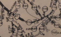
VA 97 initial east end
1940 Carroll County
|
VA 97 extended to BRP
1958 Carroll County
|
In May 1950 (CTB), VA 97 west was truncated from old VA 89 (Chestnut Dr) to the current VA 89 routing, leaving behind abandoned routing.
In Aug 1969 (CTB), VA 97 was removed from the SR 939 and SR 940 loops east of Pipers Gap.
The Sept 1972 CTB turned down a proposal to extend VA 97 to US 52 Fancy Gap via SR 775
The Jan 1980 (CTB) turned down a Carroll County request to extend VA 97 to US 52 Fancy Gap. The CTB gave them VA 148 instead.
Improvements: VA 97 was paved from Galax to SR 713 upon designation
In 1939 or 1940, VA 97 was paved out to its original east end.
The extension to SR 608-620 is shown as paved on all officials although the 1958 Carroll County map shows some of it as gravel.
VA 97 has no multilane segments
Posting: fully posted; cutout on VA 89 NB
Multiplexes: None
Legislative names: None
Other names: Pipers Gap Rd
Scenic Byway: No segments
Comment: VA 97 was extended to provide access to the Blue Ridge Pkwy which it does via SR 608. Technically the BRP and VA 97 do not touch.
The 1939 VDOT report on primary system development had recommended that VA 97 be decommissioned in its entirety.
VA 97 initial routing
1933 Official
|
VA 97 extended to BRP
1946 Official
|
|
 |
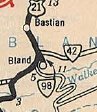
From:  Bland CH (Bland County) Bland CH (Bland County)
To:
 Bland CH (Bland County) Bland CH (Bland County)
Total Length: 0.50 miles
|
|
|
|
|
ROUTE LOG
US 52, VA 42: 0 - 0
SR 605: 0.50 - 0.50
|
|
Creation: Appeared in July 1933 (CTB) as a renumbering of VA 26-Y running the way it does now. This is the only VA 98.
Adjustments: None
Improvements: paved upon inception; no multilane segments.
Posting: Fully posted;
Multiplexes: None
Legislative names: None
Other names: Main St
Scenic Byway: No segments
Comment: VA 98 provides access to the Bland municipal buildings. Otherwise this is a pointless route. Perhaps the Y designation was eschewed because somebody thought the route might one day extend south to Wytheville. This shoulod have been numbered VA 42Y.
The original VA 26 and Raleigh-Grayson Turnpike mostly used SR 656 and not that much VA 98.
Although very short and minor, VA 98 appears on all the official maps since 1933.
|
Tiny VA 98
1933 Official
|
|
 |
From: F-047 just below  McAdam (Pulaski County) McAdam (Pulaski County)
To:
 NCL Pulaski (Pulaski County) NCL Pulaski (Pulaski County)
Total Length: 5.20 miles
|
|
|
|
|
ROUTE LOG
F-047: 0 - 0
I-81 (exit 94), VA 100: 0.05 - 0.05
US 11: 3.72 - 3.77
SR 738: 1.43 - 5.20
|
|
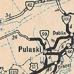
Creation: Appeared in JUly 1933 as a renumbering of VA 10 from VA 100 (now F047) McAdam to Pulaski, then replacing VA 228 northwest of Pulaski several miles. Thisis the only VA 99.
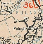
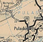
Adjustments: In Aug 1936 (CTB), VA 99 was extended to the Bland County Line.
In Sept 1937 (CTB), VA 99 was extended west to VA 42 (now SR 634) Mechanicsburg.
In Jan 1943 (CTB), VA 99 was extended west over what had been part of VA 42 out to the new VA 42 bypass of Mechanicsburg.
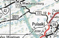
In May 1952 (CTB), VA 99 west was truncated to the NCL of Pulaski, leaving behind SR 738 (Jake Buford Blvd just north of VA 99 end was part of VA 99).
In July 1961 (CTB), VA 99 was rebuilt onto new alignment around the new I-81 interchange, leaving behind SR 769 McAdam Crossing Dr north of I-81 and SR 672 Lilly Rd south of I-81.
In May 1962 (CTB), VA 99 was given its modern routing east of Pulaski, leaving behind: a small duplex with US 11, Dora Hwy, SRs 771 and SR 770
Sometime after 1981, VA 99 was spilt into one-way alignments in Pulaski: WB using 3rd St and EB using 2nd St/Main St. However, in the field EB is posted to use 4th St and US 11 to Main.
Improvements: Paved upon inception; however, the extension to VA 42 was not paved.
The Bland COunty portion was paved in 1951. The rest was never paved before it was decommissioned.
Official maps today still don't show VA 99 as multilaned between SR 611 and Pulaski. Bridge dates suggest it happened in 1962. VA 99 is also multilaned at the I-81 interchange.
Posting: fully posted; two generations of circle 99 shields existed in Pulaski. However, the new set of circles was actually replaced by correct shields in 2009.
Multiplexes: None
Legislative names: None
Other names: Count Pulaski Dr (Pulaski Co); Main St/2nd St/3rd St/Randolph Ave (Pulaski).
Scenic Byway: no segments
Comment: VA 99 is the suggested truck route from I-81 to Pulaski instead of US 11.
SR 738 is posted heavily for trucks to avoid the mountain crossing. In 2009 Froggie and I took a trip over SR 738. It is paved now but is extremely narrow, unstriped, and has numerous tight switchbacks. You will not make any time trying to cut over from I-81 to VA 42 using old 99.
VA 99 initial route
1933 Official
|
VA 99 extended to Bland line
1937 Official
|
VA 99 extended to VA 42
1938 Official
|
VA 99 truncated to Pulaski
1955 Official
|
|
   |
From: Hillsville (Carroll County)
To:
 Narrows (Giles County) Narrows (Giles County)
Total Length: 52.88 miles
|
|
|
|
|
ROUTE LOG
US 221: 0 - 0
Wythe-Carroll Line: 8.12 - 8.12
Pulaski-Wythe Line: 6.16 - 14.28
I-81 SB (exit 89), US 11: 3.91 - 18.19
VA 99: 3.78 - 21.97
I-81 NB (exit 98): 4.35 - 26.32
US 11: 1.56 - 27.88
VA 373: 0.21 - 28.09
Giles-Pulaski Line: 7.95 - 36.04
VA 42: 1.37 - 37.41
US 460 Bus EB: 10.37 - 47.78
US 460 Bus WB: 0.38 - 48.16
VA 61: 4.72 - 52.88
|
|
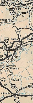
Creation: Appeared July 1933 as a renumbering of VA 212 from Hillsville to Draper; VA 10 from Draper to McAdam; VA 213 from McAdam to Pearisburg where VA 100 ended at VA 8 (now US 460 Bus). This is the 2nd VA 100.
Adjustments: In Oct 1938, VA 100 was removed from SR 696 near Staffordsville.
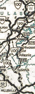
In Nov 1942 (CTB), VA 100 was rerouted north of Sylvatus to its current routing to US 11 near Pulaski Mtn as mostly new construction, then replaced part of VA 101 east to Draper. The old route through Allisonia and Hiawasee became SR 693 and SR 777; abandoned ferry over the New River; SR 658.
Current VA 100
1933 Official
|
VA 100 straightened out north of Hillsville
1946 Official
|
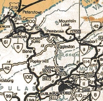
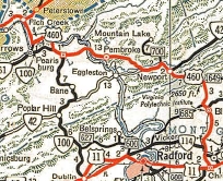
Also in Nov 1942 (CTB), VA 100 was extended northwest with VA 8 briefly, then as new routing (and an upgrade to parts of SR 641) to VA 8 (now VA 61) across the New River from Narrows, then replaced VA 8 to end at US 219 Rich Creek.
About 1947, VA 100 was rerouted at Pearisburg to use its current route over to VA 61 Narrows (replacing VA 8. The old route on the other side of the New River to Rich Creek became US 460.
VA 100 extended to Rich Creek
1944 Official
|
VA 100 rerouted to Narrows
1947 Official
|
In May 1948 (CTB), VA 100 was removed from SR 783 south of Sylvatus.
In Aug 1952 (CTB), VA 100 was rerouted to avoid central Dublin as new construction. This left behind SR 611/682, Newbern Rd, Main St and SR 746 Giles Ave.
In July 1961 (CTB), VA 100 was moved onto I-81 from Exit 89 to 1/4 mile short of SR 644 near Newbern (no interchange - the 1963 Historic Aerial shows I-81 just narrowing down back to a 2-lane route). The old route became a lengthy F-047.
In Oct 1965 (CTB), VA 100 was added to I-81 from the 1961 endpoint to Exit 98, leaving behind more F-047.
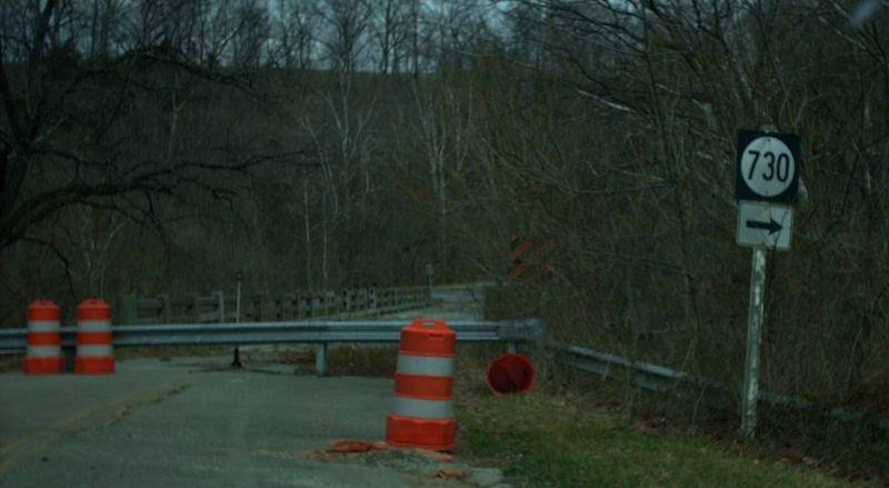
In Jan 1992 (CTB), VA 100 was rebuilt on new alignment in the Staffordsville area, leaving behind SR 660, this abandoned bridge, and SR 730.
About 2001, VA 100 was rebuilt up Walker Mtn from the south, leaving behind a much gnarlier routing.
Improvements: Paved only from the New River north to Pulaski SR 627 upon designation;
In 1936, VA 100 was paved from Pearisburg south to Bane.
In 1937, VA 100 was paved from Bane to Pulaski SR 627.
in 1942, VA 100 was paved on the new alignment above Hillsville only from the new New River bridge northward; also paved on its extension to Narrows.
VA 100 was paved from Hillsville to the New River in 1948.
VA 100 was first multilaned when it was placed on I-81 by 1965.
Although official maps still don't show it, VA 100 was multilaned from US 11 south to I-81 about 1966.
In 1969, VA 100 was multilaned from US 11 to the Dublin Airport area.
In 1973, VA 100 was multilaned from Pearisburg south 4 miles.
In 1975, VA 100 was multilaned from Dublin airport to SR 627.
In 1978, VA 100 was multilaned from the '73 widening south to Bane.
In 1992, VA 100 was multilaned from Bane to south of Staffordsville
In 2001, VA 100 was multilaned from SR 627 to the Giles County line.
Posting: fully posted; cutouts remain in Hillsville and Pearisburg. The backside of cutouts are still visible on I-81 in a couple locations.
Multiplexes: I-81 (8.13 mi)
US 460 Bus (0.38 mi)
Legislative names: Wysor Highway, entire route (since 3-24-55); Leander Sander Calfee Memorial Bridge over the New River (since 3-9-42)
Other names: Glebe Rd
Scenic Byway: No segments
Comment: VA 100 is a good route throughout its length with its improvements over Walker Mtn.
VA 100 used to be signed for the West Virginia Turnpike as late as the mid 1990s from US 221. This made sense in the pre-I77 days as VA 100 has always been a more gentle route than US 52.
|
| Previous VA 100's:
1932 ROUTE LOG
US 25E NB, US 411, VA 10: 0 - 0
TN STATE LINE: 0.15 - 0.15
|
|
VA 100 #1: Appeared Aug 1928 as a renumbering of VA 107 from US 411/VA 10 Cumberland Gap south to the Tennessee Line. VA 100 was a full duplex with US 25E.
In July 1933, VA 100 was dropped from the route (the 1933 draft route log renumbered it as VA 61) with US 25E remaining. Today what survives of this is the first 150 feet of SR 872 from its southwestern Tennessee border crossing. The ascent up this hill that curled north then northwest to VA 10 was abandoned and physically removed in the early 1970s.
VA 100-Y: Appeared in Nov 1942 as a connector from VA 100 to US 11 in the area of today's Exit 89 with I-81. VA 100Y had a brief duplex with the shortened VA 101.
In Nov 1962 (CTB), VA 100-Y was decommissioned. North of I-81 it is SR 770 Milstead Ln. South of I-81 it is part of F-047.
VA 100 #1
1932 Lee County
|
VA 100-Y
1958 Pulaski County
|
|
Previous: VA 71 - 80 |
Next: VA 101 - 120
Top | Virginia Hwy Index
Home
Page last modified
5 February 2026
| | | | | |