< VA 53 | Home | VA 55 >
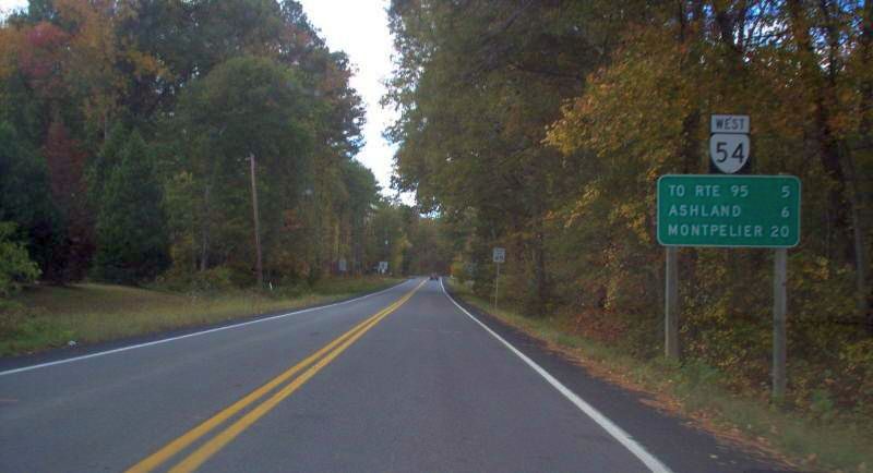
Photo: VA 54 leaving Hanover CH (photo by Mapmikey 10/25/06)
|
|
|
| ROUTE LOG |
US 33: 0 - 0 US 1: 12.54 - 12.54 I-95 (exit 92): 0.59 - 13.13 VA 54Y: 5.60 - 18.73 US 301, VA 2: 0.03 - 18.76
|
Creation: Appeared July 1933 as a renumbering of VA 39 from Montpelier to Ashland and a renumbering of VA 50 from Ashland to Hanover. This is the 2nd VA 54.
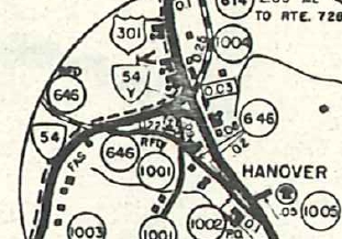
| Adjustments: In 1934, VA 54's eastern end was moved from the SR 1001/1002 jct in Hanover CH to its current loaction, leaving behind SR 646 (now SR 1002) St. Pauls Church Rd.
About 2014, VA 54 was removed from SR 828 in Montpelier, shifting the west endpoint to the south. Improvements: Paved upon designation VA 54 is multilaned from US 1 to I-95, since 1963 Posted: Fully posted; Multiplexes: None Legislative names: Patrick Henry Highway, from Negro Foot to Hanover CH (2-18-28 designation predates VA 54). Other names: Thompson St/England St (Ashland) Scenic Byway: No segments Comment: VA 54 connects western Hanover County to its courthouse area. In the far past VA 54 was much more important as west of Ashland was once how Richmond travelers went to Washington DC or to Charlottesville. | Previous VA 54's: |
VA 54 #1: Appeared Aug 1928 as a renumbering of VA 251 from Old Chapel to 8 miles east of Leesburg via Berryville and Round Hill. A second piece of VA 54 replaced VA 251 from VA 25 (now VA 123) Tysons Corner west 5 miles, then west as new primary routing to 4 miles past the Loudoun County line. Also, VA 54 was assigned as new routing from Old Chapel southwest to Boyce, then replaced more VA 251 to White Post, then west as more new routing to end at US 11/VA 33 Stephens City.
In Aug 1929 (CTB), the 6.12 mile gap in Loudoun County was placed into the primary system, making VA 54 continuous from Stephens City to Tysons Corner. In Dec 1930 (CTB), VA 54 was extended southeast as new primary routing 2.06 miles. In July 1932 (CTB), VA 54 was extended as more new routing to end at US 1-50/VA 31 (now VA 400) Alexandria. Also about 1932, VA 54 was removed from an abandoned loop over Difficult Run immediately east of current SR 743 Colvin Run Rd enear Dranesville. In July 1933, VA 54 became VA 277 from Stephens City to White Post; VA 340 from White Post to Boyce; US 340 from Boyce to Berryville; VA 7 from Berryville to Alexandria. Today this is VA 277; SR 670 through Double Tollgate; US 340; SR 628/658 through White Post; US 340; SRs 667/668/617 Boyce to Old Chapel; a bit of VA 255; US 340; SR 616 and VA 7 Bus through Berryville; VA 7; SR 679 ascending the mountain; VA 7; Simpsons Creek Rd; VA 7 Bus through Round Hill, Hamilton and Purcellville; VA 7; VA 7 Business through Leesburg; VA 7 to Alexandria except SR 743 Colvin Run Rd and abandoned routing just east of there. 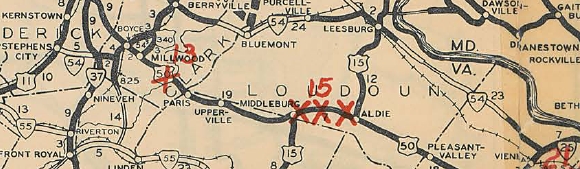
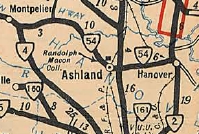
Original VA 54 1929 Official |
||||||||
Page last modified 18 February 2025