ROUTE LOG
US 360, VA 360: 0 - 0
END VA 344: 12.38 - 12.38
|
|
Creation: Created in July 1940 (CTB) when Park route R-1 and access to the concession area in Staunton River State Park (opened in 1936) were taken into the primary system, a total of 2.17 miles. This is the only VA 344.
Adjustments: In April 1951 (CTB), VA 344 was extended out of the park over SR 725 west through Scottsburg to its current ending at US 360.
Improvements: Paved upon designation; no multilane segments
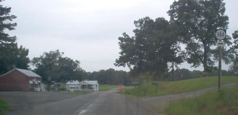
Posting: Fully posted; a circle 344 shield was present in Dryburg on SR 716 SB at VA 344 in 2009.
Multiplexes: None
Legislative names: None
Other names: Scottsburg Rd (west of Scottsburg); McDonald Rd (east of Scottsburg).
Scenic Byway: None
Comment: I believe this is the only state facility 3xx-series route that was promoted to a real state highway. Note that some of the state park roads are SR 782.
At its west end is a sign saying that VA 344 ends in 12 miles and that there is no crossing of the Staunton River - I always found this odd because I didn't have any maps that show there was ever a crossing. However, the 1932 Halifax County map shows "Logans Ferry (abandoned)" at the location of the park that went to Mecklenburg County.
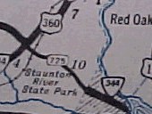
VA 344 initial routing
1941-42 Official |
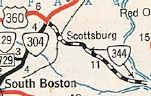
VA 344 extended west
1952 Official |
|