   |
From:   near Petersburg (Dinwiddie County) near Petersburg (Dinwiddie County)
To:
Richard Bland College (Prince George County)
Total Length: 0.49 miles
|
|
|
|
|
ROUTE LOG
SR 608-677: 0 - 0
Prince George-Dinwiddie Line: 0.08 - 0.08
END VA 345: 0.41 - 0.41
|
|
Creation: Created in Aug 1941 (CTB), serving The Petersburg State Colony for the Negro Insane which opened as part of Central State Hospital along the Prince George-Dinwiddie line in 1938. This is the 2nd VA 345.
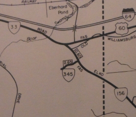
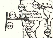
Adjustments: The Oct 1954 (CTB) takes into the primary system 2.645 miles of newly constructed driveways in the Elko Tract in Henrico County which was being developed for the Petersburg Training School and Hospital to be relocated from what is now the Richard Bland College site. Most of these roads are located in the area north of Portugee Rd and south/west of Technology Blvd.
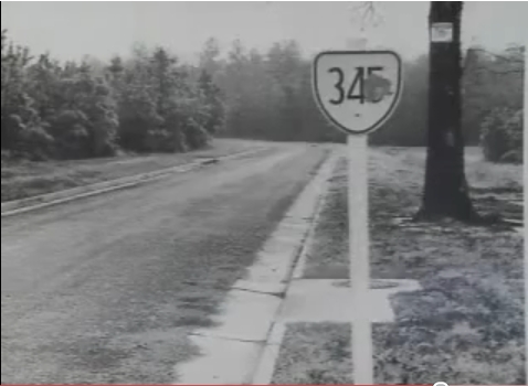
The development of the Elko Tract for the Training School was beset by budget problems and local opposition and the site eventually moved to its current location where VA 357 used to be across US 1 from VA 319. I can find no CTB references to remove this from the system. I had thought it was a new VA 359 based on what 35x numbers were already in place at the time. However, a 2010 news story in Richmond (linked below) shows pictures of these streets including a route sign - a VA 345 cutout. So the Elko Tract portion taken into the primary system by the state was a very separate piece of VA 345 - I'm guessing the initial thought would be that the original site would close down and 345 would just be out at the Elko Tract.
One of the articles linked below says that the Training School gave up on Elko Site per the Governor's direction in March 1956, while the linked news story from 2010 notes there was vocal local opposition.
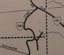
The entire 2.6 miles of VA 345 was renumbered as VA 380 between 1970-75.

VA 345 still present in 1969
1969 Henrico County Map
|

VA 380 by 1975
1975 Henrico County Map
|

Current VA 345
1958 Prince George County
|
In 1959 the Training School moved to its current location and Richard Bland College took over the property in 1960.
What is/was the Elko Tract?
The Elko Tract was originally used as a "Lost City" during World War 2 to protect either the City of Richmond itself or at least Byrd Airport. Two articles discuss the Elko Tract and its mysteries here - 1994 and 2002. The 2010 WTVR report on the Elko Tract is here.
Improvements: Fully paved upon inception; no multilane segments.
Posted: White rectangle at SR 608-677
Multiplexes: None
Legislative names: None
Other names: None
Scenic Byway: None
Comment: VA 345 is a rare 3xx facility route to cross a county line and in the 50s encompassed a third county (Henrico).
VA 345 does not appear on official state maps.
The 1968 Historic Aerial of the Elko Tract shows the roads of VA 345 pretty well (the water tower which remains standing today is the white dot to the right of the semi-circle off the NE branch). If you zoom in to the 1:600 ft level or so you can see a well defined VA 345. The current Google Earth view shows the roads are harder to discern, but zooming in one can still find the water tower very close to Technology Blvd.
|
|
| Previous VA 345's:
1942 ROUTE LOG
SR 629: 0 - 0
SR 629: 3 - 3
|
|
VA 345 #1: Although it is not listed among the state parks in the July 1940 CTB that received primary status, I believe VA 345 #1 was created July 1940 as an upgrade of SR 629 through Douthat Park near Clifton Forge.
There is also no CTB reference to decommission VA 345 back to SR 629, which happened by August 1941.
VA 345 appears on official maps from July 1940 through 1941-42.
My hunch is that perhaps it had been proposed that Douthat State Park, which opened in 1936, received mileage and was put on maps but maybe something happened to prevent it from actually being designated.
|

VA 345 #1
1941-42 Official |
|


