< VA 408 | Home | VA 410 >
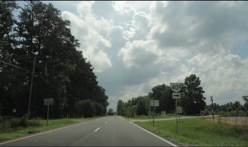
Photo: Current VA 409 from US 60 (photo by Takumi, taken 7/30/12)
| ||||||||||
| ROUTE LOG US 60: 0 - 0 VA 409 END: 0.20 - 0.20 |
Creation: VA 409 was created in 2010 as new primary
routing, running from US 60 east of Providence Forge south across the
railroad to the entrance drive to the Eastern Regional Office of the
Virginia Forestry Service. This is the 4th VA 409, the highest number to have been used 4 times.
Adjustments: None Improvements: Paved upon inception. Posted: Posted in shields at US 60 but not at its other end, though the south end now sports an "End State Maintenance" sign (as of February 2014). Multiplexes: None Legislative names: None Other names: G.W. King Blvd Scenic Byway: No segments Comment: The Eastern Regional Office moved from Tappahannock to this location in 2010 according to their website. As of 2025, VA 409 does not appear on any VDOT maps except its on-line interactive map. Mapmikey wonders...with 409 being assigned to a state facility route, are we getting ready to see an influx of new ones, since in theory only 317 had been available for this? Also of note, VA 409's crossing of the adjacent railroad tracks was initially signed as a "private crossing". However, by February 2014, the crossing had been upgraded to signals and gates, with the private crossing signs removed. | |||||||||
| Previous VA 409's: 1932 ROUTE LOG US 60, VA 20: 0 - 0 CR 15/121: 4.00 - 4.00 GAP IN ROUTE CR 11/222: 0 - 4.00 US 1, VA 31: 14.08 - 18.08 2000 ROUTE LOG US 13: 0 - 0 VA 407: 0.74 - 0.74 VA 190: 2.28 - 3.02 |
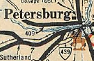
VA 409 #1: Appeared in August 1928 as an upgrade to CR 21. It
ran from US 1/VA 31 Petersburg across Campbell Bridge and west 6.7
miles through the Matoaca area.
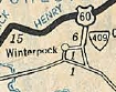
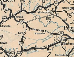
In June 1930 (CTB), VA 409 was extended west 3.02 miles. In July 1932 (CTB), VA 409 was extended west 4.36 more miles, ending at today's SR 602-635 jct. Also in 1932, a second piece of VA 409 was created when it replaced VA 411 running from US 60/VA 20 (now US 360) south towards Winterpock. In July 1933, the original piece of VA 409 was renumbered as part of VA 36 (some of this is now SR 602, too).
The other piece became part of VA 153. Today this is SR 621 except VA 409 used the northern SR 661 loop near US 360.
| |||||||||


Previous: VA 408 |
Next: VA 410
Top | Virginia Hwy Index
Home
Page last modified 13 February 2025