< VA 410 | Home | VA 412 >
| US 411 | |||
| ||||||||
| ROUTE LOG US 360: 0 - 0 VA 411 END: 0.06 - 0.06 |
Creation: VA 411 was created May 2026 (VDOT GIS) as the entrance road to Rappahannock Community College in Warsaw, which opened in 1970. This is the 5th VA 411, the highest number to have been used 5 times.
Adjustments: None Improvements: Paved upon inception. Posted: white rectangle at US 360 . Multiplexes: None Legislative names: None Other names: Campus Dr Scenic Byway: No segments Comment: Only covers the entrance road for 99 meters and not the other roads on campus. | |||||||
| Previous VA 410's: 1932 ROUTE LOG US 60, VA 20: 0 - 0 CR 15/121: 4.00 - 4.00 2000 ROUTE LOG VA 410: 0 - 0 VA 44: 1.76 - 7.76 US 58: 0.15 - 1.91 |
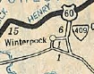
VA 411 #1: Appeared in August 1928 as an upgrade to CR 9, running from US 60/VA 20 (now US 360) south to Winterpock.
In 1932, VA 411 was renumbered as part of VA 409. Today it is SR 621 except near US 360 it used at least the northern SR 661 loop. If it used the southern SR 661 loop it stopped doing so before it was renumbered.
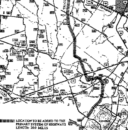
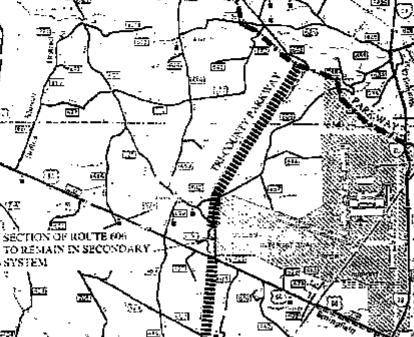
In June 2001 (CTB), the number 411 was actually assigned to the Tri-County Parkway. VA 411 was listed in 2001 and 2003 VDOT route logs: "From Route 234 in Prince William County to Route 50 in Loudoun County and from Route 621 in Loudoun County to the Dulles Greenway Parkway in Loudoun County (Tri-County Parkway). (Proposed)" In Oct 2002, per this document, the Tri-County Pkwy was extended along Godwin Dr south to end at the VA 28/VA 234 Bypass interchange. Per VDOT's website, in Nov 2005, the CTB approved the location for a new 10.4 mile north-south transportation link that would connect Manassas with the Dulles corridor. The location of the new road would be north of I-66 from the I-66 and Route 234 interchange to Route 50 in Loudoun County. The possible paths that were studied are shown here (pdf). The chosen path is segments C and D, roughly paralleling SRs 705 and 616 and runs 10.4 miles. The website says the Final Environmental Impact Statement is expected to be approved by the Federal highway Administration in fall of 2010. Note that this selection had no overlap with the Tri-County Pkwy as approved in 2001. The Nov 2005 CTB minutes says it will be limited access but does not mention a route number for the route. The selection of segment D overlaps the Manassas Battlefield Bypass that is desired in order to remove VA 234 from the Battlefield. I could not find anywhere on VDOT's website any mention of what happened to the SR 621 to Dulles Greenway segment, although the June 2013 public meeting on the Bi-County Pkwy does mention a study underway to extend it north of US 50 and east over to SR 606 to help serve Dulles and the upcoming Silver line. Additionally, the VTrans 2035 document from Nov 2010 does still mention VA 411 being on the future Loudoun County Pkwy from SR 621 to SR 772, as well as being on the moved location of what is now the Bi-County Pkwy. A small bit of the Loudoun County Pkwy in this defined area is built and appears to be signed as SR 607. In Feb 2013 (CTB), the Tri-County Pkwy (still called this then even though Fairfax County is no longer in the path) from I-66/VA 234 Byp interchange north to VA 234 was essentially described such that it will be VA 234 when built. Later in 2013 the project begins to be referenced as the Bi-County Pkwy instead. Public meeting brochures from Sept/Oct 2013 imply the entire Bi-County Pkwy will be VA 234. There is an FAQ that talks about what will happen to 234 through the Battlefield but there is no mention of what would happen to VA 234 from Catharpin to US 15 and whether it would remain in the primary system or not. In March 2016, Prince William County voted to remove the roadway from the county plans. In 2022, the parkway was reintroduced into Prince William County discussions. | |||||||