< VA 548 | Home | VA 599 >
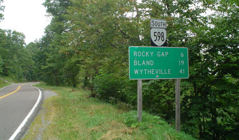
Photo: VA 598 begins its descent from the West Virginia line. (photo by Chris E 9/4/04)
|
|
|
| ROUTE LOG |
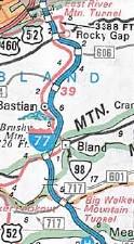
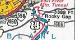
I-77 (exit 66), US 52: 0 - 0 WV STATE LINE: 4.16 - 4.16
|
Creation: Appeared in June 1980 (AASHTO) as a renumbering of US 52. This has been the only VA 598.
| Adjustments: None Improvements: Fully paved upon designation; no multilane segments. Posting: Fully posted. However, VA 598 is not mentioned on the SB I-77 BGS at this exit (only mentions US 52) Multiplexes: None Legislative names: None Other Names: None Scenic Byway: None Comment: Yes Virginia, there is a VA 598. This is very nearly the highest theoretical primary state highway number which can be used until the secondary numbers take over at 600. Why 598 was chosen, I have no idea. It would have made more sense to put US 52 on I-77 starting in Band and let old 52 to West Virginia be VA 98. There is a scenic overlook and old rest area at the state line crossing on top of East River Mountain.
| |||||||
Previous: VA 548 |
Next: VA 599
Top | Virginia Hwy Index
Home
Page last modified 23 August 2025