< US 50 | Home | US 58 >
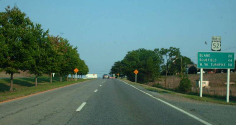
Photo: US 52 leaving I-81 north of Wytheville (photo by Mapmikey 8/18/07)
|
|
|
| ROUTE LOG |
NC STATE LINE: 0 - 0 Blue Ridge Pkwy: 8.67 - 8.67 VA 148: 0.75 - 9.42 US 58: 5.69 - 15.11 US 58 Bus, US 221: 1.32 - 16.43 Wythe-Carroll Line: 11.01 - 27.44 VA 69: 0.24 - 27.68 VA 94: 8.00 - 35.68 I-77 SB, I-81 NB (exit 80), US 11 NB, VA 121: 1.22 - 36.90 US 11 SB: 5.61 - 42.51 I-77 NB (exit 40): 1.29 - 43.80 I-81 SB (exit 70), US 21: 1.99 - 45.79 Bland-Wythe Line: 11.88 - 57.67 VA 42 WB: 4.18 - 61.85 I-77 (exit 52): 3.97 - 65.82 VA 98: 0.66 - 66.48 VA 42 EB: 0.25 - 66.71 VA 61 WB: 12.77 - 79.48 I-77 (exit 64): 0.06 - 79.54 VA 61 EB: 0.40 - 79.94 I-77 SB (exit 66), VA 598: 2.07 - 82.01 WV STATE Line: 0.79 - 82.80
|
Creation: US 52 is an original US Highway that appeared in the 1925 US Route plan, running from Newport News west via Richmond, Burkeville, Lynchburg, Lexington and Covington before dipping to Crows and northwest into West Virginia.
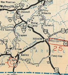
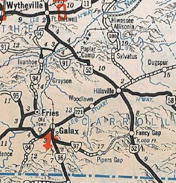
| Adjustments: Kentucky was adamant that a X0 US route run through its state and in the machinations to make that happen, US 52 in Virginia was to be renumbered. They went through US 60E (rejected by Virginia) and US 62 (actually approved Jan 14, 1926 by AASHO but then rejected by Kentucky) until finally deciding on US 60 on August 11, 1926. US 52 re-appeared in Virginia about Sept 1934 (AASHO), running essentially as it does now, as a replacement for US 121 from North Carolina to Fort Chiswell, US 11 over to Wytheville, and as an addition to US 21 from Wytheville to West Virginia. I believe US 52 was removed from SR 642 Hicksville in the mid-1930s. By 1936, US 52 was removed from 11th St/Withers Road in Wytheville. Sometime after 1936, US 52 was removed from VA 91 (now VA 69) and SR 719 at poplar Camp. In Oct 1951 (CTB), US 52 was placed on new alignments north of Wytheville leaving behind a number of abandoned segments. In March 1952 (CTB), US 52 was removed from SR 736 south of Fort Chiswell. In Aug 1952 (CTB), US 52 was placed on one-way alignments north of US 11 in Wytheville. NB used Tazewell St to Monroe St to 4th St while SB used 4th St. In Sept 1959 (CTB), US 52 was removed from SR 892 and Wisler Rd in Cana. In Aug 1960 (CTB), the Wytheville mileage reimburesment was changed to have US 52 use 4th St south to the one-way splits instead of Tazewell St. However, the 1958 Wythe County atlas already showed Tazewell St as SR 735. Given that VA 90 was downgraded to SR 749 in Dec 1953 (CTB), it is possible the relocation to 4th St actually occurred in the Aug 1952 action. About 1966, US 52 was placed onto I-81 around Wytheville leaving behind parts of US 11 and US 21.
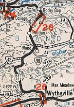
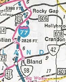
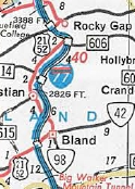
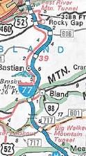
In Feb 1971 (CTB), US 52 was removed from SR 659 Kegley Dr west of Bland CH. About 1975, US 52 was placed on its current routing from Bland SR 612 to Bastian leaving behind abandoned routing east of I-77 plus a little SR 648. Also, US 52 was placed on its current routing from South Gap to VA 61 then over to Rocky Gap, leaving behind I-77's NB lanes and some SR 685. In June 1979 (AASHO), US 21 was removed from US 52 north of Wytheville. In June 1980 (AASHO), US 52 was placed onto I-77 at the West Virginia State Line, leaving behind VA 598.
I cannot find any reference to when US 52 stopped using one-way alignments in central Wytheville or if it was still that way when it was moved to I-81. Some of the frontage roads on both sides of I-77/81 were part of the US 11-52 alignments, and they were left behind when US 52 was placed on the new I-77/81 around 1987. Improvements: Upon designation in 1934, US 52 was fully paved everywhere. The First segment of US 52 to be 4-laned was from Wytheville south a couple miles, in 1958 In 1960 or 1961, US 52 was multilaned from Wytheville to Fort Chiswell. In 1965, US 52 was multilaned when placed onto I-81 around Wytheville. US 52 was multilaned on its VA 61 multiplex at I-77 in 1975. In 1980, US 52 was multilaned when placed on I-77 at the West Virginia line. US 52 is multilaned a short distance north of I-81 Wytheville but when this occurred is not certain but it was by 1987. Posted: Fully posted; The only US 52 cutouts thought to be remaining are in Hillsville. One set north of Wytheville made it to at least 2012. A cutout 52 shield on the frontage road of I-77/81 was replaced in 2011. VA 52 shields existed in Cana in 2000 (gone now) and also at VA 69 in the late 2000s (also gone now). US 52 is posted as North-South but was posted East-West into the 1960's: 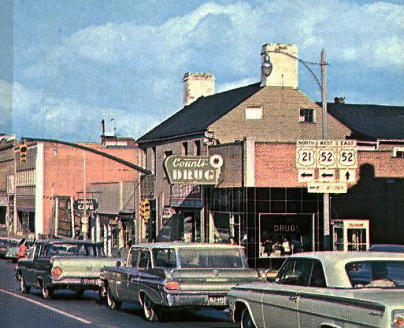 US 52 posted East-West courtesy Michael Summa Multiplexes: I-77, I-81, US 11 (5.61 mi) I-77, I-81 (1.29 mi) I-81 (1.99 mi) VA 42 (4.88 mi) VA 61 (0.46 mi) I-77 (0.79 mi) Legislative names: Colonel Ira B. Coltrane Memorial Bridge over Little Reed Island Creek near Hillsville(2-20-40) Other names: Fancy Gap Hwy (s of Hillsville); Main St (Hillsville); Poplar Camp Rd (Carroll Co n of Hillsville); Fort Chiswell Rd (Wythe Co s of I-81); 4th St (Wytheville); Stoney Fork Rd (Wyte Co n of Wytheville); Scenic Hwy (Bland Co); Clear Fork Creek Hwy (VA 61 duplex) Scenic Byway: WYthe SR 717 to I-77 Bland CH (9-17-92); I-77 overpass near New River to I-81 (8-19-76) Truck Route: While not posted as US 52 Truck, trucks over 8 tons are not allowed on US 52 south of VA 148. They are supposed to use VA 148, I-77, and I-74 to Mt Airy. This has been in place back to at least Oct 1980 (CTB). Prior to I-74 being built you were supposed to use NC 89. Comments: Answer to the trivia question which road goes through North Carolina and North Dakota. Although US 52 has been rebuilt to accomodate I-77 north of Bland CH, there are still some gnarly segments. US 52 is a pretty minor route in Virginia, unlike its neighbors to the north and south. | |||||||||||||
Previous: US 50 |
Next: US 58
Top | Virginia Hwy Index
Home
Page last modified 5 February 2022
