< SC 30 | Home | SC 32 >
|
|
|
| ROUTE LOG |
SC 707: 0 - 0 SC 544: 3.7 - 3.7 US 501: 4.6 - 8.3 SC 22: 11.9 - 20.2 SC 9: 7.8 - 28.0
|
Creation: Appeared as new freeway construction about 2002. Initially ran only from US 501 to SC 9. This is the 3rd SC 31.
| Adjustments: In 2005, SC 31 was extended southwest as more new freeway to SC 544. In Nov 2019, SC 31 was extended southwest as more new freeway to SC 707.
Improvements: SC 31 was fully freeway on all segments upon opening. Comment: There are tentative plans with North Carolina to extend the freeway to US 17 near Grissettown. There do not appear to be any concrete plans to extend SC 31 southeast back to US 17, which would be beneficial as a US 17 bypass since the US 17 bypass of Myrtle Beach is quite built up. SC 31 is potentially slated to become I-173 at some point in the far future. | Previous SC 31's:
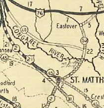
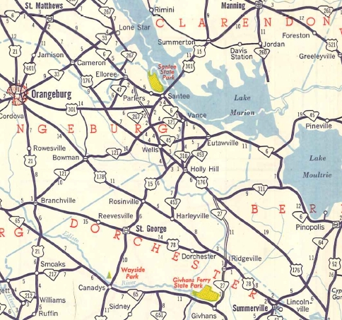
1950 ROUTE LOG US 52: 0 - 0 SC 64: 5.6 - 5.6 SC 311: 19.1 - 24.7 SC 27: 1.2 - 25.9 Orangeburg-Berkeley Line: 1.1 - 27.0 SC 453 SB: 4.7 - 31.7 SC 453 NB: 0.2 - 31.9 SC 310: 0.6 - 32.5 SC 314: 0.9 - 33.4 US 15, SC 45: 3.7 - 37.1 SC 121: 4.0 - 41.1 US 301: 6.9 - 48.0 Calhoun-Orangeburg Line: 1.0 - 49.0 SC 33: 7.7 - 56.7 SC 26: 3.6 - 60.3 US 21: 0.1 - 60.4 1989 ROUTE LOG SC 7: 0 - 0 SC 61 CONN: 1.3 - 1.3 SC 642: 3.5 - 4.8 |
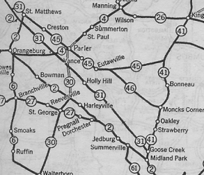
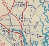
SC 31 #1: An original state route. Ran from SC 41 (current US 52) Goose Creek northwest through Holly Hill and St Matthews to end at SC 2 (now US 176) northwest of St. Matthews.
In 1929, SC 31 was truncated to US 21/SC 2 southeast of St Matthews. The loop through St Matthews became part of SC 52 (now US 601) and SC 45 (now SC 6).
In 1942, SC 31 was extended as new primary routing from Goose Creek east to Red Bank Plantation. In 1947, SC 31 was truncated back to US 52 Goose Creek, leaving behind S-8-37 and S-8-29. In 1951, SC 31 was renumbered as part of US 176. SC 31 was misidentified as SC 2 on the 1922 Auto Trails Map.
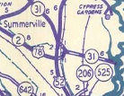
SC 31 #2: Appeared about 1985 as the first numbering of what is now I-526 between SC 7 and SC 642. The freeway had previously been unnumbered when it was open only from the SC 61 Connector (now SC 461) to Leeds Ave.
|
||||||||||||||||


Previous: SC 30 |
Next: SC 32
Top | South Carolina Hwy Index
Home
Page last modified 15 November 2019