< SC 170 | Home | SC 171 ALT | SC 171-Y | SC 172 >
|
|
|
| ROUTE LOG |
SC 7: 0 - 0 SC 61 NB: 1.7 - 1.7 SC 61 SB: 1.6 - 3.3 US 17: 0.1 - 3.4 SC 700 EB: 0.1 - 3.5 SC 700 WB: 1.2 - 4.7 SC 30: 1.0 - 5.7 END SC 171: 6.8 - 12.5
|
Creation: SC 171 appeared in 1956 as a renumbering of SC 615 from Folly beach to US 17, then after an overlay with SC 61, continued north partially replacing S-10-80 to SC 7. This is the 2nd SC 171.
| Adjustments: None Improvements: paved upon inception In 1956, SC 171 was multilaned from US 17 to Maybank Hwy In 1962, SC 171 was multilaned on its SC 61 overlay. In 1964, SC 171 was multilaned from Maybank Hwy south to the Long Island bridge. In 1966 or 1967, SC 171 was multilaned from SC 61 to SC 7. Comment: SC 171 is not posted on Folly Beach anymore. SC 171 serves Charlestown Landing State Park, where English settlers first came to the area in 1670.
| Previous SC 171's:
1948 ROUTE LOG SC 261: 0 - 0 US 52: 3.1 - 3.1 SC 261: 7.3 - 10.4 US 521: 0.3 - 10.7 |
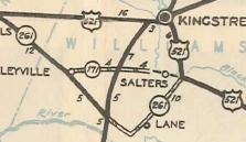
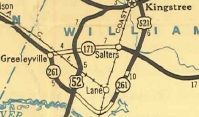
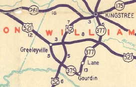
SC 171 #1: Appeared in 1930 as new routing running from SC 261 (now S-45-27) Greeleyville east to US 17 (now US 52) using today's S-45-593 Old Greeleyville Rd which used to go all the way past US 52 to S-45-220.
In 1931, SC 171 west was extended west to the relocated SC 261 (now SC 375) in Greeleyville. In 1934 or 1935, SC 171 was extended east as new primary routing 4 more miles near Salters. In 1937, SC 171 was east as more new primary routing to end at US 521 Bryans Crossroads. It appears that in 1940 SC 171 was removed from Old Greeleyville Rd. Varner Ave in Greeleyville became SC 171-Y (now S-45-27). In 1949, SC 171 was renumbered as part of US 521.
|
||||||||||||
Previous: SC 170 |
Next: SC 171 ALT | SC 171-Y | SC 172
Top | South Carolina Hwy Index
Home
Page last modified 4 September 2015
