< US 13 | Home | US 15 ALT | US 15 Bus | US 17 >
|
|
|
| ROUTE LOG |
US 17 ALT SB, SC 63: 0 � 0 US 17 ALT NB: 0.2 - 0.2 SC 64 Bus EB: 0.1 - 0.3 SC 64 Bus WB: 0.2 - 0.5 SC 64: 0.5 - 1 SC 61: 10.3 - 11.3 Dorchester-Colleton Line: 0.7 - 12 US 78: 8.6 - 20.6 US 178: 6 - 26.6 I-26 (exit 172): 2.5 - 29.1 Orangeburg-Dorchester Line: 1.7 - 30.8 SC 314: 1.9 - 32.7 US 176, SC 45: 3.7 - 36.4 I-95 (exit 93): 3.1 - 39.5 SC 210: 0.5 - 40 SC 267: 1.5 - 41.5 US 301 SB: 2.2 - 43.7 I-95 SB (exit 97): 1.1 - 44.8 SC 6: 1.6 - 46.4 Clarendon-Orangeburg Line: 1.5 - 47.9 I-95 NB (exit 102): 2.2 - 50.1 US 301 NB: 7.4 - 57.5 SC 261: 9.6 - 67.1 Sumter-Clarendon Line: 2.6 - 69.7 US 521: 8.5 - 78.2 US 76 Bus, SC 763: 3.1 - 81.3 US 401: 0.3 - 81.6 US 76, US 378: 1.6 - 83.2 Lee-Sumter Line: 9.7 - 92.9 SC 441: 5.1 - 98 I-20 (exit 116): 3.1 - 101.1 SC 154: 1.7 - 102.8 SC 34 WB, SC 341 SB: 0.9 - 103.7 SC 341 NB: 1.4 - 105.1 Darlington-Lee Line: 6.5 - 111.6 SC 34 EB: 3.4 - 115 SC 403: 0.3 - 115.3 SC 151: 2.7 - 118 US 15 Bus: 0.6 - 118.6 SC 151 Bus: 1.1 - 119.7 US 15 Bus: 3.9 - 123.6 US 52 SB, US 401 SB: 10.6 - 134.2 US 52 NB: 2.1 - 136.3 Marlboro-Darlington Line: 1.2 - 137.5 SC 912: 5.5 - 143 SC 385: 3.2 - 146.2 SC 9 WB, SC 38 WB: 1.3 - 147.5 SC 9 Bus, SC 38 SB, SC 38 Bus: 0.8 - 148.3 SC 9 EB: 1.2 - 149.5 SC 381: 8.2 - 157.7 NC STATE LINE: 1.7 - 159.4
|
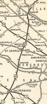
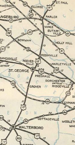
Creation: Although US 15 was an original US Highway, it did not come to South Carolina until 1935 when it was extended south from the Tar Heel State to end at US 17 (current SC 63) Walterboro. It ran generally the way it does now, and was a full renumbering of the first US 401.
|
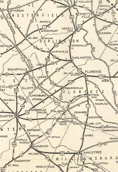
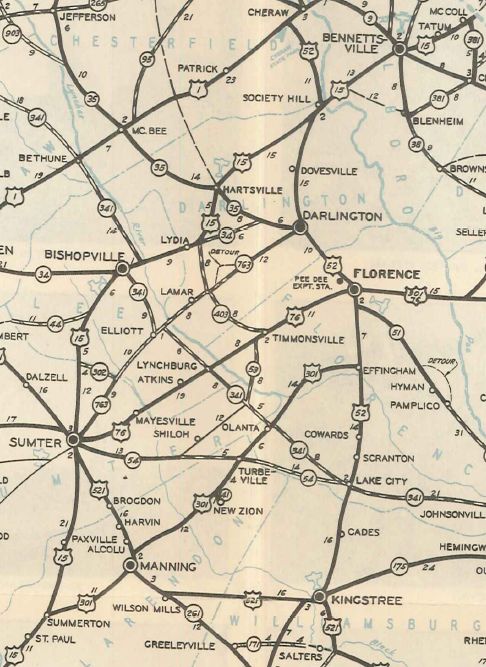
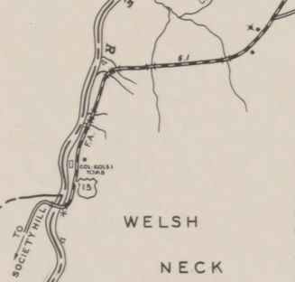
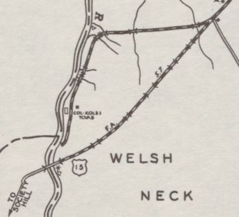
Adjustments: In 1935, US 15 was placed on its crossing of Whites Mill Pond north of Sumter leaving behind today's S-43-46 and S-43-325. About 1950, US 15 was given a straighter approach and a new crossing of the Great Pee Dee River on the Marlboro County side. The old route is today's S-35-167 and the E-W portion is abndoned routing. On the Darlington County side, the old route is the private portions of Bradshaw and Burlington Sts outside Society Hill. The piers to the original bridge are still standing just off S-35-167.
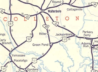
In 1951, US 15 was extended south replacing to US 17-21 Pocotaligo. In 1952, US 15 was truncated back to SC 63 Walterboro, as US 17 ALT was sent to Yemassee and Pocotaligo instead. See comments way below.
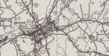
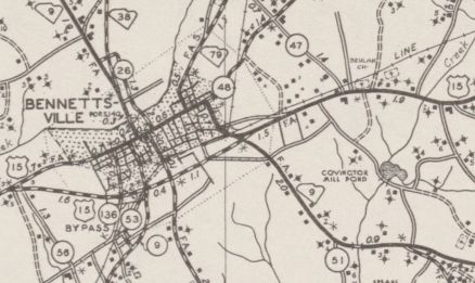
In 1952, US 15 was given an eastern bypass around Bennettsville, leaving behind US 15 Business (today this is SC 385 and SC 385 CONN).
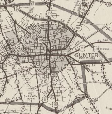
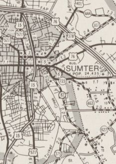
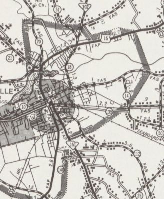
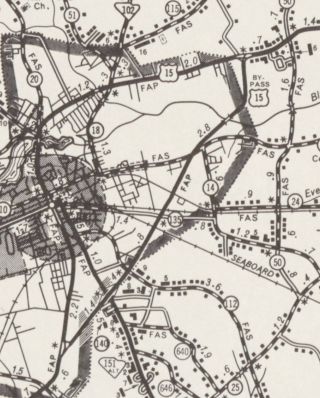
In 1964, US 15 was rerouted to avoid central Sumter. Originally using Main St, US 15 was routed around to the east on new alignment Lafayette Rd as it runs today. Main St north of downtown became a US 15-521 CONN (now S-43-5) while south of downtown Manning Rd remained part of US 521 (now S-43-152).
In 1968, US 15 was given an eastern bypass of Hartsville, leaving behind US 15 Business.
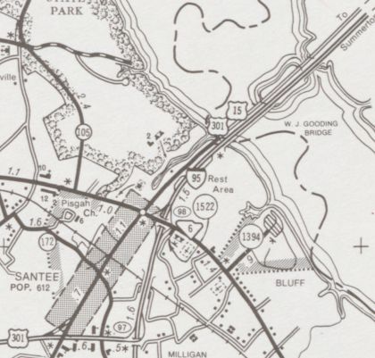
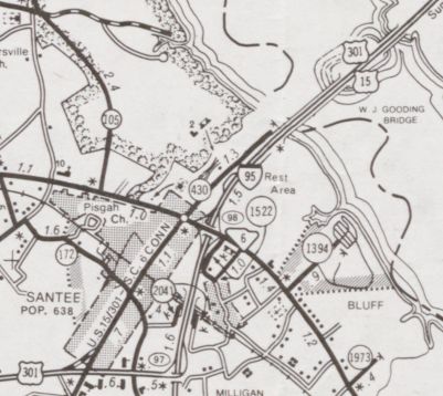
In 1987, US 15 was put onto I-95 between Exit 97 and Exit 102, over Lake Marion. The US 15-301 bridge over Lake Marion has been closed to traffic ever since. The road south of Lake Marion became S-38-430 and US 15/301-SC 6 CONN. The approach to I-95 north of the lake had been S-14-400 and the route connecting US 15-301 to I-95 Exit 97 had previously been I-95/US 301 CONN.
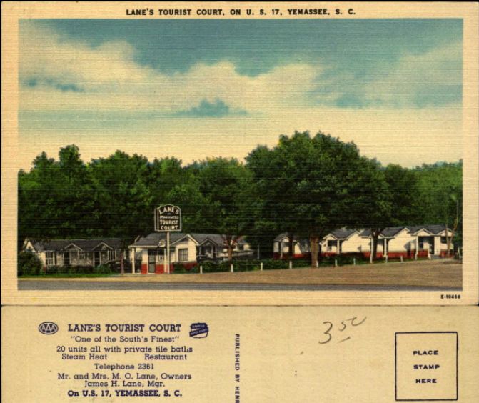
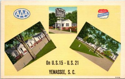
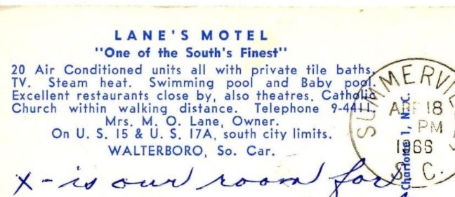
Between 2006-08, US 15 was rerouted to meet SC 34-403 at the same intersection when the curved piece between SC 34 and SC 403 was removed. Improvements: Upon designation, US 15 was fully paved. The first piece of US 15 to be 4-laned was the first few miles north out of Walterboro, in 1951 or 1952. The Bennettsville bypass was 4-laned in 1958. The bypass of downtown Sumter was 4-laned upon opening in 1964 (US 521 to US 76-378 Bypass). In 1970, US 15 was 4-laned from US 521 south to S-43-251. When US 15 was moved onto I-95 and the US 301 CONN in 1987 it became multilane. In 2007, US 15 was multilaned from I-20 to Bishopville. Comment: US 15 is one of South Carolina's underused routes, as it parallels I-95 for a good stretch and is not that far away from I-95 when it doesn't. The Hartsville Bypass, while 2-lane does have an interchange at its south end and also with SC 151 Business. US 15 is poorly posted in the Santee area So. Did US 15 really exist south of Walterboro? The only map evidence so far is the 1951 official showing it. But there is another piece of evidence...check out the post cards below: These first two show Lane's as first being located on US 17, then being located on US 15-21 in Yemassee.
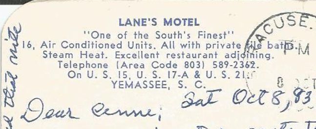
These next two show Lane's in Yemassee on US 15-17 ALT-21 (I have yet to definitively located where this was) and US 15-17 ALT at their Walterboro location (a little southwest of SC 303 jct).
There is insufficient county map evidence to accept or refute absolutely whether US 15 was extended south or not.
So my theory at this point is that US 15 was at least openly discussed as being extended enough that a business had its post cards reflect the change. But I need to find some photo evidence or SCDOT records to definitively say there is something beyond circumstantial evidence. | ||||||||||||||||||||||||||

Previous: US 13 |
Next: US 15 ALT | US 15 Bus | US 17
Top | South Carolina Hwy Index
Home
Page last modified 29 July 2017