< US 15 | Home | US 17 ALT | US 17 Bus | US 17-Y | US 21 >
|
|
|
|
| ROUTE LOG |
GA STATE LINE: 0 - 0 SC 315: 4.1 - 4.1 SC 170 SB: 2.5 - 6.6 SC 170 NB: 1.6 - 8.2 I-95 (exit 5): 4.5 - 12.7 US 321: 0.7 - 13.4 SC 46: 0.2 - 13.6 US 278 EB: 2.0 - 15.6 SC 336: 11.7 - 27.3 US 278 WB: 0.2 - 27.5 I-95 SB (exit 22): 1.1 - 28.6 SC 462: 6.0 - 34.6 I-95 NB (exit 33): 4.8 - 41.4 Beaufort-Jasper Line: 1.5 - 42.9 US 17 ALT, US 21 NB: 0.2 - 43.1 US 21 SB: 6.7 - 49.8 Colleton-Beaufort Line: 5.9 - 55.7 SC 303: 6.1 - 61.8 SC 64: 10.2 - 72 Charleston-Colleton Line: 1.0 - 73 SC 174: 5.9 - 78.9 SC 165: 6.0 - 84.9 SC 162: 5.9 - 90.8 SC 7: 7.4 - 98.2 I-526 (exit 9): 0.1 - 98.3 SC 171: 3.9 - 102.2 SC 700: 0.2 - 102.4 SC 61: 0.1 - 102.5 SC 30: 1.0 - 103.5 US 78: 0.9 - 104.4 BEGIN I-26 (exit 221): 0.1 - 104.5 I-26 WB (exit 220): 0.7 - 105.2 US 52: 0.1 - 105.3 SC 703: 3.0 - 108.3 I-526 (exit 30), I-526 SPUR: 3.2 - 111.5 I-526 (exit 29): 0.3 - 111.8 SC 517: 1.0 - 112.8 SC 41: 3.6 - 116.4 SC 45: 26.6 - 143 Georgetown-Charleston Line: 7.5 - 150.5 US 521: 15.2 - 165.7 US 17 ALT, US 701: 0.2 - 165.9 US 17 BUS: 19.2 - 185.1 SC 707: 3.1 - 188.2 Horry-Georgetown Line: 0.4 - 188.6 US 17 Bus: 0.2 - 188.8 SC 544: 5.9 - 194.7 SC 707: 2.6 - 197.3 US 501: 3.2 - 200.5 US 17 Bus: 7.7 - 208.2 SC 22: 2.0 - 210.2 SC 65: 4.2 - 214.2 SC 9 EB: 4.5 - 218.7 SC 9 WB, SC 90: 0.9 - 219.6 SC 90: 1.2 - 220.8 SC 179: 2.8 - 223.6 NC STATE LINE: 0.9 - 224.5
|
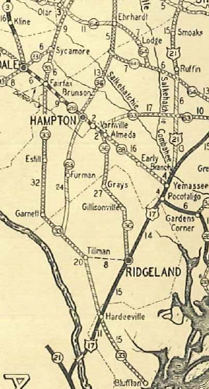
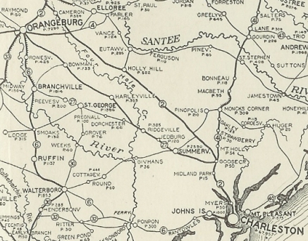
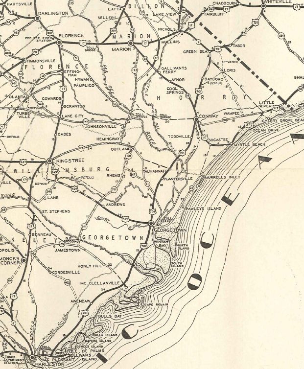
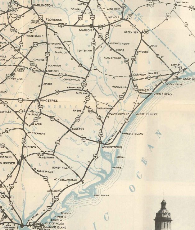
Creation: Appeared in late 1926 as an original US highway. Entered South Carolina from Georgia at Port Wentworth, GA, then headed north to Hardeeville, Ridgeland, Yemassee and Walterboro, then proceeding east to Jacksonboro and Charleston, then heading north to Moncks Corner, Kingstree, Lake City and Florence, then east to Marion and Mullins before slipping east into North Carolina near Nichols. US 17 was attached to SC 1 from Georgia to Yemassee; SC 30 from Yemassee to Walterboro;
|
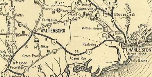
SC 6 from Walterboro to Charleston (used Spring St to King St);
SC 2 from Charleston to near today's Goose Creek and SC 41 from Goose Creek to Florence (used Irby to Chevis); SC 3 from Florence to North Carolina. This zig-zag route through the coastal area of South Carolina was 288 miles long.
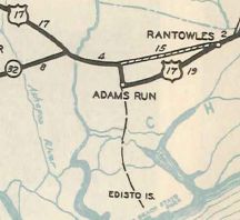
In 1938, US 17 was given a bypass of Rantowles, Ravenel, and Adams Run on new alignment that may have had a primary designation briefly first. The old route briefly became a US 17 ALT. Today this is all of SC 162, some of SC 174, and S-10-40.
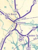
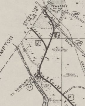
Also in 1938, US 17 was given a bypass around central Yemassee, leaving behind US 21 ALT. Today it is S-7-3 and S-25-1.
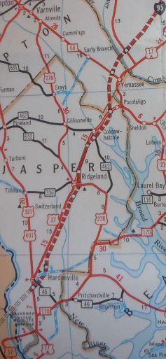
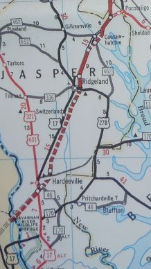
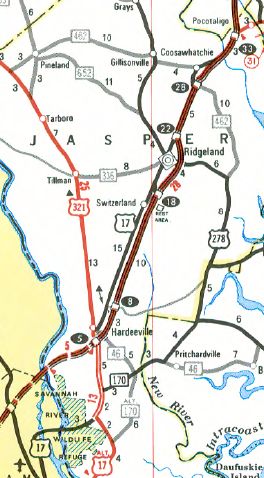
Between 1941-46, US 17 was removed from Green St in Ridgeland onto its current routing. Green St became US 17 ALT (now S-27-32). Between 1943-47, US 17 was rerouted in Charleston to run Spring/Meeting/Lee Sts.
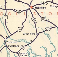
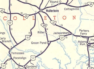
About 1951, US 17 was rerouted to run directly from Jacksonboro to Pocotaligo, replacing SC 32. The old route from Jacksonboro to Walterboro became SC 63 (now mostly SC 64, plus a little SC 64 bus and SC 63), and US 15 (now US 17 ALT) down to Pocotaligo.
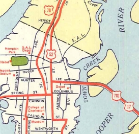
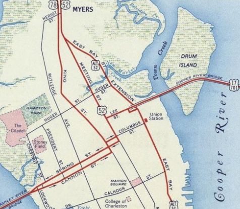
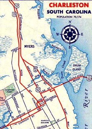
In 1952, US 17 was rerouted in Charleston into one-way splits - NB used Cannon/King/Columbus/Meeting, while SB used Meeting/Spring Sts. The two alignments crossed each other at King and Spring Sts. In 1957 or 1958, US 17 NB split was rerouted in Charleston to use Cannon/Coming/Line Sts to Meeting. The NB-SB routes still crossed, now at Coming at Spring Sts.
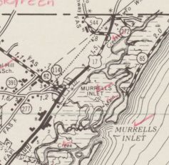
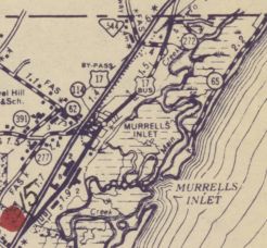
In 1958, US 17 was removed from S-10-1024 Old Charleston Hwy in the Red Top area. Between 1964-66, US 17 received its western bypass of Murrells Inlet leaving behind US 17 Business.
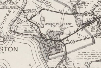
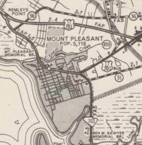
About 1967, US 17 received its northern bypass of Mt. Pleasant, leaving behind US 17 Business. Today this is half SC 703 and all of I-526 Bus.
In 1968 or 1969, US 17 was rerouted through Downtown Charleston onto the "Crosstown Expwy". Previously US 17 split into one way streets through the downtown area using Spring/Cannon St, and Line/Lee Sts. In 1970, US 17 was placed on new expressway in the vicinity of SC 9 and the Intracoastal Waterway, leaving behind S-26-20 and SC 90.
In 1971, US 17 was placed onto I-95 from Ridgeland to just south of Coosawhatchie. In 1973, US 17 was placed on I-95 from north of Coosawhatchie to Pocotaligo. In 1975, US 17 was placed on I-95 around Coosawhatchie.
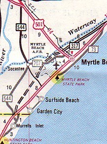
About 1981, US 17 was given its bypass of Myrtle Beach leaving behind US 17 Business. From Murrells Inlet to US 501 was new construction, while US 501 northward was a replacement of SC 317.
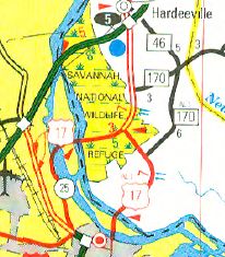
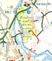
In 1997, US 17 was rerouted below Hardeeville to cross into Georgia right at Downtown Savannah, replacing US 17 ALT. The old route into Georgia became part of an extended SC 170.
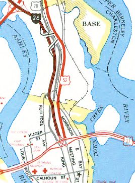
In 2005, US 17 was rerouted in Charleston to multiplex up I-26 a short distance then heading east across a new Cooper River Bridge crossing.
Improvements: Upon designation, US 17 was paved only from Megget to Charleston to near Goose Creek. In 1928, US 17 was paved from Adams Run to Megget and from Pee Dee to Nichols. US 17 was fully paved in 1930. The first piece of US 17 to be 4-laned was in place between 1947-52, from US 501 north a couple miles. In 1956, US 17 was 4-laned from Ridgeland to Pocotaligo. Also in 1956 US 17 was 4-laned from SC 615 (current SC 171) into downtown Charleston. In 1958, US 17 was 4-laned from SC 171 west to S-10-20 Main Rd; also from the Cooper River to Mt Pleasant. In 1959, US 17 was 4-laned a couple miles to the south of US 501 Myrtle Beach. Around 1962, US 17 was 4-laned from Myrtle Beach south to near the Waccamaw River Bridge, except around Murrells Inlet. In 1963, US 17 was 4-laned north from Myrtle Beach to Atlantic Beach. About 1967, US 17 was 4-laned from Charleston to the north end of the Mt. Pleasant Bypass and also on the new Murrells Inlet Bypass. In 1968 or 1969, US 17 was 4-laned across the Waccamaw/Pee Dee/Black Rivers into Georgetown. In 1970, US 17 was 4-laned from the north end of the Mt. Pleasant Bypass to SC 41. In 1971, US 17 was 4-laned from Crescent Beach to the NC Line, except at the Intracoastal Waterway. In 1972, US 17 was 4-laned around teh SC 9 interchanges and also from SC 162 Rantowles to S-10-20. In 1973, US 17 was 4-laned from SC 64 Jacksonboro to SC 162. In 1974, US 17 was 4-laned from US 321 Hardeeville south to the US 17-17 ALT split near Savannah; also US 17 was 4-laned around Awendaw. In 1976, US 17 was 4-laned from Georgetown south for several miles. In 1978, US 17 was 4-laned from from SC 41 to Awendaw and also from the Santee River Bridges north to Georgetown. In 1979, US 17 was 4-laned from Mclellanville to the Santee River. In 1980, US 17 was 4-laned from Awendaw to McLellanville. When I drove US 17 in January 2004 there were 3 sections of a mile each of undivided 4-lane ("passing lanes") between Gardens Corner and Jacksonboro. About 2014, US 17 was formally widened from Gardens Corner to inside Colleton County. About 2015, US 17 was widened the rest of the way to Jacksonboro. In summary US 17 is 4-laned continuously from Ridgeland north to the North Carolina line, as well as a small segment south of Hardeeville. Comment: US 17 is South Carolina's important coastal route, north of Pocotaligo. The Myrtle Beach bypass is now not so much a good way to avoid the Grand Strand and the development between Georgetown and Myrtle Beach (especially Pawleys Island area) has saddled down US 17. Two better alternatives: US 701 from Georgetown to Conway, SC 90 east to S-26-57 to US 17 in North Carolina; OR US 17 to SC 544 to SC 31 to SC 9.... US 17 is known as the "Ocean Hiway" in South Carolina. US 17 between SC 41 and Georgetown is still very sparsely settled, with the Francis Marion National Forest and Santee River swamps limiting development potential. US 17 truck traffic is directed to use I-526 on both ends around Charleston. US 17 directly serves Brookgreen Gardens and Myrtle Beach and Huntington Beach State Parks. The first welcome center ever built in South Carolina was the Little River center on US 17. | ||||||||||||||||||||||||||||||||||


Previous: US 15 |
Next: US 17 ALT | US 17 Bus | US 17-Y | US 21
Top | South Carolina Hwy Index
Home
Page last modified 31 July 2017