< TN 84 | Home | TN 85A | TN 86 >
|
|
|
| ROUTE LOG |
TN 80: 0 - 0 TN 263: 1.6 - 1.6 Jackson-Smith Line: 8.2 - 9.8 TN 262 WB: 3.8 - 13.6 TN 262 EB: 3.1 - 16.7 TN 56 NB, TN 135 NB: 8.7 - 25.4 TN 53 SB, TN 56 SB: 4.0 - 29.4 TN 135 SB: 0.2 - 29.6 TN 53 NB: 0.6 - 30.2 Overton-Jackson Line: 9.6 - 39.8 TN 136: 4.0 - 43.8 TN 84: 6.1 - 49.9 TN 111 SB: 1.1 - 51.0 TN 111 NB: 0.3 - 51.3 TN 52 WB: 0.8 - 52.1 TN 294: 0.9 - 53.0 TN 52 EB: 8.3 - 61.3 TN 164: 11.0 - 72.3 Fentress-Overton Line: 2.3 - 74.6 US 127, TN 28: 11.0 - 85.6
|
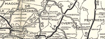
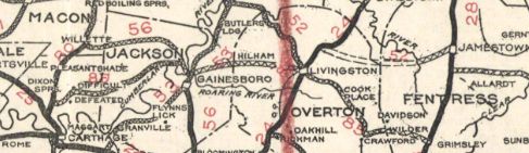
Creation: Appeared in 1927 or 1928 running from TN 53 Gainesboro to TN 24 (current TN 52-85 jct) Livingston.
| Adjustments: In 1930, TN 85 was extended east, replacing TN 52 to TN 28 (now US 127) in Grimsley. Also TN 85 was extended with TN 53 south then TN 56 north out of Gainesboro, then west to end at TN 80 Monoville.
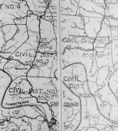
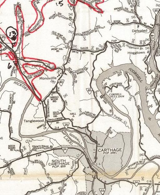
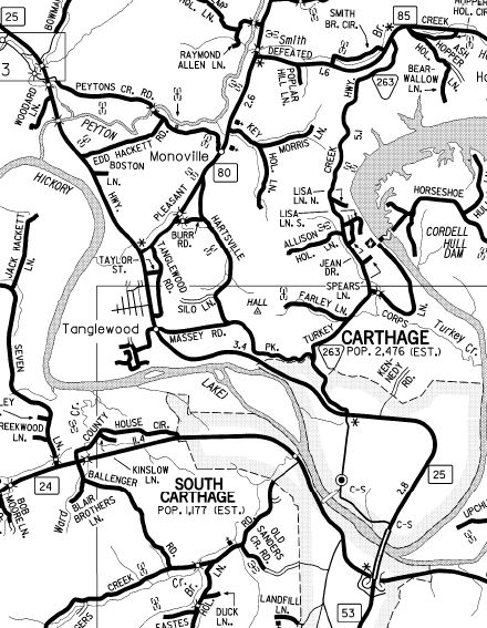
State Officials are not quite distinct enough to tell, but by 1938, TN 85 was removed from Old Grimsley Rd to meet TN 28 at today's TN 85 east endpoint. About 1939, TN 85 was rerouted on its west end to dip down to end at TN 25 (now Hartsville Pike) Carthage. The road west to TN 80 was removed from the state highway system. Some of it is TN 85 again but the original alignment used the western half of Smith Branch Rd (if TN 85 ever used the eastern half it stopped by 1932) and a little bit of Bear Ln. Near TN 263 was on abandoned alignment wedged between the current routings of TN 85 and TN 263. The one-way splits in Livingston using Broad St WB and Main St EB (original TN 85) may have been in place as early as the mid-1950s. In 1963, TN 85 west was extended over TN 25 east to meet the newly built TN 25 in Carthage. Also around 1963, TN 85 was shifted west to accommodate the expanded Defeated Creek created from Cordell Hull Dam. The new alignment was roughly from Lakeside Dr to Short Hollow Ln. Also in 1963, TN 85 was removed from Smith Bend Ln and (no longer connects to) Holland Loop in Gladdice; road into Wartrace Rec area, underwater routing, a bit of TN 262 and Dow Cook Rd at Highland In 1966, TN 85 was removed from Old Wilder Rd at the W. Ober River. In 1972, TN 85 was rerouted east out of Gainesboro to its current Roaring River crossing. The old route became more TN 135 and abnadoned routing through Roaring Creek Park to the former bridge crossing. In 1983, TN 85 west was removed from Carthage and put back on its original west ending at TN 80 above Monoville via Defetaed Creek Hwy, which was totally rebuilt mostly on new alignments since TN 85 had used it before. Turkey Creek Hwy down to Carthage became TN 263.
About 1983, TN 85 was removed from Thomas Rd at Gladdice; abandoned looped routing on both sides of TN 85; east half of Sanders Ln Between 2000-06, TN 85 was rebuilt just west of TN 164 to remove some of the hairpins. Posting: Posted as secondary southeast of TN 52 and between TN 56 and TN 262; primary routing everywhere else The TN 56 and TN 53 overlays are only posted at the TN 53-56 jct in Gainesboro. The TN 111 overlay is posted and the TN 52 overlay is not. Secret US Route Overlay: None Comment: TN 85 between TN 262 and TN 56 disallows trucks, which makes it all the more strange that TN 262 (old TN 85A) east to Gainesboro is not TN 85. | ||||||||||