< US 70S | Home | US 74 >
| |||||||||||||||
| ROUTE LOG US 51, US 64 WB, US 70 WB, US 79 WB, TN 3, TN 23 Begin: 0 - 0 US 64 EB, US 70 EB, US 79 EB, TN 277: 2.1 - 2.1 TN 23 EB, TN 57 WB: 1.0 - 3.1 I-240 (exit 15): 6.0 - 9.1 TN 177 SB: 3.4 - 12.5 TN 177 NB: 0.2 - 12.7 TN 175: 7.7 - 20.4 TN 57 EB, TN 86 Begin: 0.3 - 20.7 TN 385: 2.2 - 22.9 I-269 (exit 1): 1.1 - 24.0 Fayette-Shelby Line: 0 - 24.0 TN 195: 1.7 - 25.7 MS STATE LINE: 0.2 - 25.9 GAP IN ROUTE AL STATE LINE: 0 - 25.9 TN 156: 2.5 - 28.4 I-24 WB (exit 152), US 64 WB, TN 27 NB, TN 150 Begin: 1.7 - 30.1 TN 2 NB: 0.3 - 30.4 US 41 NB, TN 28: 4.9 - 35.3 TN 27: 3.1 - 38.4 TN 134: 2.6 - 41.0 Hamilton-Marion Line: 12.2 - 53.2 I-24 (exit 174): 2.1 - 55.3 US 11 SB, TN 38: 0.2 - 55.5 TN 318: 1.6 - 57.1 TN 148: 1.1 - 58.2 TN 17 SB: 0.9 - 59.1 I-24 (exit 178), US 27: 1.3 - 60.4 US 11 NB, US 64 EB, TN 2 NB: 0.2 - 60.6 US 41 NB, TN 8 SB, TN 17 NB: 0.3 - 60.9 TN 316: 0.6 - 61.5 US 76, US 127, TN 8 NB, TN 27: 0.1 - 61.6 |
Creation: US 72 was an original US route, running from US 70 (now Sycamore View Rd) Bartlett east with TN 15 to Selmer, then followed US 45 south to Mississippi, then reappeared from Alabama at South Pittsburg following TN 27 to US 41 (now TN 2) west of Kimball. It was not in the original 1925 plan but was born in the January 1926 revision as Memphis to Chattanooga. The final plan reduced it to Bartlett to Kimball.
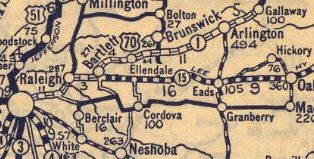
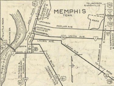
Adjustments: In 1927, US 72 was given TN 15's current routing from TN 225 to Selmer. The old route used Prentiss Johnson Ln (no longer connects to), Sandy Flat Rd and John Moore Rd. About 1929, US 72 west was truncated to the new (and current) US 70 in Bartlett. If US 72 ever used Old Jackson Rd/Union Rd/Laconia Rd east out of Somerville or Railroad Dr east of Laconia it stopped doing so by 1929. The 1929 and 1930 Official map insets of Memphis imply that US 72 contined with US 70 into Memphis to end at US 51. However, the original AASHO route log in 1927 definitely had US 72 end in Bartlett. TN 15, also implied to extend into Memphis is shown on the route logs of the 1929/30 Officials to begin at Bartlett.
In 1930, US 72 was removed from Cherry Rd/Donelson Rd through Hickory White. Also in 1930, US 72 was removed from Breeden Ln (no longer connects to), Hornsby Loop (no longer connects to) and Donaldson Ln between Bolivar and Hornsby. In 1932, US 72 west was truncated to the US 45-64 south split in Selmer, with the route west to Bartlett becoming US 64 (which it still is except US 64 Bus in Whitesville and Selmer; Main St through Hornsby)
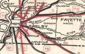
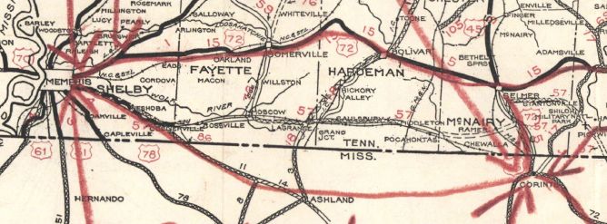 US 72 original western segment 1930 Official
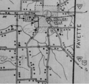
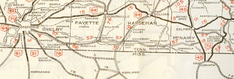 US 72 truncated to Selmer, replaced by US 64 1932 Official In late 1934, US 72 was removed from US 45 in Tennessee to instead continue west in Mississippi to emerge near Collierville, attached to TN 86.
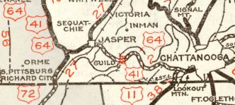
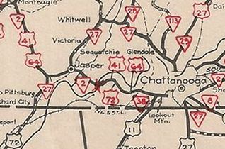
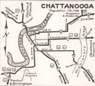
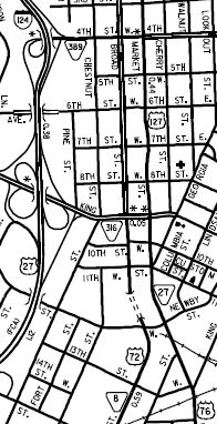
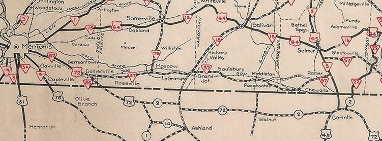 US 72 rerouted at Corinth MS to stay in Mississippi until nearly Memphis 1935 Official Also in late 1934, US 72 was extended east with US 41-64 to Chattanooga, ending at Broad/Market/11th intersection where US 76 also ended.
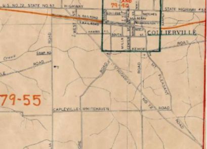
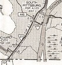
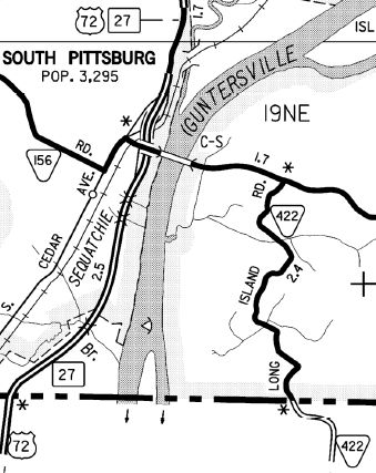
About 1935, US 72 was removed from the two Kellys Ferry segments west out of Lookout Valley; also removed from today's TN 318 and Old Wauhatchie Pike (no longer continuous) By 1936, US 72 was removed from Old Jasper Rd north of S. Pittsburg There is conflicting information on when TN 86 was placed on its mostly newly constructed routing (current route). Uglybridges says a bridge was initially built in 1930, but the 1939 Shelby/Fayette County maps still show the original TN 86 routing, with US 72. The railroad bridge right at TN 57 was built in 1942, though certainly could've been at-grade first. The 1929 Official is the only one that appears to show the initial routing, though also implies it used Quinn Rd directly south to Mississippi. Available topo maps don't bo back that far to see if the 1930 bridge could've been on a secondary road absorbed into the new TN 86 routing. Additionally, the mileage log for TN 86 on official maps drops from 6 to 5 between the 1930 and 1932 issues.
My guess is that US 72 was removed from Glover Hill Rd in Jasper in 1954. Between 1957-60, US 41-76 was changed to follow Main St to Broad St, which became the new endpoint for US 72. About 1958, US 72 was rerouted to use the new Union Ave Ext from Poplar to East Pkwy. Gousha maps show it as US 72 ALT first, which I am skeptical of. In response to the 1968 Federal Highway Act, Tennessee requested an interstate corridor along US 72 from I-24 Jasper to Alabama. This was not approved. In 1995, US 72 was removed from S. Cedar Ave from the Alabama line through S. Pittsburg
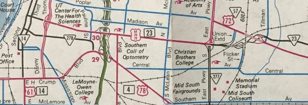
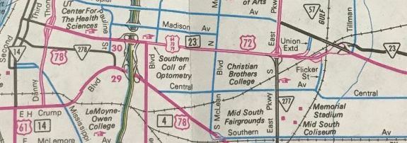
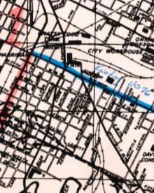
In 1995 or 1996, US 72 was extended west along US 64-70-79 to its current endpoint at US 51. Note that US 72 was posted eastbound well west of East Pkwy much earlier than this - 1960 photo 3rd leaving Linden and 1963 photo Crump at Riverside; only this 1951 map is all I have found to support any claim of US 72 being routed to downtown Memphis. If you zoom in on a 1960 photo of US 72 WB at US 64-70-79, you can see there is no US 72 WB posting on Union leaving the intersection. There are also early 1950s photos of EB Union with no US 72 shield.
In 2002, US 72 was extended east replacing US 11-64 to downtown Chattanooga to end at US 76-127.
Posting: Fully posted but poorly posted in Chattanooga (possibly only 1 shield east of TN 17-58) and Memphis. In Memphis there is a US 72 posting on Union at I-240, prior to US 72's beginning. Secret TN Route Overlay: TN 23 (3.1 mi) TN 57 (17.6 mi) TN 86 (3.3 mi) TN 27 (4.2 mi) TN 150 (0.3 mi) TN 2 (30.2 mi) TN 17 (0.3 mi) TN 8 (0.7 mi) Comment: US 72 is a major corridor from Memphis to I-24 Kimball, though 90% of that is in Mississippi and Alabama. In 1930, North Carolina floated renumbering US 421 as US 72 to coincide with its attempt to get it extended to Johnson City. I guess they didn't own any maps... | ||||||||||||||
