< WV 4 | Home | WV 6 >
|
|
|
| ROUTE LOG |
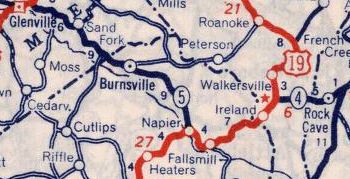
WV 14: 0 - 0 WV 53: 0.5 - 0.5 Calhoun-Wirt Line: 13.4 - 13.9 WV 16: 13.0 - 26.9 Gilmer-Calhoun Line: 5.5 - 32.4 US 33 WB, US 119 SB: 14.3 - 46.7 US 33 EB, US 119 NB: 1.1 - 47.8 Braxton-Gilmer Line: 10.9 - 58.7 US 19, WV 4: 12.9 - 71.6
|
Creation: Appeared in 1938 as a renumbering of WV 35 from Elizabeth to WV 4-20 Rock Cave. This is the 2nd WV 5.
|
WV 35 from Elizabeth to Rock Cave 1935 Official
WV 5 replaces WV 35 1939 Rand McN Adjustments: In 1940, WV 5 east was truncated to US 19/WV 4 at Napier. The route to Rock Cave remained part of WV 4. In 1973 (bridge date), WV 5 was removed from CR 5/10 at Burnsville. In 1974 or 1975, WV 5 east was truncated to I-79 at Burnsville, leaving behind CR 5/11 and abandoned routing covered by Burnsville Lake. Some of old WV 5 from US 19 Napier northwestward still exists as an access road. Between 1978-80, WV 5 was rerouted at Burnsville to turn south just prior to I-79 (leaving behind more CR 5/11) and replacing CR 3 south via Gem to US 19/WV 4 at Heaters. Most of the road down to Gem had once been WV 94 #2.
Improvements: Upon designation, WV 5 was paved from Bigbend to Grantsville; DeKalb to Rock Cave. In 1940, WV 5 was paved from Creston to Big Bend. Betweenn 1947-56, WV 5 was paved from Elizabeth east 5 miles; Grantsville to DeKalb I don't have a narrow date range when the remainder of WV 5 was paved. WV 5 has no multilane segments. Comment: WV 5 is blown off by I-79 but is easily accessible from CR 5/11 in Burnsville. | Previous WV 5's:
1937 ROUTE LOG WV 2: 0 - 0 WV 87: 9 - 9 US 21: 4 - 13 WV 14: 23 - 36 US 119 SB: 1 - 37 WV 16 SB: 13 - 50 WV 16 NB: 2 - 52 WV 35 WB: 24 - 76 WV 35 EB: 1 - 77 WV 47: 9 - 86 US 19: 17 - 103 US 119 NB, WV 20: 16 - 119 US 250 NB: 19 - 138 US 219 NB: 5 - 143 US 219 SB, US 250 SB: 1 - 144 WV 32: 22 - 166 WV 28 NB: 12 - 178 WV 28 SB: 11 - 189 US 220 NB: 14 - 203 US 220 SB: 1 - 204 Virginia State Line: 20 - 224 |
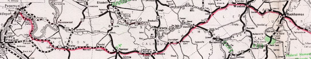
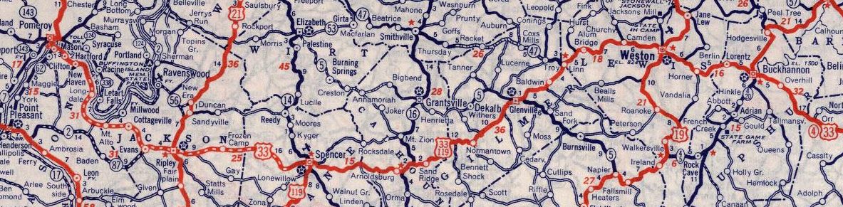
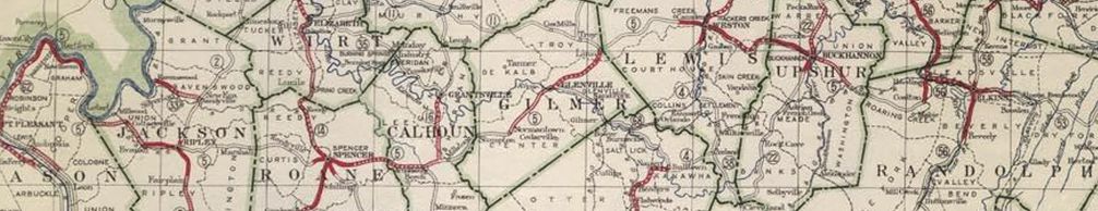
WV 5 #1: An original 1922 state route. Ran from WV 62 Mason heading east through Ripley, Spencer, Glenville, Weston, and Buckannon before ending at WV 56 (now CR 151) Harding.
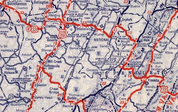
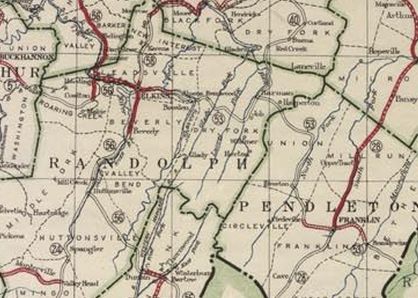
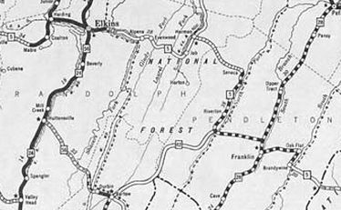
WV 5 #1 from Mason to almost Elkins 1923 Official In 1931, WV 5 was extended with WV 56 to Elkins, then replaced WV 53 east to Seneca Rocks, Franklin, and into Virginia.
Also in 1931, WV 5 was rerouted away from Mason to head west directly to Point Pleasant as new primary routing, then replaced WV 62 southwest to end at US 60 (now WV 101) Huntington. The old route to Mason became an extended WV 62. In 1932, WV 5 was rerouted away from Mt. Alto and instead used new routing directly east to Evans. The old route became more WV 62 (this is now WV 331, CR 33/17, and CR 5). Also in 1932, WV 5 was removed from today's CR 31 and CR 28 down to Job south of Harman In 1935 (bridge date), WV 5 was removed from CR 33/25 John/Arnold Sts in Weston In 1936, WV 5 west was truncated to WV 2. The route down to Huntington became part of WV 2 (WV 5 used CR 2/12, 2/13, and 2/14 in Green Bottom; CR 2/10 in Lesage).
Between 1934-37, WV 5 was removed from CR 5/17 Pike St east of Spencer. About 1937, WV 5 was removed from CR 5/18 and 5/19 in the Wymer area east of Elkins. In late 1937, WV 5 was replaced by WV 87 #2 from WV 2 to Evans and US 33 from Mt. Alto all the way to Virginia. WV 5 is approximated by WV 87; US 33 to Buckannon except CR 33/10 Battenfarm Rd and CR 33/21 Old Rte 33 near Ripley; CR 33/1 W. Main St into Spencer; CR 5/24 Old Golf Course Rd; CR 33/2 Circle Heights east of Weston; CR 33/1 through McGuire Park; CR 33/3 through Gaston and Homer; CR 33/4 Hidden Ln; CR 12/1 and CR 12 to Buckannon (except WV 5 used CR 12/5 loop). From Buckannon to Seneca Rocks WV 5 used CR 151 (except WV 5 used CR 53 through Womelsdorf), CR 151/4, WV 92, US 33, CR 33/8, US 33 except CR 32/5 Main St and CR 33/16 Mott St in Harman. WV 5 used US 33 from Seneca Rocks to Virginia except: CR 9/6 in Riverton; CR 33/8 at Judy Gap which no longer crosses the S. Potomac River; CR 3/7 and CR 3/8 at Oak Flat
WV 5 replaced by WV 87 and US 33 1939 Rand McN
WV 5 replaced by US 33 all the way to Virginia 1939 Rand McN |
||||||||||||||


Previous: WV 4 |
Next: WV 6
Top | West Virginia Hwy Index
Home
Page last modified 14 May 2022