< WV 40 | Home | WV 42 >
|
|
|
| ROUTE LOG |
WV 210: 0 - 0 US 19 SB: 0.9 - 0.9 US 19 NB: 0.8 - 1.7 US 19 BYP: 0.3 - 2.0 WV 61: 4.8 - 6.8 Fayette-Raleigh Line: 4.0 - 10.8 US 60 EB: 22.2 - 33.0 US 60 WB: 2.5 - 35.5 Nicholas-Fayette Line: 5.7 - 41.2 WV 129: 8.2 - 49.4 US 19 SB: 0.8 - 50.2 US 19 NB: 4.6 - 54.8 WV 39 EB: 1.0 - 55.8 WV 39 WB: 0.2 - 56.0 US 19: 2.9 - 58.9 WV 55: 6.5 - 65.4
|
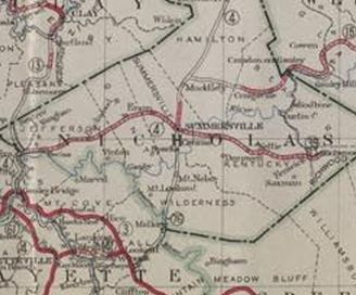
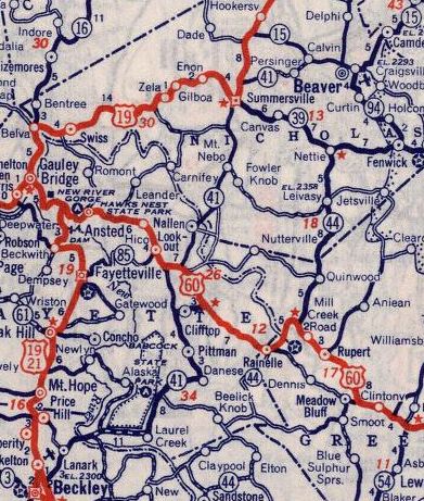
Creation: Appeared in 1922 as new primary routing, running from WV 4 (now WV 16) Fayetteville to WV 3 (now US 60) Lookout. This is the only WV 41.
| Adjustments: About 1931, WV 41 was extended east with US 60 from Lookout, then north replacing WV 76 to US 19/WV 39 Summersville.
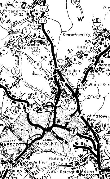
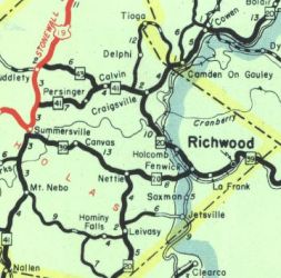
In 1932, WV 41 was extended north with US 19 a short distance, then east as new primary routing to end at WV 15 (now WV 55) near Calvin. In 1935, WV 41 south was rerouted at US 60 to instead head south as new primary routing to end at WV 3 (now WV 210) Beckley, with the route west from Lookout to Fayetteville becoming WV 85 (now CR 82).
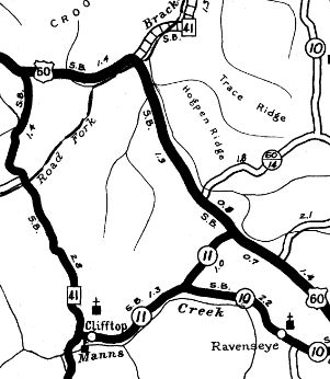
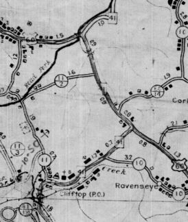
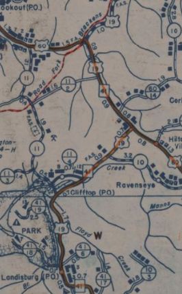
In 1936 or 1937, WV 41 was rerouted at Clifftop to head east to US 60 instead of north to US 60 in a route swap with CR 11. In 1939 (bridge date), WV 41 was given a bypass of Clifftop, leaving behind CR 11 and CR 11/4.
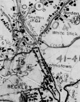
Between 1938-46, WV 41 was moved from Vance Dr/Hunter St to Johnstown Rd
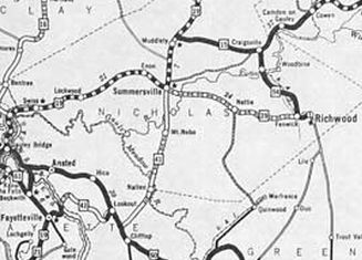
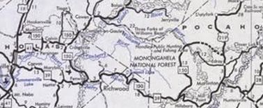
In 1941, WV 41 north was extended replacing WV 15 to end at WV 20 Craigsville. Between 1950-73, WV 41 was removed from CR 41/41 Holliday Rd north of US 60. About 1964, WV 41 was placed on modern US 19 from the Summersville Lake Bridge northward with the old route underneath Summersville Lake and Salmon Run; unnumbered access to the Salmon Run boat ramp; CR 41/16 Broad St Between 1978-80, WV 41 north was truncated back to its Calvin endpoint, replaced by today's WV 150 (now WV 55).
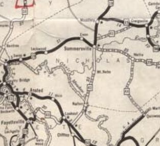
Between 1981-83, WV 41 was removed from CR 19/66 from Mt Nebo to Summersville Lake Improvements: In 1923, WV 41 was paved from Fayetteville to the New River In 1924, WV 41 was paved from Lookout west to Winona Between 1933-35, WV 41 was paved from US 19 halfway to Calvin. The 1935 reroute to Beckley was paved from Beckley to McCreery; Layland to Clifftop; US 60 duplex By 1939, WV 41 was paved from Laurel Creek to Layland; US 60 to Summersville By 1946, WV 41 was fully paved. WV 41 is multilaned on its US 19 duplex from Mt. Nebo to south of Summersville, as well as its US 19 duplex in Beckley. Comment: WV 41 is a back door alternative to US 19 from Beckley to Summersville if 4-lane highway offends you - in fact WV 41 was part of US 19 for a time. |
||||||||||||||||