< WV 75 | Home | WV 77 >
|
|
|
| ROUTE LOG |
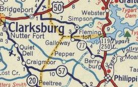
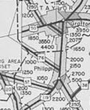
US 50: 0 - 0 Taylor-Harrison Line: 2.0 - 2.0 Barbour-Taylor Line: 13.7 - 15.7 US 119, US 250: 6.6 - 22.3
|
Creation: WV 76 was designated about 1961 as a renumbering of WV 77. This is the 2nd WV 76.
| Adjustments: In the 1970s, WV 76 west was truncated slightly to a rerouted US 50 which was avoid an airport expansion. The old piece of WV 76 is still present but not a public road. Improvements: WV 76 was fully paved upon designation; no mulitlane segments. Comment: none
| Previous WV 76's:
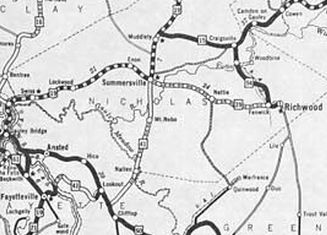
1930 ROUTE LOG US 60: 0 - 0 Nicholas-Fayette Line: 6 - 6 WV 39 EB: 14 - 20 US 19, WV 39 END: 3 blocks - 20 |
WV 76 #1: Appeared 1924 (WVDOT annual report) as new primary routing running from WV 3 (now US 60) east of Lookout to WV 4-39 Summersville.
About 1931, WV 76 was renumbered as part of WV 41. It remains WV 41 today except: CR 41/41 Holliday Rd near US 60; Old Gauley Rd north of Mt Nebo; underneath Summersville Lake and Salmon Run; unnumbered access to the Salmon Run boat ramp; CR 41/16 Broad St
|
||||||||||