< WV 44 | Home | WV 45 ALT | WV 46 >
|
|
|
| ROUTE LOG |
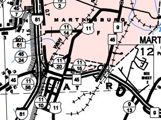
Virginia State Line: 0 - 0 WV 51: 7.1 - 7.1 I-81 (exit 12): 8.1 - 15.2 US 11: 0.4 - 15.6 WV 9 EB: 0.7 - 16.3 US 11 SB: 1.0 - 17.3 US 11 NB, WV 9 WB: 0.9 - 18.2 Jefferson-Berkeley Line: 5.7 - 23.9 WV 45 ALT: 1.6 - 25.5 WV 230, WV 480: 0.9 - 26.4
|
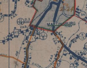
Creation: Appeared in 1932 from unnumbered primary route from US 11 Martinsburg to WV 48 (now WV 480) Shepherdstown. This is the 2nd WV 45.
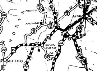
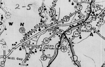
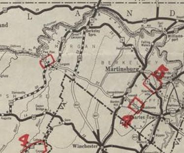
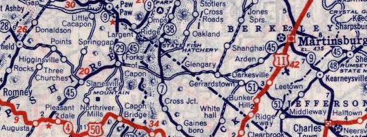
| Adjustments: In 1935, WV 45 west was extended with US 11 south through Martinsburg, then extended west as new primary routing to the Virginia Line west of Glengary, then picked up again from the Virginia line in Hampshire County as new primary routing to Forks of Capon, then replaced WV 29 west to end at US 50 near Augusta. In 1936 or 1937, WV 45 was removed from CR 37 between Mills Gap and Arden.
In 1960 (bridge date), WV 45 was placed on newly constructed routing and took over some of CR 45/3 to avoid Forks of Capon, leaving behind CR 45/7 Gaston Rd as well as an extended WV 29. About 1968, WV 45 was rerouted in Martinsburg onto newly constructed Apple Harvest Dr from I-81 to WV 9, leaving behind CR 11/20 Alonzo Dr (now cut off by shopping area from where WV 45 and I-81 come together) as well as US 11 into downtown.
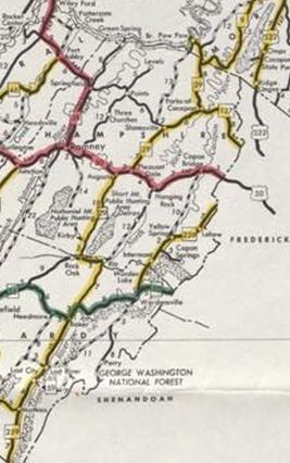
About 1975, WV 45 from US 50 to Forks of Capon was renumbered as more extended WV 29 and from there to the Virginia line was renumbered as WV 127.
Improvements: By 1935, WV 45 was fully paved from Arden to Shepherdstown. By 1939, WV 45 was paved from US 50 to Forks of Capon. By 1946, WV 45 was paved from Arden to just west of Glengary. Glengary west to Virginia was paved by 1956 and Forks of Capon east to Virginia between 1957-60. WV 45 is multilane from US 11 to WV 9 south of Martinsburg. Comment: The Virginia CTB turned down a request to have a primary route connect the two pieces of WV 45, though later they did put VA 127 into the system. | Previous WV 45's:
1931 ROUTE LOG WV 28: 0 - 0 US 50 WB: 26 - 26 US 50 EB: 6 - 32 Maryland State Line: 6 - 38 |
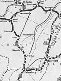
WV 45 #1: Appeared 1922 as new primary routing, running from WV 1 (now US 50) east of Hartmansville and heading into Maryland at Blaine.
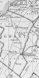
Between 1929-31, WV 45 south was extended west with US 50 to Mt Storm, then replaced WV 44 south to end at WV 28 (now US 220) Petersburg. In 1932, WV 45 was renumbered as WV 42 except for the last mile into Petersburg which was neither WV 28 nor WV 42 - I have not found a map that identifies what this mile was designated from 1932-35. In 1935 it became part of WV 28. Note that WV 45 used CR 42/15 Old Rt 42 near Petersburg; CR 42/14 and CR 1 through Scherr; CR 50/11 in northern Grant County.
|
||||||||||||||||