The Highways of North Carolina
I-40 
< 36 | Home | 40 Bus | 140 | 240 | 440 | 540 | 640 | 840 | 42 >
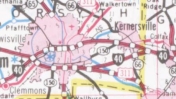
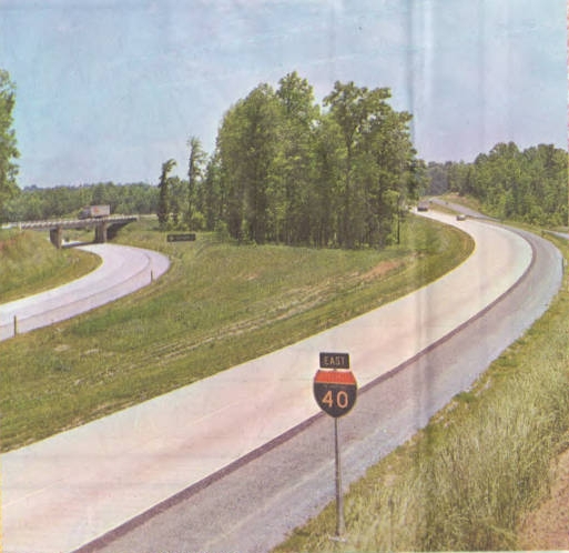
Photo: I-40's exit with old NC 6 west of Greensboro (reverse side 1961 Official map)
I-40
I-40  420 miles
The Road: Begins at the Tennessee State line at Mt. Serling (Haywood County) and ends at US 117/NC 132 near Wilmington (New Hanover County).
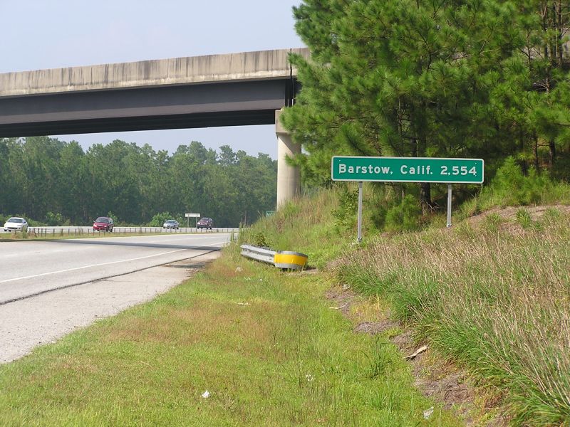
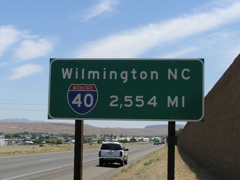
Nationally I-40 runs from Wilmington to I-15 Barstow, CA
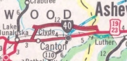
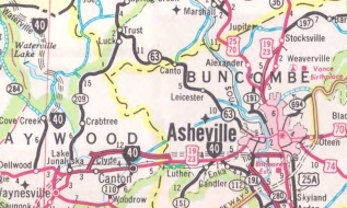
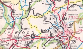
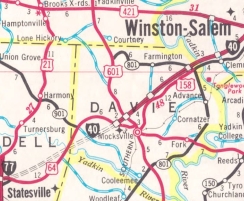
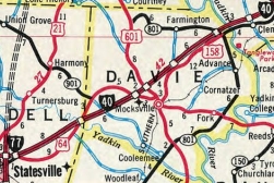
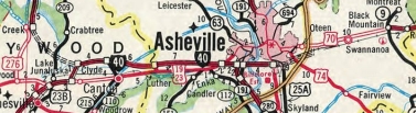
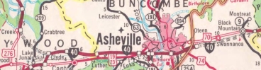
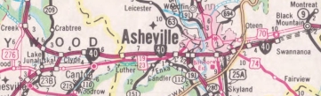
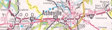
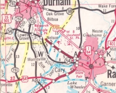
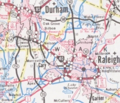
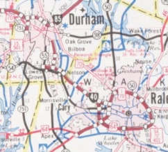
Towns and Attractions: Haywood Co.: Pisgah Nat'l Forest, Clyde, Canton  
Buncombe Co.: Enka, Asheville, Swannanoa, Black Mountain  
McDowell Co.: Marion  
Burke Co.: Morganton, Valdese, Rutherford College, Icard  
Catawba Co.: Hickory, Conover  
Iredell Co.: Statesville  
Davie Co.: Mocksville  
Forsyth Co.: Clemmons, Winston-Salem  
Guilford Co.: Greensboro  
Alamance Co.: Burlington, Graham  
Orange Co.: Hillsborough  
Durham Co.: Research Triangle Park  
Wake Co.: Raleigh, Garner  
Johnston Co.: Benson  
Sampson Co.: Newton Grove  
Duplin Co.: Warsaw  
Pender Co.: Burgaw  
New Hanover Co.: Wilmington  
History:
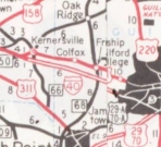
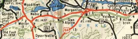
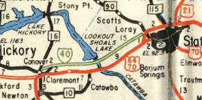
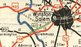
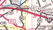
Many of the following timelines are from North Carolina's I-40 entry on their 50th anniversary of interstates website.
I-40 was an original 1957 interstate that first appears on the 1959 Official as open from US 421 (now Exit 16 of I-40 Bus) Kernersville east to its endpoint of US 29-70 (also I-85 in 1960) Greensboro. According to NCDOT, I-40 was also assigned by then to 3 miles of the Winston-Salem Expressway which was built as part of US 158 a couple years prior.
The 1960 Official shows I-40 open from Exit 94 in western Burke County to US 64-A (now SR 1890 I-40 Access Rd SE) at Hildebran; also from NC 16 Conover to NC 90 Statesville; also NC 801 to the US 158-421 spilt east of Winston-Salem.

1959 Official
I-40's first open segment
1959 Official
1960 Official
I-40 open from western Burke to Hildebran
1960 Official

1960 Official
I-40 open from Conover to Statesville
1960 Official
1960 Official
I-40 open from NC 801 through Winston-Salem
1960 Official

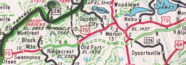
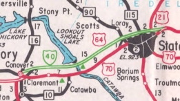
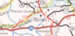
The 1961 Official shows I-40 open from Black Mountain to Old Fort utilizing the US 70 alignment down the escarpment that was built in 1954; also from NC 226 Marion east to Exit 94; also NC 90 to US 64 on the other side of Statesville utilizing the US 64 Bypass of Statesville first built about 1954.

1961 Official
I-40 shown open from Black Mtn to Old Fort and Marion to Burke Co
1961 Official
1961 Official
I-40 finished on Statesville Bypass
1961 Official

The 1962 Official shows I-40 open from Old Fort to NC 226.
The 1963 Official shows I-40 open from east Winston-Salem to Kernersville.
The 1964 Official shows I-40 open from what is now the US 74 split at Clyde east to a connector called US 23-A just inside Buncombe County (now exit 37).

1962 Official
I-40 shown open from Old Fort to Marion
1962 Official
1964 Official
I-40 finished in Kernersville area
1964 Official
1964 Official
I-40 finished in Canton area
1964 Official

The 1967 Official shows I-40 open from NC 191 to US 25 in Asheville.
In 1968, I-40 was opened from the Tennessee Line to US 276 at Cove Creek.
In Nov 1968, NCDOT requested from the Bureau of Public Roads to extended I-40 east through Greensboro and Raleigh to end at I-95.
The 1969 Official shows I-40 open from US 19-23 Enka to NC 191.

1967 Official
I-40 shown open from NC 191 to US 25
1967 Official
1969 Official
I-40 shown open from Tenn to US 276
1969 Official

The 1970 Official shows I-40 open from US 64 Mocksville to NC 801.
The 1971 Official shows I-40 open from Exit 37 to US 19-23 Enka; also US 64 Statesville to US 64 Mocksville.

1970 Official
I-40 shown open from Mocksville to NC 801
1970 Official
1971 Official
I-40 shown open from Statesville to Mocksville
1971 Official

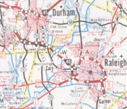
In Dec 1971 (NCDOT), I-40 was open from what is now NC 147 RTP to what is now Exit 289 Wade Ave in Raleigh. Although maps show Wade Ave as a continuous freeway with I-40. I have found NO official map or Wake County map that shows anything on Wade Ave east of where it now leaves I-40 as part of I-40. I cannot vouch from experience how Wade Ave was posted from what is now I-440 at that time. on the west end, there is no map evidence I-40 was ever assigned to what is now NC 147 heading north into Durham.
The 1972 Official shows I-40 open from US 25 to Oteen.

1971 Official
I-40 shown open from Canton to Enka
1971 Official
1972 Official
I-40 shown open from US 25 to Oteen
1972 Official

The 1974 Official shows I-40 open from US 276 to Exit 37; also Oteen to Swannanoa
The 1976 Official shows I-40 open from Hildebran to NC 16.
The 1979 Official shows I-40 open from Swannanoa to Black Mountain, making I-40 continuous from Tennessee to Greensboro.

1975 Official
I-40 shown open from US 276 to Swannanoa
1975 Official
1980 Official
I-40 shown open from Swannanoa to Black Mountain
1980 Official

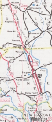
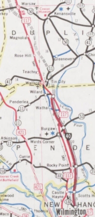
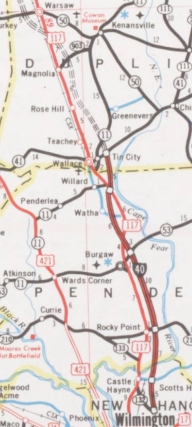
In Jan 1982 (NCDOT), I-40 was officially assigned to US 70 between Black Mountain and Old Fort. This is odd since every official map from 1961 onward shows this as an interstate. However, the official county maps only showed this as US 70.
In 1983 or 1984, I-40 was opened from Wade Ave south to US 1, then along the southside of the newly opened Raleigh Beltline.
In Aug 1984 (NCDOT), I-40 was assigned to the freeway from its current eastern end north to US 117 south of Wallace. This was briefly assigned as NC 132 prior to this. The 1985 Official showed I-40 as actually opened only from NC 210 to US 117.
The 1986 Official showed I-40 as open from NC 55 to NC 147; also NC 210 south to its present end at Exit 420.

1972 Official
I-40 shown open from RTP to Raleigh
1972 Official
1985 Official
I-40 shown open from on south part of beltline
1985 Official
1986 Official
I-40 shown open from NC 55 to NC 147
1986 Official

The 1987 official showed I-40 open from US 117 to NC 41 at Wallace.

1985 Official
I-40 shown open from NC 210 to US 117
1985 Official
1986 Official
I-40 shown open from END to NC 210
1986 Official
1987 Official
I-40 shown open from US 117 to NC 41
1987 Official

The 1988 Official showed I-40 open from US 15-501 to NC 55; also the Raleigh Beltline south to US 70 Garner.
The 1989 Official showed I-40 open from I-85 to US 15-501; also US 70 Garner to NC 210 (Johnston Co)
The 1990 Official showed I-40 open from NC 210 to I-95 Benson; also US 117 Warsaw to NC 41 Wallace.

1988 Official
I-40 shown open from US 15-501 to NC 55; Beltline to Garner
1988 Official
1989 Official
I-40 shown open from I-85 to US 15-501; Garner to NC 210
1989 Official
1990 Official
I-40 shown open from NC 210 to I-95
1990 Official

In Jan 1991 (NCDOT), I-40 was assigned to the freeway from I-95 Benson to US 117 Wallace.

1990 Official
I-40 shown open from Warsaw to Wallace
1990 Official
1992 Official
I-40 shown open from I-95 to Warsaw
1992 Official

In Nov 1992 (NCDOT), I-40 was given its freeway bypass of Winston-Salem. A portion of this utilized the US 311 freeway built in the mid-1980s but otherwise was all new construction. The old route through Winston-Salem became I-40 Business and remained part of US 421.
In Feb 2008 (per interstate guide.com), I-40 was placed on a bypass of Greensboro using newly constructed freeway and being added to the recently opened I-85 bypass of Greensboro. The old route through Greensboro became I-40 Bus.

1993 Official
I-40 bypasses Winston-Salem
1993 Official
2008 Official
I-40 bypasses Greensboro
2008 Official

In Sept 2008 (per interstate guide.com), I-40 was returned to its original Greensboro routing. The southwest piece of the bypass route became I-73 while the southeast part remained I-85.

2011 Official
I-40 returns to central Greensboro
2011 Official
Comments: The NCDOT 50th anniversary page notes that I-40s tunnels near the Tennessee border are "the only tunnels on the interstate system east of the Mississippi River." I guess they meant tunnels through mountains. There are several interstate tunnels under bodies of water on the Eastern Seaboard. The tunnels are at MM 5 and MM 8, with only a WB tube at MM 8.
I-40 along the Pigeon River has had some notable landslides over the last 20 years. Many have closed I-40 to through traffic, requiring a detour either through ther Smoky Mtn Nat'l Park and US 441 or utilizing US 25-70 northwest out of Asheville.
I-40 is by far the longest interstate in North Carolina and the 4th longest route behind US 70, US 74, and US 64.
The first official map to explicitly show the I-40/85 duplex was the 1993 issue.
The longest highway mileage sign in North Carolina resides at the east end of I-40. California returned the favor. Pictures courtesy Gary Benson

barstow sign
I-40 has a ways to go yet...
barstow sign
...to reach the other end

Exit List:

EXIT 7: FR 288 Cold Springs Creek Rd
EXIT 15: SR 1388 Fines Creek Rd
EXIT 20: US 276
EXIT 24: NC 209
EXIT 27: US 74 WEST
EXIT 31: NC 215
EXIT 33: SR 1004 Newfound Rd
EXIT 37: SR 1200 Wiggins Rd
EXIT 44: US 19, US 23, US 74-A
EXIT 46: I-26, I-240
EXIT 47: NC 191
EXIT 50: US 25
EXIT 51: US 25-A
EXIT 53: I-240, US 74-A
EXIT 55: SR 2753 Porters Cove Rd
EXIT 59: SR 2740 Patton Cove Rd
EXIT 64: NC 9
EXIT 65 (WB only): US 70 WEST
EXIT 66: SR 2531 Dunsmore Ave
EXIT 72 (EB only): US 70 EAST
EXIT 73: SR 1103 Bat Cave Rd
EXIT 75: SR 1234 Parker Padgett Rd
EXIT 81: SR 1001 Sugar Hill Rd
EXIT 83: SR 1168 Ashworth Rd
EXIT 85: US 221
EXIT 86: NC 226
EXIT 90: SR 1717 Harmony Grove Rd
EXIT 94: SR 1129 Dysartsville Rd
EXIT 96: SR 1138 Kathy Rd
EXIT 98: SR 1147 Causby Rd
EXIT 100: SR 1129 Jamestown Rd
EXIT 103: US 64
EXIT 104: SR 1922 Enola Rd
EXIT 105: NC 18
EXIT 106: SR 1704 Bethel Rd
EXIT 107: NC 114
EXIT 111: SR 1712 Flat Gap Rd
EXIT 112: SR 1744 Mineral Springs Mountain Rd
EXIT 113: SR 1741 Rutherford College Rd
EXIT 116: SR 1761 Old NC 10
EXIT 118: SR 1761 Old NC 10
EXIT 119: SR 1002 Henry River Rd
EXIT 121: SR 1124 Old Shelby Rd
EXIT 123: US 321
EXIT 125: SR 1534 Lenoir Rhyne Blvd
EXIT 126: McDonald Pkwy
EXIT 128: SR 1476 Fairgrove Church Rd
EXIT 130: SR 1007 Old US 70
EXIT 131: NC 16 Bus (removed)
EXIT 132: NC 16
EXIT 133: SR 1709 Rock Barn Rd
EXIT 135: SR 1715 N. Oxford St
EXIT 138: NC 10
EXIT 141: SR 1502 Sharon School Rd Rd
EXIT 144: SR 1005 Old Mountain Rd
EXIT 146: SR 1512 Stamey Farm Rd
EXIT 148: US 64, NC 90
EXIT 150: NC 115
EXIT 151: US 21
EXIT 152: I-77
EXIT 153 (EB only): US 64
EXIT 154: SR 2158 Old Mocksville Rd
EXIT 162: US 64
EXIT 168: US 64
EXIT 170: US 601
EXIT 174: SR 1410 Farmington Rd
EXIT 180: NC 801
EXIT 182 : SR 1101 Harper Rd
EXIT 184: SR 1103 Lewisville Clemmons Rd
EXIT 188: I-40 Bus, US 421
EXIT 189: US 158
EXIT 190 (WB only): Hanes Mall Blvd
EXIT 192: NC 150
EXIT 193C (WB only): SR 1528 Silas Creek Pkwy
EXIT 193: US 52, US 311 NORTH, NC 8
EXIT 195: NC 109
EXIT 196: US 311 SOUTH
EXIT 201: SR 2643 Union Cross Rd Rd
EXIT 203: NC 66
EXIT 206 (WB only): I-40 Bus, US 421 NORTH
EXIT 208: SR 1850 Sandy Ridge Rd
EXIT 210: NC 68

EXIT 211: SR 1554 Gallimore Dairy Rd
EXIT 212: I-73, US 421 SOUTH
EXIT 213: SR 1546 Guilford College Rd
EXIT 214: SR 1561 Wendover Ave
EXIT 216 (EB only): SR 4238 Patterson St
EXIT 217: High Point Rd
EXIT 218: US 220 SOUTH
EXIT 219: I-85 Bus SOUTH, US 29 SOUTH, US 70 WEST
EXIT 220: SR 1007 Randleman Rd
EXIT 221: SR 1400 Elm St
EXIT 222: SR 1401 Martin Luther King Jr Blvd
EXIT 223 (EB only): US 29 NORTH, US 70 EAST, US 220 NORTH
EXIT 224: SR 4240 E. Lee St
EXIT 226: SR 3000 McConnell Rd
EXIT 227: I-85 SOUTH, I-785, I-840
EXIT 132: SR 3045 Mt. Hope Church Rd
EXIT 135: SR 3056 Rock Creek Dairy Rd
EXIT 138: NC 61
EXIT 140: University Dr
EXIT 141: SR 1149 Huffman Mill Rd
EXIT 143: NC 62
EXIT 145: NC 49
EXIT 147: NC 87
EXIT 148: NC 54
EXIT 150: SR 1928 Jimmie Kerr Rd
EXIT 152: SR 1981 Trollingwood Hawfields Rd
EXIT 153: NC 119
EXIT 154: SR 1007 Mebane Oaks Rd
EXIT 157: SR 1114 Buckhorn Rd
EXIT 160: SR 1120 Mt. Willing Rd
EXIT 161: SR 1279 Interstate 85 Connector
EXIT 259: I-85 NORTH
EXIT 261: SR 1009 Old NC 86
EXIT 263: SR 1723 New Hope Church Rd
EXIT 266: NC 86
EXIT 270: US 15, US 501
EXIT 273: NC 54
EXIT 274: NC 751
EXIT 276: SR 1118 Fayetteville Rd
EXIT 278: NC 55
EXIT 279: NC 147
EXIT 280: SR 1999 Davis Dr
EXIT 281: SR 1959 Miami Blvd
EXIT 282: SR 1973 Page Rd
EXIT 283: I-540, NC 540
EXIT 284: SR 1640 Airport Blvd
EXIT 285: SR 1002 Aviation Pkwy
EXIT 287: SR 1655 N. Harrison Ave
EXIT 289: Wade Ave
EXIT 290: NC 54
EXIT 291: Cary Towne Blvd
EXIT 293: I-440, US 1, US 64 WEST
EXIT 295: Gorman St
EXIT 297: SR 1009 Lake Wheeler Rd
EXIT 298: US 70, US 401, NC 50
EXIT 299: Hammond Rd
EXIT 300: SR 2564 Rock Quarry Rd
EXIT 301: I-440, US 64 EAST
EXIT 303: SR 2547 Jones Sausage Rd
EXIT 306: US 70 WEST, US 70 Bus
EXIT 309: US 70 EAST
EXIT 312: NC 42
EXIT 319: NC 210
EXIT 325: NC 242
EXIT 328: I-95
EXIT 334: NC 96
EXIT 341: NC 50, NC 55
EXIT 343: US 701
EXIT 348: SR 1722 Suttontown Rd
EXIT 355: US 117 Conn, NC 403
EXIT 364: NC 24 WEST, NC 24 Bus
EXIT 369: US 117
EXIT 373: NC 24 EAST, NC 903
EXIT 380: SR 1102 Charity Rd
EXIT 384: NC 11
EXIT 385: NC 41
EXIT 390: US 117
EXIT 398: NC 53
EXIT 408: NC 210
EXIT 414: SR 1002 Holly Shelter Rd
EXIT 416: I-140, US 17
EXIT 420: US 117, NC 132


Last Update: 2 November 2013

Previous: I-42  |  Next: I-40 Bus | I-140 | I-240 | I-440 | I-540 | I-640 | I-840 | I-44
Top  |  NCRoads.com Home ------------------------------------------------