< I-79 | Home | I-85 >
I-81 | I-581
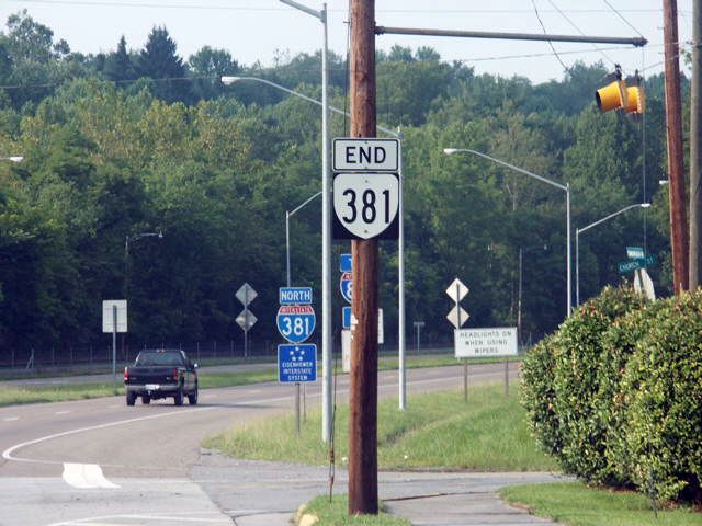
Photo: I-381 north leaving VA 381 at Keys/Church Sts (photo by HB Elkins Aug 2003)
|
|
|
| ROUTE LOG |
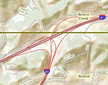
EXIT 1 - I-81 (exit 3), US 58: 0 - 0 VA 381: 1.67 - 1.67
|
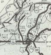
Creation: I-381 opened in Nov 1961 (per Scott Kozel's website). Its interchange with I-81 had only to/from I-81 North movements. The south end was at the Keys/Church St intersection - no interchange...the road simply stopped being a freeway. Note that in CTB documents I-381 was initially referred to as VA 407.
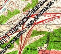
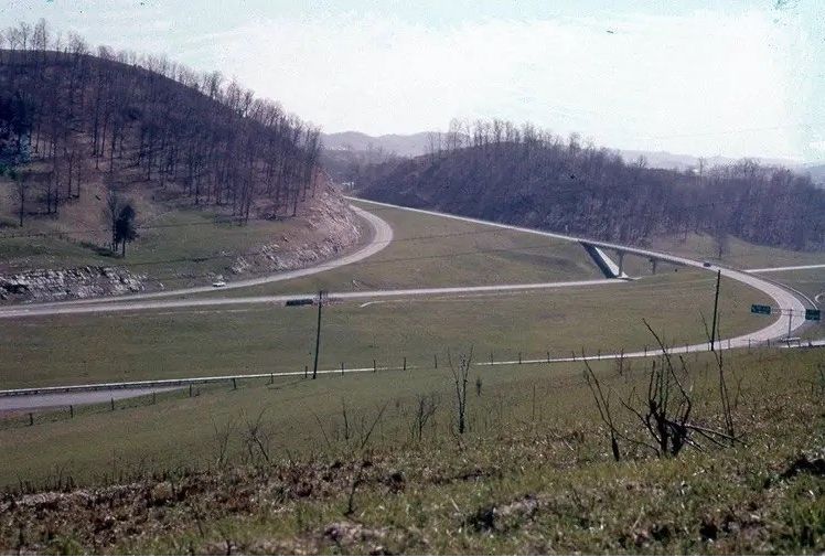
| Adjustments: In 1987 (bridge dates), the interchange with I-81/US 58 was rebuilt to allow movements to and from I-81 south as well. This reconfiguration changed the official length from 1.45 to 1.67 miles. The 1962 Topo map of the I-81/381 interchange showed an I-81 north to I-381 movement via a left-handed clover onto the I-81 south to I-381 ramp. However, a 1962 photo of the interchange shows otherwise.
Improvements: Upon designation, I-381 was a 4-laned interstate, as it remains today. Posted: Fully posted; its southern endpoint is clearly marked. Multiplexes: None Legislative names: None Other names: None Scenic Byway: No segments Comments:I-381 has no exits other than its northern endpoint with I-81 but the exit has been numbered back to at least 2008 as 1A-B (not sure it has always had exit numbers). I-381 is shown as complete on the 1961 Washington County map while I-81 is shown as under construction. I-381 first appears on Official maps in 1961. Mapmikey asks: Why isn't VA 381 signed as I-381 Bus Spur (or US 19)? | |||||||||
Previous: I-79 |
Next: I-85
I-81 | I-581
Top | Virginia Hwy Index
Home
Page last modified 6 January 2024